Toggle navigation
LMEC Home
Exhibitions
Georeferencing
Tools for Teachers
Collections
My Favorites
Sign Up / Log In
Search
Search the map portal
Map Collection
Map Collection
Map Sets
Search
Search
Search for
Search In
All Fields
Creator
Title
Subject
Place
Search All Digital Collections
Advanced Search
376 Results
My Search
Start Over
More Like
commonwealth:hx11z525b
Remove constraint More Like: commonwealth:hx11z525b
Filter your Search
Place
North and Central America
335
United States
215
Canada
103
Essex (county)
24
Louisbourg
21
Saint Lawrence River
19
Suffolk (county)
16
Warren (county)
16
more
Place
»
Topic
United States--History--French and Indian War, 1754-1763--Maps, Manuscript--Early works to 1800
57
Louisbourg (N.S.)--Maps, Manuscript--Early works to 1800
18
Fort Edward (N.Y.)--Maps, Manuscript--Early works to 1800
15
Fort Ticonderoga (N.Y.)--Maps, Manuscript--Early works to 1800
15
Saint Lawrence River--Maps, Manuscript--Early works to 1800
15
Louisbourg (N.S.)--History--Siege, 1745--Maps, Manuscript--Early works to 1800
14
Fortification--New York (State)--Maps, Manuscript--Early works to 1800
13
Fortification--New York (State)--Fort Edward--Maps, Manuscript--Early works to 1800
12
more
Topic
»
Date
Date range begin
–
Date range end
Current results range from
1664
to
1816
View distribution
Creator
Royal United Services Institute for Defence and Security Studies
160
George, III, King of Great Britain, 1738-1820
151
George, IV, King of Great Britain, 1762-1830
150
Amherst, Jeffery Amherst, Baron, 1717-1797
128
Skinner, Monier
28
Skinner, William, 1700-1780
28
Brasier, William
16
Bastide, John Henry, approximately 1700-1770
15
more
Creator
»
Format
Maps/Atlases
359
Manuscripts
149
Drawings/Illustrations
15
Georeferenced
Yes
7
No
369
Collection
British Library Collection
376
American Revolutionary War-Era Maps
352
Boston and New England Maps
21
Urban Maps
5
Maritime Charts and Atlases
2
Available to use
Creative Commons license
376
Search Constraints
Sort by title
relevance
title
date (asc)
date (desc)
Number of results to display per page
50 per page
10
per page
20
per page
50
per page
100
per page
View results as:
grid view
map view
Search Results
251.
PLAN of the Encampement at Lake George the 27th Iuin 1759
252.
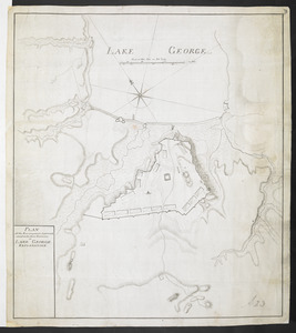
PLAN of the Encampment Intrenchment with thier Environs at LAKE GEORGE
253.
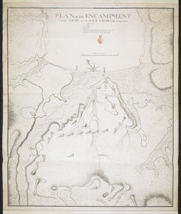
PLAN OF THE ENCAMPMENT OF THE ARMY AT LAKE GEORGE JUNE 1759
254.
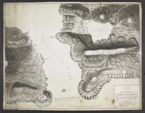
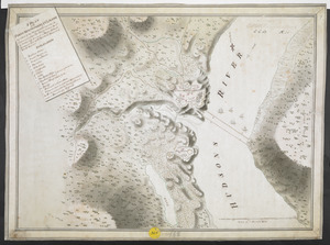
PLAN OF THE ENTRANCE OF ST IOHN'S HARBOUR NEWFOUNDLAND Shewing the additional Work's erecting for its defence
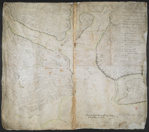
255.
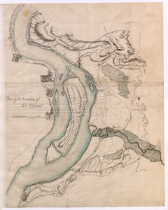
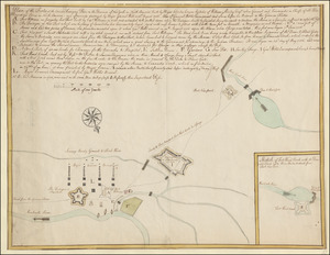
Plan of the Environs of Fort Edward
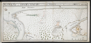
256.
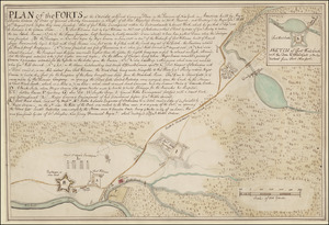
Plan Of the Fort and ATTACK of NIAGARA, and road leading To the ENGLISH Landing place, Also the Action Where the FRENCH were...
257.
A Plan of the Fort and Barracks at Mount Pleasant in Maryland
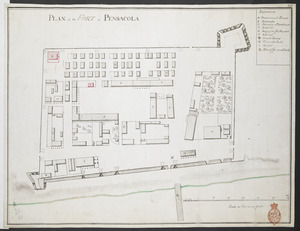
258.
PLAN of the FORT at PENSACOLA
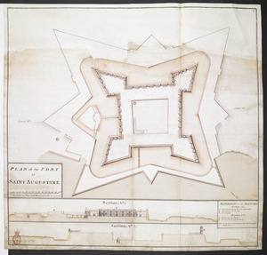
259.
PLAN of the FORT at SAINT AUGUSTINE
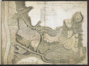
260.
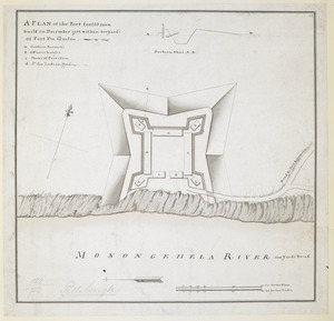
A PLAN of the Fort for 220 men built in December 1758 within 400 Yard's of Fort du Quesne
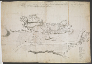
261.
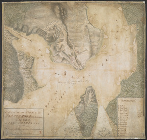
PLAN of the FORT in TIENDEROGA and Environs at the head of LAKE CHAMPLAIN November 1759
262.
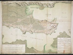
PLAN of the FORTRESS and dependant FORTS at CROWN POINT with their Environs and part of LAKE CHAMPLAIN. 1759
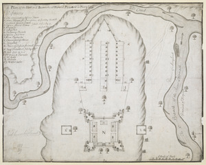
263.
PLAN of the FORTS at the Onoida or Great Carrying Place in the Province of New York in America built by Major Charles Craven by...
264.
Plan of the Forts at the Onoida or Great Carrying Place in the Province of New York in North America built by Major Charles...
265.
A PLAN of the FORTS MONTGOMERY & CLINTON as taken by his Majesty's Forces under the Command of Gen:l Sir Henry clinton the 6.th...
266.
PLAN of the Great Falls on Hudsons River
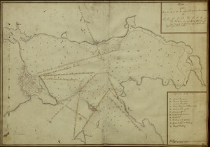
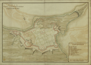
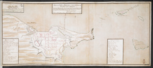
267.
A PLAN OF THE HARBOUR AND FORTIFICATIONS OF LOUISBOURG
268.
A PLAN OF THE HARBOUR AND FORTIFICATIONS OF LOUISBOURG
269.
Plan of the HARBOUR and FORTIFICATIONS OF LOUISBOURG
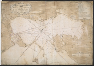
270.
A PLAN OF THE HARBOUR AND FORTIFICATIONS OF LOUISBOURG : The Harbour Survey'd by Cap.t Phi; Durrell The Fortifications by Cap.t...
271.
PLAN of the HARBOUR and FORTIFICATIONS of LOUISBOURG : The Harbour Survey'd by Capt Phill Durell the Town & Fortifications by...
272.
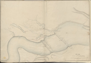
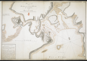
PLAN of the HARBOUR and Part of the RIVER S.T JOHNS in the BAY of FUNDY
273.
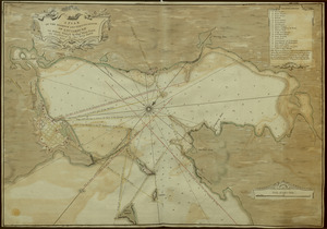
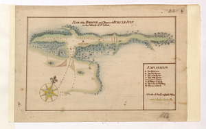
PLAN of the HARBOUR and Rivers of PORT LE JOYE in the Island of S.t Iohn
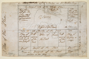
274.
Plan of the Harbour of St John's in the Bay of Fundy= Plan & Section of the Fort as it is Near Finish'd= Plan & Section's of...
275.
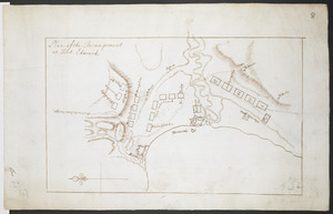
Plan of the Incampement at Fort Edward
276.
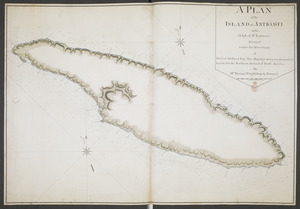
A PLAN of the ISLAND of ANTICOSTI in the Gulph of S.T Lawrence Surveyed under the Directions of Samuel Holland Esq.r His...
277.
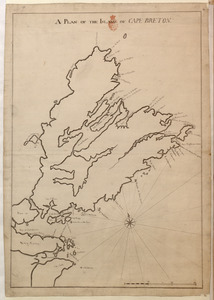
A PLAN OF THE ISLAND OF CAPE BRETON
278.
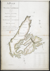
A PLAN of the ISLAND of CAPE BRITAIN reduced from the large Survey made according to the ORDERS and INSTRUCTIONS of the RIGHT...
279.
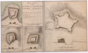
PLAN of the new FORT, and REDOUTS at CROWN POINT, called as below
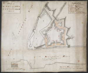
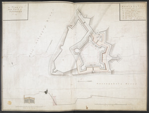
280.
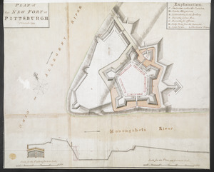
PLAN of the NEW FORT at PITSBURGH November 1759
281.
PLAN of the NEW FORT at PITTSBURGH November 1759
282.
A plan of the New Fort at Pittsburgh Novr 1759
283.
PLAN OF THE PENINSULA OF CHESOPEAK BAY
284.
A Plan of the Plan
285.
PLAN of the Position of the Army under the command of Lieut:t Gen:l Burgoyne near Still Water in which it encamped on ye 20th...
286.
PLAN of the Position w:ch the Army under L.t Gen:l Burgoyne took at Saratoga on the 10th Sept.r 1777 and in which it remained...
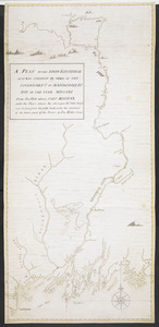
287.
A PLAN OF THE RIVER KENNEBECK AS IT WAS SVRVEYED BY ORDER OF THE GOVERNMENT OF MASSACHUSETS BAY IN THE YEAR MDCCLXI From the...
288.
A Plan Of the River of Chibenaccadie from its Source To its Discharge into the Bay of Mines Surveyed in August 1754 : The...
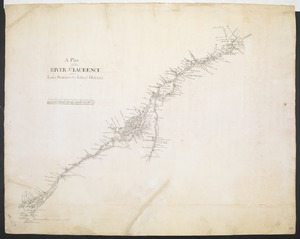
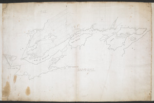
289.
A Plan of the RIVER S.T LAURENCE from Lake Ontario to the Island Orleans
290.
A PLAN of the Rivers and Boundary Lines referr'd to in ye Proceedings & Judgment of ye Commissioners for adjusting the Bounds...
291.
A Plan of the Road, Harbour and Town of Placentia in the Island of Newfoundland From an Actual Survey shewing the Situation of...
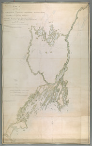
292.
A PLAN of the SEA COAST from CAPE ELIZABETH to the ENTRANCE of SAGADAHOCK or KENNEBECK RIVER Including Casco Bay with all it's...
293.
Plan of the Settlement on the Bay of Quinte
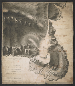
294.
PLAN of the SOUTH HEAD of the Entrance into the Harbour of St IOHNS NEWFOUNDLAND Shewing the BATTERIES to be Erected theron for...
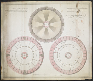
295.
PLAN of the TOWER at POINT PLEASANT for the protection of the Sea Batteries at that place and for the defence of the Harbour of...
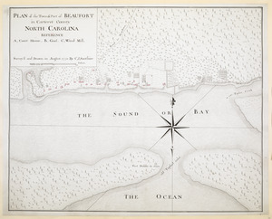
296.
PLAN of the Town & Port of BEAUFORT in Carteret County NORTH CAROLINA
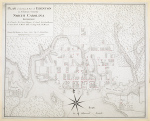
297.
PLAN of the Town & Port of EDENTON in Chowan County NORTH CAROLINA
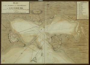
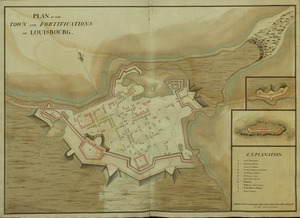
298.
PLAN of the TOWN and FORTIFICATIONS of LOUISBOURG
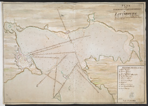
299.
PLAN of the TOWN and FORTIFICATIONS of LOUISBOURG
300.
PLAN of the TOWN and FORTRESS of LOUISBOURG on the ISLAND CAPE BRETON : Surrender'd ye 16th June 1745 after a Seige of 12 days...
‹ Prev
Next ›
1
2
3
4
5
6
7
8