Toggle navigation
LMEC Home
Exhibitions
Georeferencing
Tools for Teachers
Collections
My Favorites
Sign Up / Log In
Search
Search the map portal
Map Collection
Map Collection
Map Sets
Search
Search
Search for
Search In
All Fields
Creator
Title
Subject
Place
Search All Digital Collections
Advanced Search
8207 Results
My Search
Start Over
More Like
commonwealth:9s161f25j
Remove constraint More Like: commonwealth:9s161f25j
Filter your Search
Place
North and Central America
4,956
United States
3,646
Suffolk (county)
1,070
Boston
1,043
Europe
963
Canada
427
France
269
Massachusetts
248
more
Place
»
Topic
Boston (Mass.)--Maps
576
United States--Maps
270
Real property--Massachusetts--Boston--Maps
185
Massachusetts--Maps
160
Landowners--Massachusetts--Boston--Maps
136
North America--Maps--Early works to 1800
103
City planning--Massachusetts--Boston--Maps
101
New England--Maps
99
more
Topic
»
Date
Date range begin
–
Date range end
Current results range from
1482
to
2023
View distribution
Creator
United States. Hydrographic Office
357
O.H. Bailey & Co
148
Des Barres, Joseph F. W. (Joseph Frederick Wallet), 1722-1824
123
United States. Post Office Dept
120
Boston Redevelopment Authority
105
Ptolemy, 2nd cent
100
Walling, Henry Francis, 1825-1888
94
Jefferys, Thomas, -1771
84
more
Creator
»
Format
Maps/Atlases
8,148
Manuscripts
215
Prints
51
Books
36
Objects/Artifacts
10
Drawings/Illustrations
8
Posters
4
Georeferenced
Yes
869
No
7,338
Collection
Norman B. Leventhal Map Center Collection
8,163
Boston and New England Maps
2,224
Urban Maps
1,965
Maritime Charts and Atlases
750
American Revolutionary War-Era Maps
616
Boston Redevelopment Authority Collection
126
Massachusetts Real Estate Atlases
4
Mapping Boston Collection
1
Available to use
No known restrictions
8,061
Creative Commons license
47
Search Constraints
Sort by date (desc)
relevance
title
date (asc)
date (desc)
Number of results to display per page
100 per page
10
per page
20
per page
50
per page
100
per page
View results as:
grid view
map view
Search Results
601.
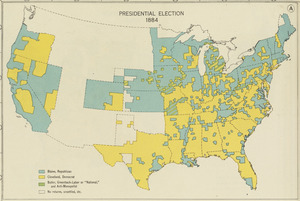
Presidential election 1884
602.
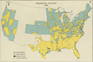
Presidential election 1888
603.
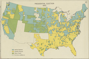
Presidential election 1892
604.
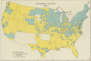
Presidential election 1896
605.
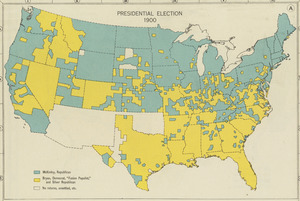
Presidential election 1900
606.
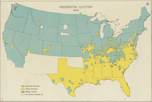
Presidential election 1904
607.
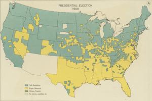
Presidential election 1908
608.
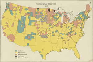
Presidential election 1912
609.
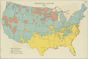
Presidential election 1924
610.
Property qualifications for suffrage, 1775
611.
Property qualifications for suffrage, 1800
612.
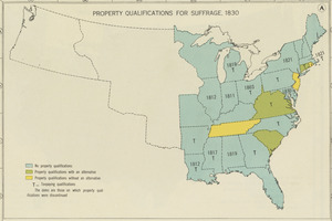
Property qualifications for suffrage, 1830
613.
Property qualifications for suffrage, 1860
614.
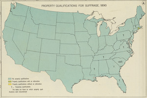
Property qualifications for suffrage, 1890
615.
Property qualifications for suffrage, 1920
616.
Public lands of the United States, 1850
617.
Public lands of the United States, 1870
618.
Public lands of the United States, 1890
619.
Public lands of the United States, 1910
620.
Reconstruction Act, March 2, 1867, Vote on passage over President's veto
621.
Territorial acquisitions, 1783-1853
622.
Thirteenth Amendment, January 31, 1865, Vote on passage of resolution submitting
623.
Woman suffrage, 1875
624.
Woman suffrage, 1900
625.
Woman suffrage, 1915
626.
Woman suffrage, 1920
627.
Atlas of the city of Boston : Roxbury : from actual surveys and official plans
628.
Being a map of the United States in the year 1831 when the Country Gentleman first made its appearance as the Genesee Farmer
629.
Bus routes Boston Elevated Railway 1931 July 18
630.
A chart of the history of printing in Europe
631.
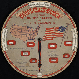
Geographic chart of the United States and our presidents
632.
Historic Niagara Frontier
633.
An historical and literary map of the Old Line State of Maryland : showing forth divers curious and notable facts relating to...
634.
An illustrated map of Chicago : youthful city of the big shoulders, restless, ingenious, wilful, violent, proud to be alive!
635.
A map of the Cape Peninsula
636.
A map of the Seneca villages and the Jesuit and French contacts 1615-1708
637.
Mercator map of the world
638.
Nationalist government of Nanking - nominally ruling over entire China, 1930
639.
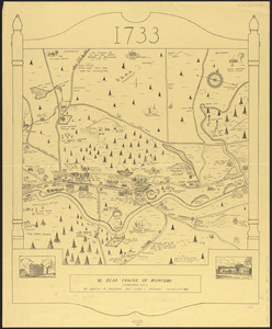
Ye olde towne of Rumford : (Concord, N.H.)
640.
Santiam National Forest, Oregon
641.
Town of Belmont Assessors plans
642.
Atlas of the city of Cambridge, Massachusetts : from actual surveys and official plans
643.
Birdsboro, Pa. : settled 1740
644.
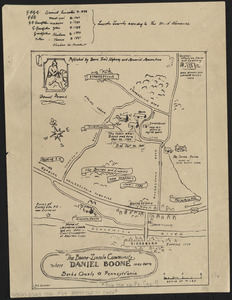
The Boone-Lincoln community where Daniel Boone was born, Berks County, Pennsylvania
645.
The facts of prohibition in the United States
646.
Historical map of the town of Scituate, Plymouth County, Massachusetts, incorporated 1636
647.
Historical map of Watertown, 1630-1930
648.
Map of Connecticut, circa 1625, Indian trails, villages, sachemdoms
649.
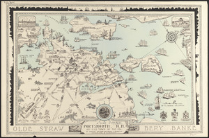
A map of Portsmouth, N.H. : an old town by the sea
650.
A map of the Bermuda Islands : ya des demonios, isles of the devils
651.
Motor routes that intersect the Bay Circuit
652.
North America
653.
Outline map of the various Boston metropolitan districts
654.
Pictorial map of Kansas
655.
The port of Salem, Massachusetts
656.
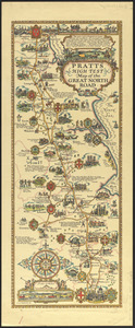
Pratts high test map of the Great North Road
657.
Rose garden in Fens-Back Bay
658.
Town of Brookline, Mass. assessors' plans 1930
659.
Umatilla National Forest, Oregon and Washington
660.
Winthrop - anciently Pullin Point : our peninsula in 1624
661.
Atlas of the city of Newton, Massachusetts
662.
Boston Elevated Railway system
663.
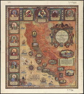
A general map of California during Spanish and Mexican occupation, 1542-1847
664.
Geologic map of copper range from Gratiot to La Salle, Michigan
665.
Geologic sections in T. 56 N., R. 33 W.
666.
Geologic sections in T. 56 N., Rs. 32 and 33 W.
667.
Illustrated map of the route of Transcontinental Air Transport, Inc.
668.
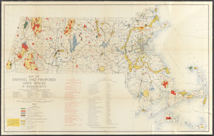
Map of existing and proposed open spaces in Massachusetts
669.
A map of the Maine coast from York Harbor to Saco Bay : reminiscent & actual
670.
Meiguo Sanfan Shi hua qiao qu : xiang xi tu = Map of San Francisco Chinatown
671.
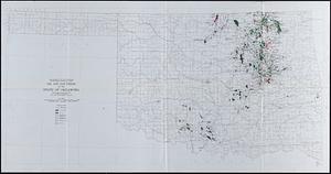
Oil and gas fields of the state of Oklahoma
672.
The picture map of France
673.
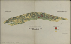
Plan of Isle Royale Lode : developments to 1925
674.
Topographic map of the Island of Niihau, Kauai County, Hawaii
675.
Atlas of the city of Boston : Boston proper and Back Bay : from actual surveys and official plans
676.
Density of population in greater Tokyo - census of 1926
677.
District within fire limit of Tokyo - 1928
678.
Gas and water-supply in greater Tokyo - 1928
679.
Map in commemoration of the travels of Charles A. Lindbergh
680.
A map of Concord, the old Musketaquid Plantation
681.
A map of Portland Maine and some places thereabout
682.
Map of the history and romance of Wyoming
683.
A map of the history of New York state
684.
Map showing the overland and overseas flights of Charles A. Lindbergh
685.
New Haven
686.
The new map of the world
687.
Plan of Boston showing existing ways and owners on December 25, 1635
688.
Reconstruction work in Tokyo
689.
Saskatchewan : map showing disposition of lands
690.
Showing rental values in greater Tokyo - 1926
691.
Street plan of greater Tokyo - decided 1927
692.
Zoning map of town-planning area of Tokyo - 1925
693.
Atlas of the town of Brookline, Norfolk County, Massachusetts : from actual surveys and official plans
694.
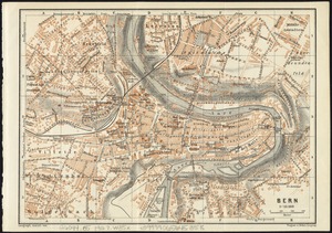
Bern
695.
Cape Ann and the North Shore : a map displaying the hardy maritime development of these historic parts
696.
Elihu Geer Sons new map of East Hartford, Connecticut
697.
Flathead National Forest, Montana
698.
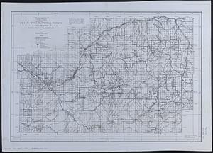
Grand Mesa National Forest, Colorado
699.
Hagstrom's map of Brooklyn (New York City) : house-number and subway guide
700.
Holy Cross National Forest, Colorado
‹ Prev
Next ›
1
2
3
4
5
6
7
8
9
10
11
…
82
83