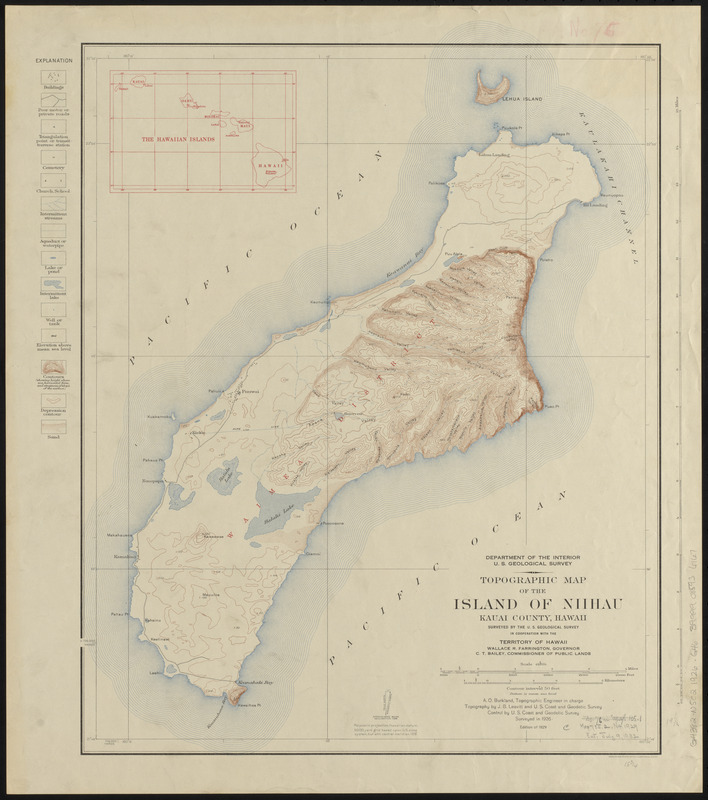
Topographic map of the Island of Niihau, Kauai County, Hawaii
Item Information
- Title:
- Topographic map of the Island of Niihau, Kauai County, Hawaii
- Cartographer:
- Geological Survey (U.S.)
- Name on Item:
-
surveyed by the U.S. Geological Survey in cooperation with the Territory of Hawaii
- Date:
-
1929
- Format:
-
Maps/Atlases
- Location:
-
Boston Public Library
Norman B. Leventhal Map & Education Center - Collection (local):
-
Norman B. Leventhal Map & Education Center Collection
- Subjects:
-
Niihau (Hawaii)--Maps
- Places:
-
HawaiiKauai (county)Niihau (island)
- Extent:
- 1 map : color ; 50 x 40 cm
- Terms of Use:
-
No known copyright restrictions.
No known restrictions on use.
- Publisher:
-
Washington, D.C. :
U.S. Geological Survey
- Edition:
- Edition of 1929
- Scale:
-
Scale 1:62,500
- Projection:
- polyconic projection
- Language:
-
English
- Notes:
-
Relief shown by contours and spot heights.
Surveyed in 1926.
Datum is mean sea level.
Inset: The Hawaiian Islands.
- Notes (citation):
-
LC Hawaii, 16
- Identifier:
-
06_01_015398
- Call #:
-
G4382.N5C2 1926 .G46
- Barcode:
-
39999085936167


