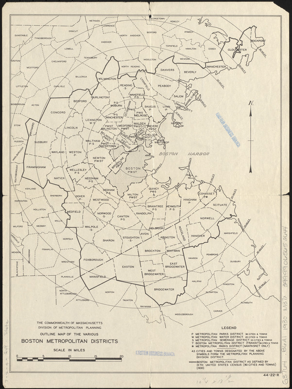
Outline map of the various Boston metropolitan districts
Item Information
- Title:
- Outline map of the various Boston metropolitan districts
- Cartographer:
- Massachusetts. Division of Metropolitan Planning
- Name on Item:
-
Commonwealth of Massachusetts, Division of Metropolitan Planning
- Date:
-
[ca. 1930]
- Format:
-
Maps/Atlases
- Location:
-
Boston Public Library
Norman B. Leventhal Map & Education Center - Collection (local):
-
Norman B. Leventhal Map & Education Center Collection
- Subjects:
-
Boston Metropolitan Area (Mass.)--Maps
Outline maps
- Places:
-
MassachusettsSuffolk (county)Boston
- Extent:
- 1 map ; 35 x 27 cm.
- Terms of Use:
-
No known copyright restrictions.
No known restrictions on use.
- Publisher:
-
[Boston] :
Division of Metropolitan Planning
- Scale:
-
Scale [ca. 316,000]
- Language:
-
English
- Notes:
-
Shows metropolitan districts as defined by 15th U.S. census (1930).
- Notes (exhibitions):
-
Exhibited: "Bending lines: maps and data from distortion to deception," organized by the Norman B. Leventhal Map & Education Center at the Boston Public Library, 2020-2021.
- Identifier:
-
06_01_017129
- Call #:
-
G3764.B6A1 1930 .M37x
- Barcode:
-
39999065652644


