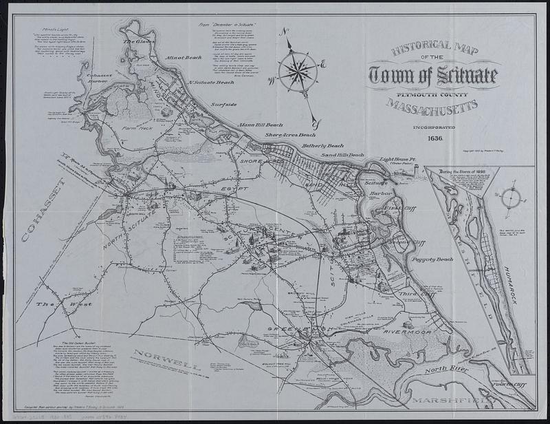
Historical map of the town of Scituate, Plymouth County, Massachusetts, incorporated 1636
Item Information
- Title:
- Historical map of the town of Scituate, Plymouth County, Massachusetts, incorporated 1636
- Cartographer:
- Bailey, Frederic T.
- Name on Item:
-
compiled from various sources by Frederic T. Bailey, N. Scituate, 1929
- Date:
-
1930
- Format:
-
Maps/Atlases
- Genre:
-
Pictorial maps
- Location:
-
Boston Public Library
Norman B. Leventhal Map & Education Center - Collection (local):
-
Norman B. Leventhal Map & Education Center Collection
- Subjects:
-
Scituate (Mass. : Town)--History--Maps
- Places:
-
MassachusettsPlymouth (county)Scituate
- Extent:
- 1 map ; 41 x 54 cm
- Terms of Use:
-
No known copyright restrictions.
No known restrictions on use.
- Publisher:
-
N. Scituate :
Frederic T. Bailey
- Language:
-
English
- Notes:
-
Oriented with north to the upper left.
Includes text and illustrations.
Inset: [Continuation to the south].
- Identifier:
-
06_01_018542
- Call #:
-
G3764.S322S1 1930 .B35
- Barcode:
-
39999085968434


