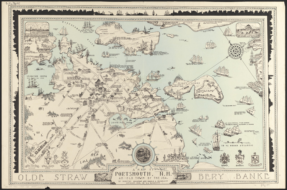
A map of Portsmouth, N.H. : an old town by the sea
Item Information
- Title:
- A map of Portsmouth, N.H. : an old town by the sea
- Cartographer:
- Vaughan, Dorothy M. (Dorothy Mansfield)
- Cartographer:
- Rundlett, Harold G.
- Name on Item:
-
by Dorothy Vaughan and Harold G. Rundlett
- Date:
-
1930
- Format:
-
Maps/Atlases
- Location:
-
Boston Public Library
Norman B. Leventhal Map & Education Center - Collection (local):
-
Norman B. Leventhal Map & Education Center Collection
- Subjects:
-
Portsmouth (N.H.)--History--Maps
- Places:
-
New HampshireRockingham (county)Portsmouth
- Extent:
- 1 map : color ; 51 x 82 cm
- Terms of Use:
-
No known copyright restrictions.
No known restrictions on use.
- Publisher:
-
[Place of publication not identified] :
[publisher not identified]
- Scale:
-
Scale approximately 1:3,700
- Language:
-
English
- Notes:
-
Pictorial map.
Oriented with north to the upper left.
Includes illustrations and notes.
In lower border: Olde Strawbery Banke
Inset illustrations: Fort Constitution, 1650 Newcastle -- Fort McClary, 1690 Ketterie.
- Identifier:
-
06_01_014804
- Call #:
-
G3744.P8S1 1930 .V38
- Barcode:
-
39999065706663


