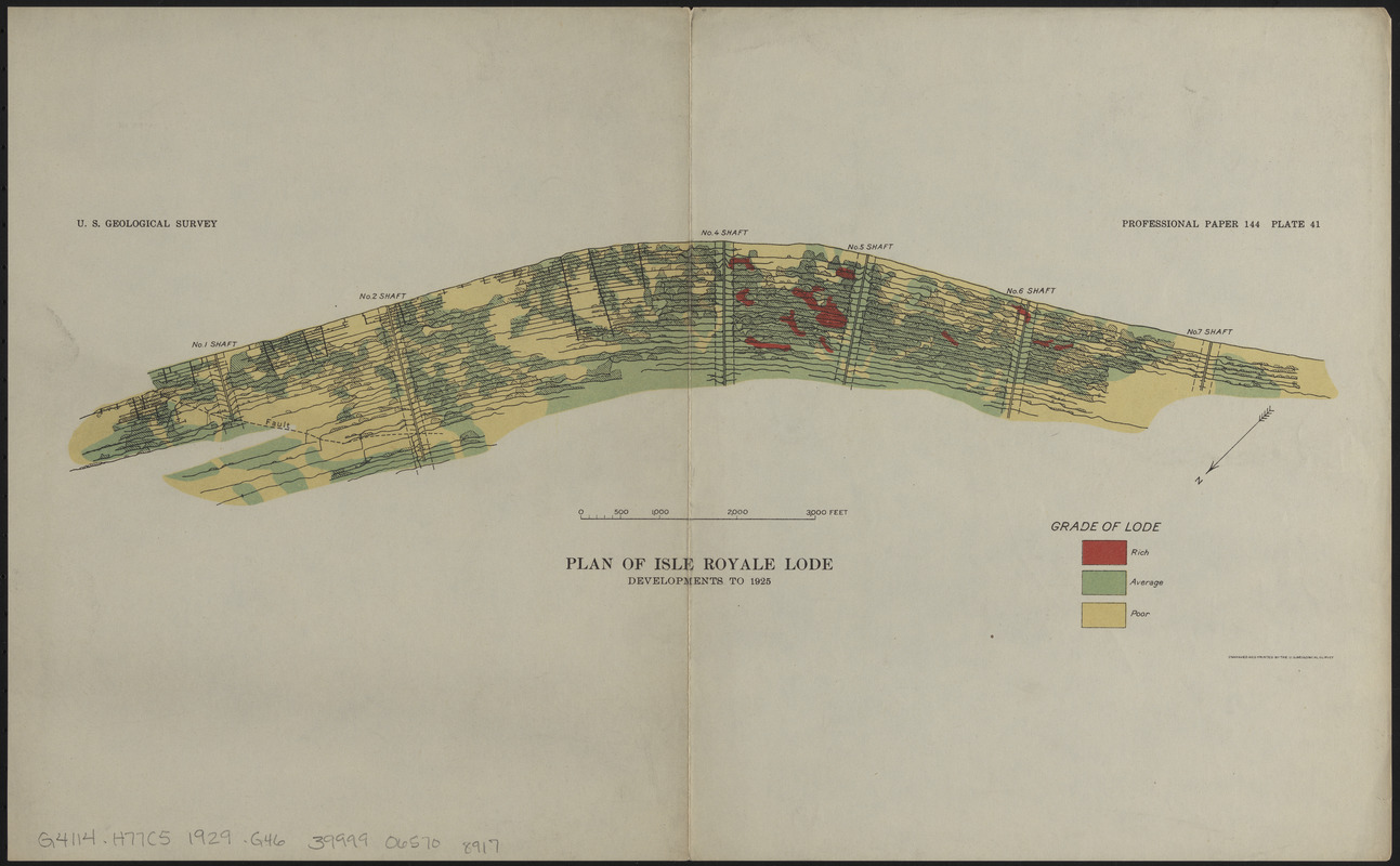
Plan of Isle Royale Lode : developments to 1925
Item Information
- Title:
- Plan of Isle Royale Lode : developments to 1925
- Publisher:
- Geological Survey (U.S.)
- Date:
-
[1929]
- Format:
-
Maps/Atlases
- Location:
-
Boston Public Library
Norman B. Leventhal Map & Education Center - Collection (local):
-
Norman B. Leventhal Map & Education Center Collection
- Subjects:
-
Geological cross sections--Michigan--Isle Royale Mine--Maps
Geology--Michigan--Isle Royale Mine--Maps
Isle Royale Mine (Mich.)--Maps
- Places:
-
MichiganHoughton (county)Isle Royale Mine
- Extent:
- 1 map : color ; sheet 28 x 46 cm
- Terms of Use:
-
No known copyright restrictions.
No known restrictions on use.
- Publisher:
-
[Washington, D.C.] :
[Government Printing Office]
- Scale:
-
Scale approximately 1:11,850
- Language:
-
English
- Notes:
-
Oriented with north to the lower left.
"Professional paper 144 plate 41."
From The copper deposits of Michigan / by B.S. Butler (Washington, D.C. : G.P.O, 1929).
- Notes (date):
-
This date is inferred.
- Identifier:
-
06_01_014952
- Call #:
-
G4114.H77C5 1929 .G46
- Barcode:
-
39999065708917


