Toggle navigation
LMEC Home
Exhibitions
Georeferencing
Tools for Teachers
Collections
My Favorites
Sign Up / Log In
Search
Search the map portal
Map Collection
Map Collection
Map Sets
Search
Search
Search for
Search In
All Fields
Creator
Title
Subject
Place
Search All Digital Collections
Advanced Search
8601 Results
My Search
Start Over
More Like
commonwealth:7h149w855
Remove constraint More Like: commonwealth:7h149w855
Filter your Search
Place
North and Central America
5,887
United States
4,811
Massachusetts
2,052
Europe
1,359
Suffolk (county)
1,034
Boston
1,007
Canada
471
Asia
422
more
Place
»
Topic
Boston (Mass.)--Maps
577
United States--Maps
314
Real property--Massachusetts--Boston--Maps
174
Massachusetts--Maps
160
Landowners--Massachusetts--Boston--Maps
132
New England--Maps
104
North America--Maps--Early works to 1800
103
Europe--Maps
78
more
Topic
»
Date
Date range begin
–
Date range end
Current results range from
1482
to
2023
View distribution
Creator
United States. Hydrographic Office
594
O.H. Bailey & Co
148
Des Barres, Joseph F. W. (Joseph Frederick Wallet), 1722-1824
123
United States. Post Office Dept
120
Ptolemy, 2nd cent
100
Walling, Henry Francis, 1825-1888
94
Geological Survey (U.S.)
87
Jefferys, Thomas, -1771
85
more
Creator
»
Format
Maps/Atlases
8,542
Manuscripts
215
Prints
56
Books
36
Objects/Artifacts
10
Drawings/Illustrations
8
Posters
4
Georeferenced
Yes
871
No
7,730
Collection
Norman B. Leventhal Map & Education Center Collection
8,554
Boston and New England Maps
2,204
Urban Maps
1,936
Maritime Charts and Atlases
1,081
American Revolutionary War-Era Maps
661
Boston Redevelopment Authority Collection
87
American Antiquarian Society Collection
23
William L. Clements Library Collection
20
more
Collection
»
Available to use
No known restrictions
8,411
Creative Commons license
49
Search Constraints
Sort by relevance
relevance
title
date (asc)
date (desc)
Number of results to display per page
50 per page
10
per page
20
per page
50
per page
100
per page
View results as:
grid view
map view
Search Results
151.
Map of the United States of America, Mexico, Central America, and the West India Islands
152.
Map of the United States of America, the British Provinces, Mexico, the West Indies and Central America, with part of New...
153.
Map of the United States of America, the British provinces, Mexico, the West Indies and Central America, with part of New...
154.
Map of the United States of North America
155.
A map of the United States of North America : drawn from a number of critical researches
156.
Map of the United States of North America, upper & lower Canada, New Brunswick, Nova Scotia & British Columbia, Mexico, Cuba,...
157.
Map of the United States, showing by colors the area of freedom and slavery, and the territories whose destiny is yet to be...
158.
Map of the United States showing principal cities, rivers, and mountain ranges
159.
Map of the United States, the British provinces, Mexico, &c : showing the routes of the U.S. Mail steam packets to California,...
160.
Map showing distribution of indian stocks and tribes, between 1710-1720
161.
Map showing in five degrees of density the distribution of woodland within the territory of the United States, 1873
162.
Map showing Indian reservations within the limits of the United States, 1901
163.
Map showing Indian reservations within the limits of the United States, 1903
164.
Map showing Indian reservations within the limits of the United States, 1904
165.
Map showing Indian reservations within the limits of the United States, 1905
166.
Map showing Indian reservations within the limits of the United States, 1906
167.
Map showing lines of the Bell telephone companies in the United States and Canada : July 1st, 1904
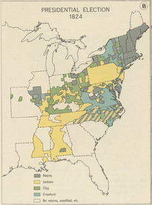
168.
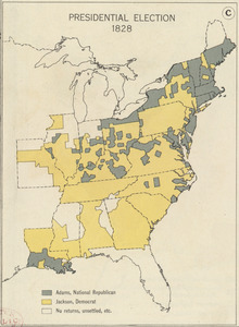
Maps showing the range, and, within the range, the degree of cultivation of certain principal crops
169.
Mean monthly average temperature
170.
Military map of the United States
171.
Military map of the United States of America showing location of all forces in training
172.
Missouri Compromise, March 20, 1820, Vote on striking out provisions restricting slavery
173.
Mitchell's national map of the American Republic or United States of North America : together with maps of the vicinities of...
174.
A nation of immigrants
175.
National map of the United States
176.
New Hampshire by recent survey : made under the supreme authority and published according to law
177.
New map of the American overland route showing its connections, and land grants of 30,000,000 acres
178.
A new map of the United States including part of Louisiana : from the best authorities
179.
A new map of the United States of America
180.
Nuclear America
181.
The nuclear weapons complex transportation routes
182.
Oil in America : a pictorial story of the petroleum industry in the United States
183.
Paul Sample's America, its soil
184.
Phelps & Ensign's travellers' guide, and map of the United States, containing the roads, distances, steam boat and canal routes &c
185.
Phelps & Ensign's travellers' guide, and map of the United States, containing the roads, distances, steam boat and canal routes &c
186.
Phelps & Watson's new map of the United States
187.
A pictorial map of the United States
188.
Pictorial map of the United States, 1849
189.
The pictorial map, stamps of America
190.
The pictorial map, stamps of the U.S.A.
191.
The pictorial map, United States stamps
192.
Portugal is not a small country
193.
Presidential and other elections, 1800
194.
Presidential and other elections, 1804
195.
Presidential and other elections, 1808
196.
Presidential and other elections, 1812
197.
Presidential and other elections, 1816
198.
Presidential election 1820
199.
Presidential election 1824
200.
Presidential election 1828
‹ Prev
Next ›
1
2
3
4
5
6
7
8
…
172
173