Toggle navigation
LMEC Home
Exhibitions
Georeferencing
Tools for Teachers
Collections
My Favorites
Sign Up / Log In
Search
Search the map portal
Map Collection
Map Collection
Map Sets
Search
Search
Search for
Search In
All Fields
Creator
Title
Subject
Place
Search All Digital Collections
Advanced Search
13385 Results
Filter your Search
Place
North and Central America
9,353
United States
7,286
Suffolk (county)
1,664
Boston
1,621
Europe
1,035
Canada
949
Massachusetts
806
New York
534
more
Place
»
Topic
Boston (Mass.)--Maps
741
City planning--Massachusetts--Boston--Maps
418
United States--History--Revolution, 1775-1783--Maps
329
United States--Maps
315
Urban renewal--Massachusetts--Boston--Maps
254
Real property--Massachusetts--Boston--Maps
252
Massachusetts--Maps
219
Insurance surveys
197
more
Topic
»
Date
Date range begin
–
Date range end
Current results range from
1482
to
2023
View distribution
Creator
United States. Hydrographic Office
595
Boston Redevelopment Authority
403
Des Barres, Joseph F. W. (Joseph Frederick Wallet), 1722-1824
247
Royal United Services Institute for Defence and Security Studies
160
Jefferys, Thomas, -1771
154
George, III, King of Great Britain, 1738-1820
152
George, IV, King of Great Britain, 1762-1830
151
O.H. Bailey & Co
148
more
Creator
»
Format
Maps/Atlases
13,205
Manuscripts
985
Prints
102
Books
49
Drawings/Illustrations
44
Photographs
15
Objects/Artifacts
13
Documents
7
more
Format
»
Georeferenced
Yes
979
No
12,406
Collection
Norman B. Leventhal Map Center Collection
8,891
American Revolutionary War-Era Maps
3,305
Boston and New England Maps
2,804
Urban Maps
2,397
Maritime Charts and Atlases
1,150
William L. Clements Library Collection
910
Library of Congress Collection
618
Boston Redevelopment Authority Collection
475
more
Collection
»
Available to use
No known restrictions
9,952
Creative Commons license
1,677
Search Constraints
Sort by relevance
relevance
title
date (asc)
date (desc)
Number of results to display per page
50 per page
10
per page
20
per page
50
per page
100
per page
View results as:
grid view
map view
Search Results
401.
Antietam Sharpsburg and vicinity : constructed and engraved to illustrate "The war with the South"
402.
Antigoa
403.
Antigua
404.
Antigue : levée par Robert Baker, Arpenteur General de l'Isle ; traduit de l'Anglais
405.
Antilles ou Indes Occidentales
406.
Antrim, N.H. and Clinton Village : 1887
407.
Antwerp : or Anvers
408.
Apia, Apaiang or Charlotte Island, Kingsmill Group ; Cook Island, Tarawa or Knox Island, Kingsmill Group
409.
Apolima, Samoan Group ; Harbour of Oafonu, Isld. of Tutuila, north side ; Harbour of Aur, Isld. of Tutuila, north side ;...
410.
Apolima, Samoan Group ; Harbour of Oafonu, Isld. of Tutuila, north side ; Hübner Bay, Island of Tutuila ; Harbour of Aur,...
411.
Appearance of Fort Sumter on Sunday afternoon, August 23d, 1863 : sketched from the "Beacon house" on Morris Island
412.
Appearance of the land from the White Islands to St. Marys River taken two leagues off shore : The entrance of Milford Haven at...
413.
Appleton St. Woonerf
414.
Appletons' railway map of the United States and Canada
415.
Appletons' railway map of the United States and the Canadas : representing railways in actual operation, and those in the...
416.
Appomattox Court House
417.
Approach to Ta-Tong River, west coast Corea
418.
Approaches to Cohasset Harbor Mass. : topography surveyed in 1847 ; hydrography surveyed in 1846-'56
419.
Approaches to Fort Butte La Rose, Louisiana : captured by the U.S. fleet, co-operating with the forces under the command of...
420.
Approaches to Fort Hindman, Arkansas Post, on the Arkansas River : captured by the U.S. Mississippi Squadron, under command of...
421.
Approaches to Fort Hindman, Arkansas Post, on the Arkansas River : captured by the U.S. Mississippi Squadron, under command of...
422.
L'Arabia divisa in petrea, deserta, e felice
423.
Arabia, n.e. coast, Gulf of 'Omman, Maskat & Matreh : from British surveys in 1828, 1849 & 1860 : republication of the British...
424.
Arabian Sea, Maskat to Karáchi
425.
Arabia--Red Sea, Mokha Road : from a British survey in 1882
426.
Archaeological map of Castle Neck and vicinity, Ipswich, Mass. showing ancient Indian villages & remains : made from actual...
427.
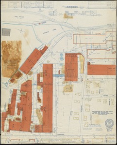
Archer Rubber Company "Central Street Plant," Milford, Mass. [insurance map]
428.
Archiepiscopatus et Electoratus Coloniensis, maximaeque partes Ducatuum Juliacensis Cliviensis, et Montensis aliaeque minores...
429.
Archiepiscopatus et Electoratus Moguntini et adjacentium regionum, ut Landgraviatuum Hasso Darmstadiensis et Rhenofeldensis,...
430.
Archiepiscopatus et Electoratus Trevirensis novissima delineatio exacte divisa in omnes suas praefecturas in hac quoque tabula...
431.
Archiepiscopatus Trevirensis
432.
Archiepiscopatus Trevirensis recentissima delineatio
433.
The archipelago of the East, being the Sunda, the Molucca, and Phillipps. Islands : the chief settlements of the Dutch in India...
434.
Archipelagus Atlanticus cum suis insulis Canariis, Hesperidibus et Azoribus
435.
Architectural styles, Chinatown historic core, historic edge
436.
Arcihiepiscopatus Cameracensis
437.
Arctic America : eastern sheet
438.
The Arctic Ocean between Greenland and Nova Zemla and between the 60th and 82d parallels of latitude : from the Swedish,...
439.
Arctic Ocean, north of Behrings Strait : Wrangel Island, as surveyed by the officers of the U.S.S. Rodgers, Lieut. R.M. Berry...
440.
Arctic Ocean, north of Behrings Strait, Rodgers Harbor on the south side of Wrangel Island
441.
Arctic Ocean, north of Behrings Strait, track of the U.S.S. Rodgers, Lieut. R.M. Berry Comdg., north of Wrangel Island,...
442.
The Arctic regions : comprising the most recent explorations of Robert E. Peary, Fridtjof Nansen and F. Jackson
443.
Arctic Sea, Spitzbergen : from the Swedish survey of 1861 to 1864, corrected from the German & Norwegian explorations to 1872
444.
Area plan as of May 1962
445.
Argentine railways, 1907
446.
Arizona
447.
Arizona (Coconino County), Bright Angel quadrangle
448.
Arlington, Massachusetts : 1884
449.
Arlington Mills "Hoosac Worsted Mills Dept." North Adams, Mass. [insurance map]
450.
Arlington Mills (Worsted Cloth), Lawrence & Methuen, Mass.
‹ Prev
Next ›
1
2
…
5
6
7
8
9
10
11
12
13
…
267
268


![Archer Rubber Company "Central Street Plant," Milford, Mass. [insurance map]](https://bpldcassets.blob.core.windows.net/derivatives/images/commonwealth:ww72bz18n/image_thumbnail_300.jpg)


![Arlington Mills "Hoosac Worsted Mills Dept." North Adams, Mass. [insurance map]](https://bpldcassets.blob.core.windows.net/derivatives/images/commonwealth:2r36vc58q/image_thumbnail_300.jpg)