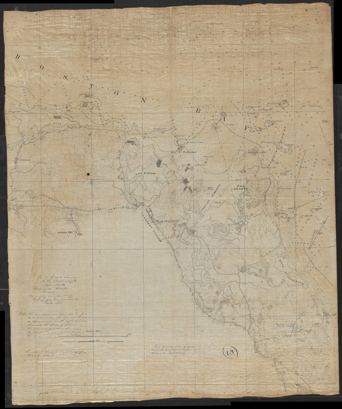
Approaches to Cohasset Harbor Mass. : topography surveyed in 1847 ; hydrography surveyed in 1846-'56
Item Information
- Title:
- Approaches to Cohasset Harbor Mass. : topography surveyed in 1847 ; hydrography surveyed in 1846-'56
- Cartographer:
- United States Coast Survey
- Name on Item:
-
traced at the U.S. Coast Survey Office
- Date:
-
1864
- Format:
-
Maps/Atlases
Manuscripts
- Location:
-
Boston Public Library
Norman B. Leventhal Map & Education Center - Collection (local):
-
Norman B. Leventhal Map & Education Center Collection
- Subjects:
-
Coasts--Massachusetts--Cohasset--Maps
Harbors--Massachusetts--Cohasset--Maps
Cohasset (Mass.)--Maps
Manuscript maps
- Places:
-
MassachusettsNorfolk (county)Cohasset
- Extent:
- 1 manuscript map : hand color ; 108 x 89 cm
- Terms of Use:
-
No known copyright restrictions.
No known restrictions on use.
- Place of origin:
-
[Washington, D.C.]
- Scale:
-
Scale 1:10,000
- Language:
-
English
- Notes:
-
Manuscript tracing in ink of an unpublished Coast Survey chart.
Relief shown by contours, hachures and spot heights. Depths shown by soundings and isolines.
Includes notes.
At head of title: U.S. Coast Survey, A.D. Bache Supdt.
- Identifier:
-
06_01_016058
- Call #:
-
G3764.C64P5 1864 .U55
- Barcode:
-
39999085941522


