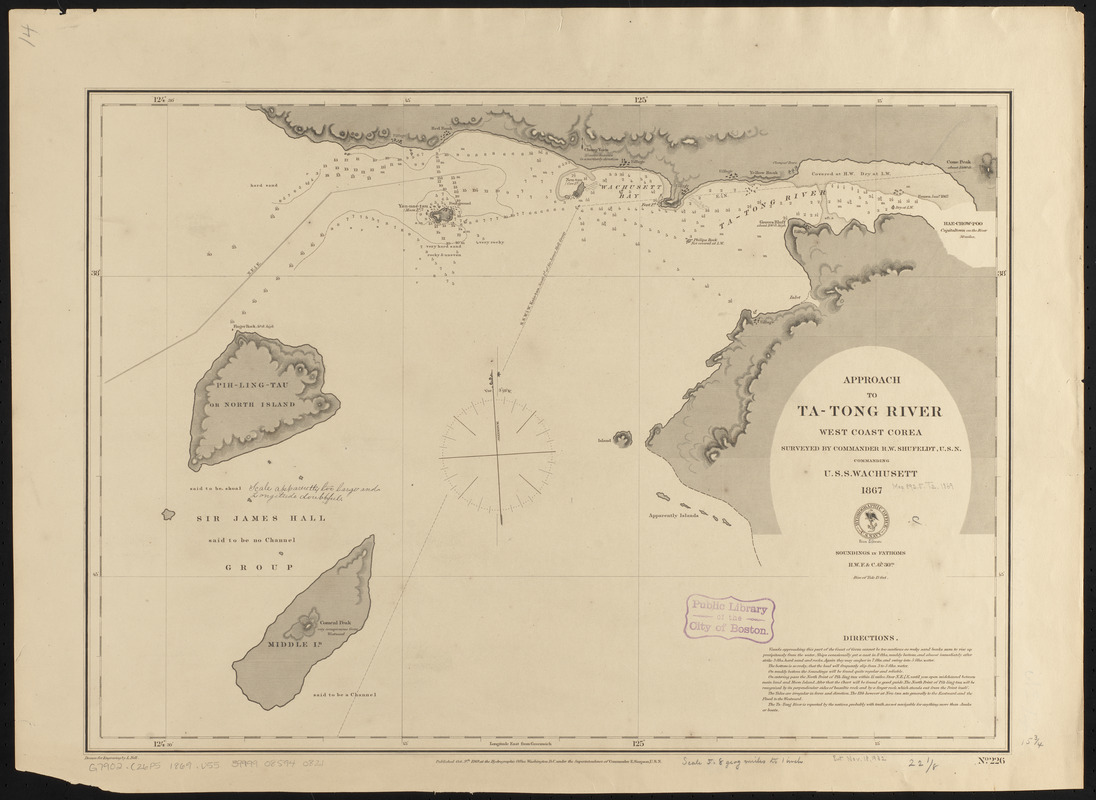
Approach to Ta-Tong River, west coast Corea
Item Information
- Title:
- Approach to Ta-Tong River, west coast Corea
- Issuing body:
- United States. Hydrographic Office
- Draftsman:
- Nell, L.
- Name on Item:
-
surveyed by Commander R.W. Shufeldt, U.S.N. commanding U.S.S. Wachusett, 1867 ; drawn for engraving by L. Nell
- Date:
-
1869
- Format:
-
Maps/Atlases
- Location:
-
Boston Public Library
Norman B. Leventhal Map & Education Center - Collection (local):
-
Norman B. Leventhal Map & Education Center Collection
- Subjects:
-
Nautical charts--Korea (North)--Kangjŏng River
Kangjŏng River (Korea)--Maps
- Places:
-
North KoreaSouth Hwanghae (province)
Kwangjŏng-ch’ŏn
- Extent:
- 1 map ; 40 x 57 cm
- Terms of Use:
-
No known copyright restrictions.
No known restrictions on use.
- Publisher:
-
Washington, D.C. :
Hydrographic Office
- Scale:
-
Scale approximately 1:110,000
- Language:
-
English
- Notes:
-
Latitude and longitude scales incorrect.
Relief shown by hachures. Depths shown by soundings.
- Identifier:
-
06_01_015918
- Call #:
-
G9096.P5 svar .U55
- Barcode:
-
39999085940821


