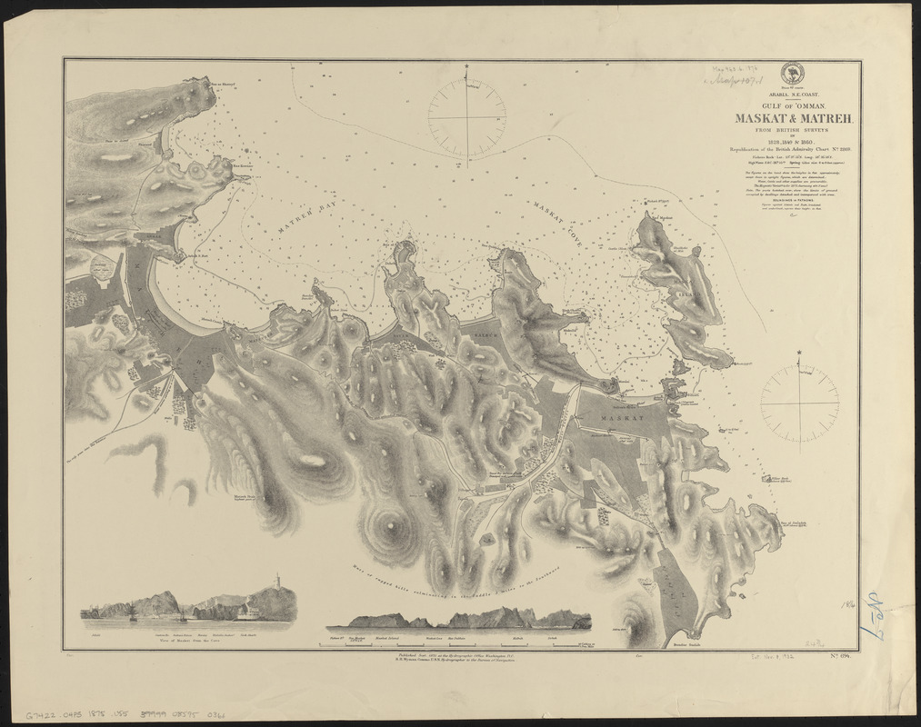
Arabia, n.e. coast, Gulf of 'Omman, Maskat & Matreh : from British surveys in 1828, 1849 & 1860 : republication of the British Admiralty chart no. 2869
Item Information
- Title:
- Arabia, n.e. coast, Gulf of 'Omman, Maskat & Matreh : from British surveys in 1828, 1849 & 1860 : republication of the British Admiralty chart no. 2869
- Title (alt.):
-
Gulf of 'Omman, Maskat & Matreh
- Issuing body:
- United States. Hydrographic Office
- Date:
-
1875
- Format:
-
Maps/Atlases
- Location:
-
Boston Public Library
Norman B. Leventhal Map & Education Center - Collection (local):
-
Norman B. Leventhal Map & Education Center Collection
- Subjects:
-
Nautical charts--Oman, Gulf of
Nautical charts--Oman--Muscat
Oman, Gulf of--Maps
Muscat (Oman)--Maps
- Places:
-
Oman, Gulf of
OmanMasqaṭMasqat
- Extent:
- 1 map ; 47 x 63 cm
- Terms of Use:
-
No known copyright restrictions.
No known restrictions on use.
- Publisher:
-
Washington, D.C. :
Hydrographic Office
- Scale:
-
Scale approximately 1:9,000
- Language:
-
English
- Notes:
-
Relief shown by hachures and spot heights. Depths shown by soundings and isolines.
Includes 2 coastal views.
- Identifier:
-
06_01_016645
- Call #:
-
G9096.P5 svar .U55
- Barcode:
-
39999085950366


