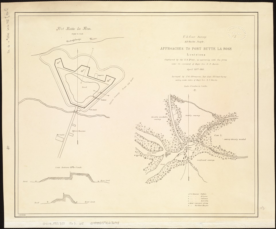
Approaches to Fort Butte La Rose, Louisiana : captured by the U.S. fleet, co-operating with the forces under the command of Major Gen. N.P. Banks. April 20th 1863
Item Information
- Title:
- Approaches to Fort Butte La Rose, Louisiana : captured by the U.S. fleet, co-operating with the forces under the command of Major Gen. N.P. Banks. April 20th 1863
- Creator:
- United States Coast Survey
- Name on Item:
-
Surveyed by J.G. Oltmanns, Sub-asst., U.S. Coast Survey, acting under orders of Major Gen. N.P. Banks ; J.W. Maedel.
- Date:
-
[1863]
- Format:
-
Maps/Atlases
- Location:
-
Boston Public Library
Norman B. Leventhal Map & Education Center - Collection (local):
-
Norman B. Leventhal Map & Education Center Collection
- Subjects:
-
Fort Butte La Rose (La.)--History--19th century--Maps
- Places:
-
LouisianaSaint Martin (county)Butte la Rose
- Extent:
- 1 map ; 33 x 39 cm.
- Terms of Use:
-
No known copyright restrictions.
No known restrictions on use.
- Publisher:
-
S.l :
U.S. Coast Survey
- Scale:
-
Scale 1:31,680.
- Language:
-
English
- Notes:
-
Gives vegetation, drainage, houses, fences, road leading from fort, and the position of the U.S. steamers Clifton, Arizona, Calhoun and Estrella, and the Confederate transport Anna and gunboat Marytie.
Insets: [Plan of] Fort Butte La Rose. 1:600. 22 x 20 cm.-- [Two] cross sections. 1:300. 7 x 15 cm.
Description derived from published bibliography.
- Notes (date):
-
This date is inferred.
- Identifier:
-
06_01_006850
- Call #:
-
G4014.F597S5 1863 .U5
- Barcode:
-
39999059028694
- LCCN:
-
99447199


