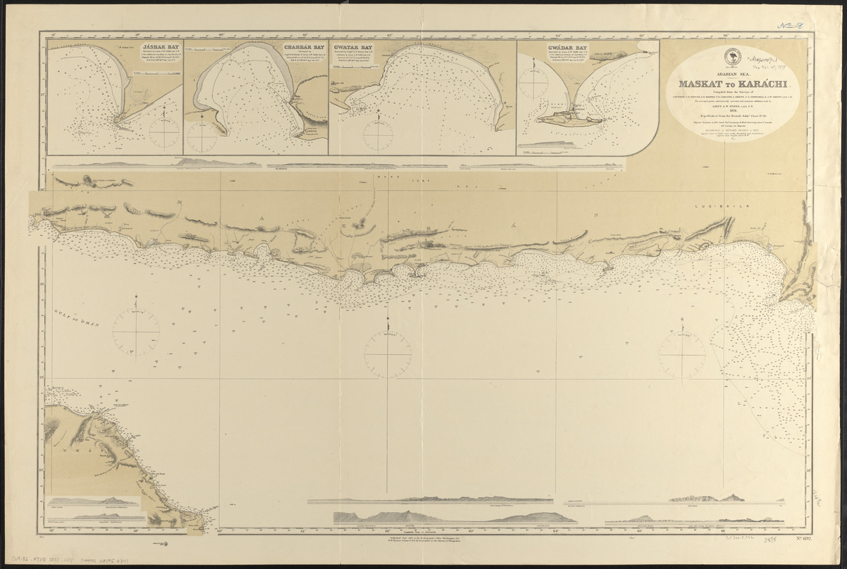
Arabian Sea, Maskat to Karáchi
Item Information
- Title:
- Arabian Sea, Maskat to Karáchi
- Title (alt.):
-
Maskat to Karáchi
- Issuing body:
- United States. Hydrographic Office
- Cartographer:
- Stiffe, A. W.
- Name on Item:
-
compiled from the surveys of Captains G.B. Brucks, S.B. Haines, T.G. Carless, A. Grieve, C.G. Constable, & A.W. Chitty, late I.N. ; the principal points astronomically corrected, and numerous additions made by Lieut. A.W. Stiffe, late I.N. 1874 ; republished from the British Admy. chart no. 38
- Date:
-
1875
- Format:
-
Maps/Atlases
- Location:
-
Boston Public Library
Norman B. Leventhal Map & Education Center - Collection (local):
-
Norman B. Leventhal Map & Education Center Collection
- Subjects:
-
Coasts--Iran--Maps
Coasts--Pakistan--Maps
Nautical charts--Arabian Sea
Arabian Sea--Maps
- Places:
-
Arabian Sea
- Extent:
- 1 map ; 65 x 101 cm
- Terms of Use:
-
No known copyright restrictions.
No known restrictions on use.
- Publisher:
-
Washington, D.C. :
Hydrographic Office
- Scale:
-
Scale approximately 1:930,000
- Language:
-
English
- Notes:
-
Relief shown by hachures and spot heights. Depths shown by soundings and isolines.
Insets: Jáshak Bay -- Chahbár Bay -- Gwatar Bay -- Gwádar Bay.
Includes 9 coastal views.
- Identifier:
-
06_01_016643
- Call #:
-
G9096.P5 svar .U55
- Barcode:
-
39999085950341


