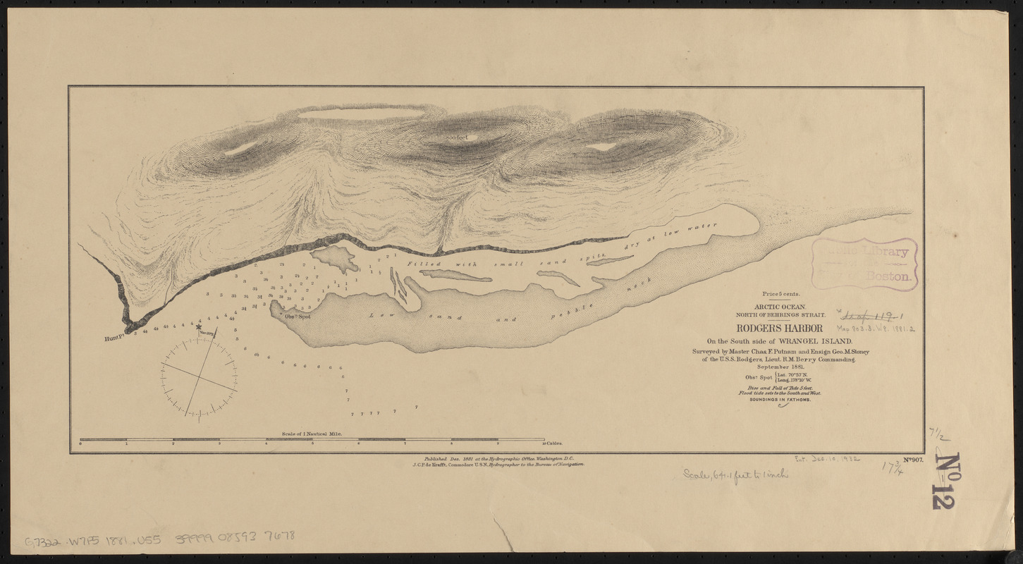
Arctic Ocean, north of Behrings Strait, Rodgers Harbor on the south side of Wrangel Island
Item Information
- Title:
- Arctic Ocean, north of Behrings Strait, Rodgers Harbor on the south side of Wrangel Island
- Title (alt.):
-
Rodgers Harbor on the south side of Wrangel Island
- Issuing body:
- United States. Hydrographic Office
- Surveyor:
- Putnam, Charles F.
- Surveyor:
- Stoney, George M., 1852-1905
- Name on Item:
-
surveyed by Master Chas. F. Putnam and Ensign Geo. M. Stoney of the U.S.S. Rodgers, Lieut. R.M. Berry Commanding, September 1881
- Date:
-
1881
- Format:
-
Maps/Atlases
- Location:
-
Boston Public Library
Norman B. Leventhal Map & Education Center - Collection (local):
-
Norman B. Leventhal Map & Education Center Collection
- Subjects:
-
Nautical charts--Russia (Federation)--Wrangel Island
Wrangel Island (Russia)--Maps
- Places:
-
RussiaWrangel Island (island)
- Extent:
- 1 map : mounted on linen ; 20 x 45 cm
- Terms of Use:
-
No known copyright restrictions.
No known restrictions on use.
- Publisher:
-
Washington, D.C. :
Hydrographic Office
- Scale:
-
Scale approximately 1:7,500
- Language:
-
English
- Notes:
-
Relief shown by hachures and spot heights. Depths shown by soundings.
"No. 907."
"Obsn. spot : Lat. 70⁰57ʹ N, Long. 178⁰10ʹ W."
- Identifier:
-
06_01_015520
- Call #:
-
G9096.P5 svar .U55
- Barcode:
-
39999085937678


