Toggle navigation
LMEC Home
Exhibitions
Georeferencing
Tools for Teachers
Collections
My Favorites
Sign Up / Log In
Search
Search the map portal
Map Collection
Map Collection
Map Sets
Search
Search
Search for
Search In
All Fields
Creator
Title
Subject
Place
Search All Digital Collections
Advanced Search
13385 Results
Filter your Search
Place
North and Central America
10,111
United States
8,249
Massachusetts
2,691
Suffolk (county)
1,664
Boston
1,621
Europe
1,386
Canada
949
New York
640
more
Place
»
Topic
Boston (Mass.)--Maps
741
City planning--Massachusetts--Boston--Maps
418
United States--History--Revolution, 1775-1783--Maps
329
United States--Maps
315
Urban renewal--Massachusetts--Boston--Maps
254
Real property--Massachusetts--Boston--Maps
252
Massachusetts--Maps
219
Insurance surveys
197
more
Topic
»
Date
Date range begin
–
Date range end
Current results range from
1482
to
2023
View distribution
Creator
United States. Hydrographic Office
595
Boston Redevelopment Authority
403
Des Barres, Joseph F. W. (Joseph Frederick Wallet), 1722-1824
247
Royal United Services Institute for Defence and Security Studies
160
Jefferys, Thomas, -1771
154
George, III, King of Great Britain, 1738-1820
152
George, IV, King of Great Britain, 1762-1830
151
O.H. Bailey & Co
148
more
Creator
»
Format
Maps/Atlases
13,205
Manuscripts
985
Prints
102
Books
49
Drawings/Illustrations
44
Photographs
15
Objects/Artifacts
13
Documents
7
more
Format
»
Georeferenced
Yes
979
No
12,406
Collection
Norman B. Leventhal Map & Education Center Collection
8,891
American Revolutionary War-Era Maps
3,305
Boston and New England Maps
2,804
Urban Maps
2,397
Maritime Charts and Atlases
1,150
William L. Clements Library Collection
910
Library of Congress Collection
618
Boston Redevelopment Authority Collection
475
more
Collection
»
Available to use
No known restrictions
9,952
Creative Commons license
1,677
Search Constraints
Sort by title
relevance
title
date (asc)
date (desc)
Number of results to display per page
50 per page
10
per page
20
per page
50
per page
100
per page
View results as:
grid view
map view
Search Results
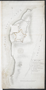
51.
A, PLAN of the Ground Defined to be Fortified at OSWEGO
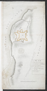
52.
A, PLAN of the Ground Defined to be Fortified at OSWEGO
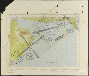
53.
[A sketch map of the proposed battery (?) on Jekyll Island (?)]
54.
The A.A.A. key road map of continental Europe
55.
AAF special chart - Gulf of Oman
56.
Aaron Bohrod's America, its history
57.
ABC pathfinder railway guide map : eastern division
58.
The able doctor; or America swallowing the bitter draught
59.
Abolition of Slavery, 1863
60.
Aboriginal map of North America, denoting the boundaries and the locations of various Indian tribes
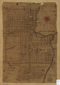
61.
The above is a connection of the three surveys which I have been able to make on Peters Creek, of yours to gether with John...
62.
The Above is a plan of the town of Cabot, State of Vermont
63.
The above plan is a discription of a new township called Royalsborough in the county of Cumberland : bounded southeasterly on...
64.
The above plan is a discription of a new township containing the quantity of seven and a half mile of land & water, granted by...
65.
Abriss der stadt Gibraltar und der darinn befindlichen festen platze, nebst dem meerbusen von Algesiras
66.
[Acadie, Isle Saint Jean and part of Isle Royale with the Baye Francoise]
67.
Acapulco, México
68.
[Account of the action at Fort Niagara]
69.
Accurata delineatio Castrorum Suecicorum, ut et Haffniae, Regni Daniae Metropolis
70.
Accurata delineatio oppugnatae a faederatis, Caesareis, Polonicis, Danicis, et Brandeburgicis copijs sub-ductu Seren: Electoris...
71.
Accurata delineatio regionis circa Nieburgum Fioniæ cum prælio ibi commisso inter Danorum et fæderatorum exercitum ab una et...
72.
Accurata Scaniae, Blekingiae et Hallandiae descriptio
73.
An accurate map of Canada, with the adjacent countries : exhibiting the late seat of war between the English & French in those...
74.
An accurate map of Canada, with the adjacent countries; exhibiting the late seat of war between the English & French in those...
75.
An accurate map of Cuba, and the adjacent islands
76.
An accurate map of Dorset Shire divided into hundreds
77.
An accurate map of Dorset Shire, divided into its hundreds
78.
An accurate map of England and Wales with the principal roads from the best authorities
79.
An accurate map of England and Wales with the principal roads from the best authorities
80.
An accurate map of Europe from the best authorities
81.
An accurate map of Hindostan or India, from the best authorities
82.
An accurate map of His Majesty's province of New-Hampshire in New England : taken from actual surveys of all the inhabited...
83.
An accurate map of His Majesty's province of New-Hampshire in New England : taken from actual surveys of all the inhabited...
84.
An accurate map of His Majesty's Province of New-Hampshire in New England & all the adjacent country northward to the River St....
85.
An Accurate map of New Hampshire in New England, from a late survey
86.
An accurate map of New York in North America from a late survey
87.
An Accurate map of New York in North America, from a late survey
88.
An accurate map of North America
89.
An accurate map of North America : describing and distinguishing the British, Spanish and French dominions on this great...
90.
An accurate map of North America : describing and distinguishing the British and Spanish dominions on this great continent :...
91.
An accurate map of North America : describing and distinguishing the British and Spanish dominions on this great continent :...
92.
An accurate map of North America : Describing and distinguishing the British and Spanish dominions of this great continent;...
93.
An accurate map of North America : describing and distinguishing the British and Spanish dominions of this great continent;...
94.
An accurate map of North and South Carolina with their Indian frontiers, shewing in a distinct manner all the mountains,...
95.
An accurate map of Rhode Island, part of Connecticut and Massachusets, shewing Admiral Arbuthnot's station in blocking up...
96.
An accurate map of Rhode Island, part of Connecticut and Massachusets, shewing Admiral Arbuthnot's station in blocking up...
97.
An accurate map of Staten Island : with that part of New York, Long Island and the Jerseys, which is the rendesvous of the two...
98.
An accurate map of the British Empire in Nth. America as settled by the preliminaries in 1762
99.
An accurate map of the British empire in Nth. America as settled by the preliminaries in 1762
100.
An accurate map of the British, French & Spanish settlements in Nth. America and the West Indies : as stipulated by the...
‹ Prev
Next ›
1
2
3
4
5
6
…
267
268
![[A sketch map of the proposed battery (?) on Jekyll Island (?)]](https://bpldcassets.blob.core.windows.net/derivatives/images/commonwealth:hx11z460q/image_thumbnail_300.jpg)


![[Acadie, Isle Saint Jean and part of Isle Royale with the Baye Francoise]](https://bpldcassets.blob.core.windows.net/derivatives/images/commonwealth:hx11z490f/image_thumbnail_300.jpg)

![[Account of the action at Fort Niagara]](https://bpldcassets.blob.core.windows.net/derivatives/images/commonwealth:6108vv66z/image_thumbnail_300.jpg)


