Search Constraints
Search Results


13206. West Newton, Massachusetts

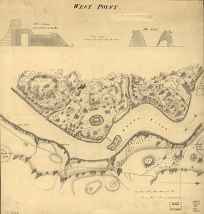
13208. West Point

13210. West Point


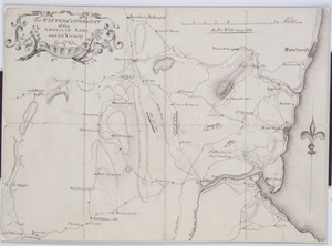
13212. West Point and vicinity

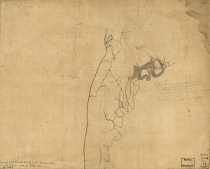
13213. West Point, New York

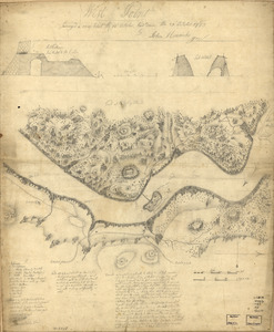
13214. West Point; or Fort Defiance

13215. West Randolph, Vt : 1886


13218. Westboro, Mass., 1880


13223. Western hemisphere


13231. Western theatre-European war

13232. Westfield

13233. Westfield, Mass : 1875

13234. Westford, Mass : 1886


13239. Westindische Inseln


13241. Westliche halbkugel


13243. Weymouth, Mass., 1880


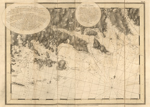
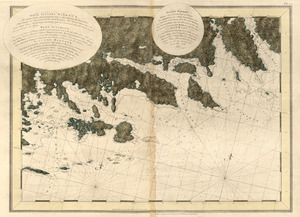
13245. Whale chart

13246. Whale chart


13251. White Haven
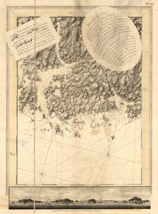
13252. White Haven

13253. White Haven
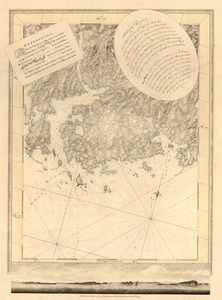
13254. White Haven

13255. White Haven


13263. White Plains

13264. Whitinsville, Mass.


![Whitman Mills (Cotton Mill), New Bedford, Mass. [insurance map]](https://bpldcassets.blob.core.windows.net/derivatives/images/commonwealth:ww72c001v/image_thumbnail_300.jpg)


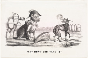
13271. Why don't you take it?


13274. Wilbraham
![Wilcox Manufacturing Company, Bldg., Kalco Textile Company, Inc. et al., Ten., New Bedford, Mass. [insurance map]](https://bpldcassets.blob.core.windows.net/derivatives/images/commonwealth:ww72c004p/image_thumbnail_300.jpg)

13276. The Wilderness

![[Willard's new map of the Hudson River for 1844]](https://bpldcassets.blob.core.windows.net/derivatives/images/commonwealth:b8516310f/image_thumbnail_300.jpg)
![William G. Schoonover & Linton A. Thrasher (Bldg.), Joseph P. Duchaine d/b/a My Bread Baking Co. (Ten.), New Bedford, Mass. [insurance map]](https://bpldcassets.blob.core.windows.net/derivatives/images/commonwealth:ww72bz99v/image_thumbnail_300.jpg)


13284. Williamstown, Mass


13286. Wilmington, Del : 1874

13287. Wilmington, Delaware

13288. Wilton, N.H


13290. Winchendon


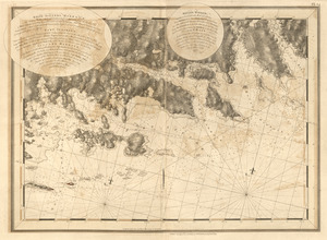
![Wind and current chart of the North Atlantic [sheet 1]](https://bpldcassets.blob.core.windows.net/derivatives/images/commonwealth:jh344151t/image_thumbnail_300.jpg)

13294. Windsor, Vermont : 1886


![Winslow & McKenzie "Warehouse," New Bedford, Mass. [insurance map]](https://bpldcassets.blob.core.windows.net/derivatives/images/commonwealth:ww72c0067/image_thumbnail_300.jpg)