West Point, New York
Item Information
- Title:
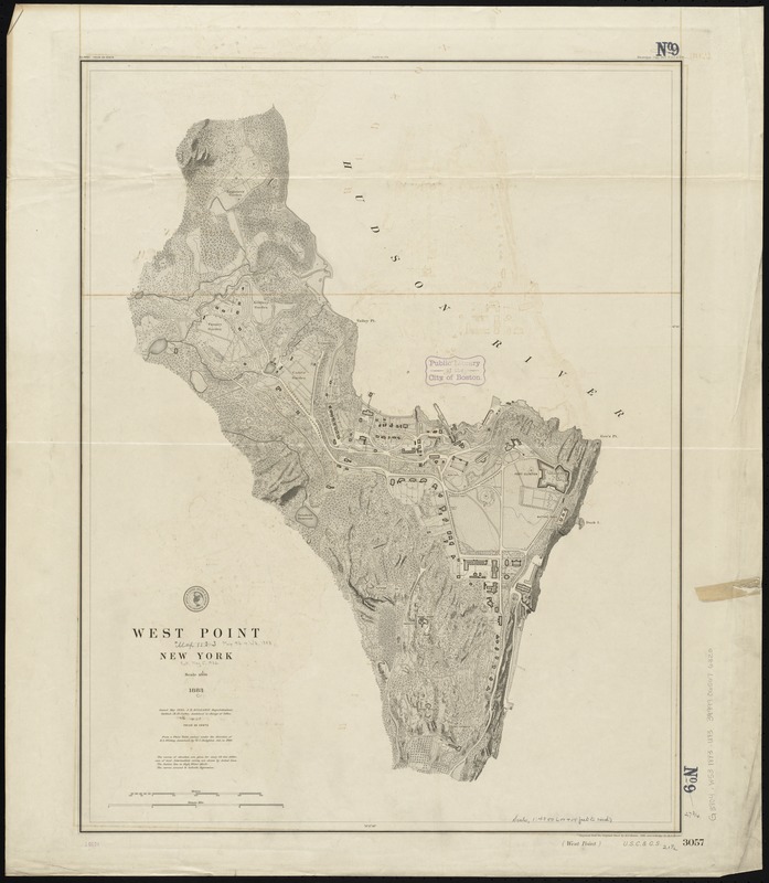
- West Point, New York
- Title in lower margin :
- West Point, U.S.C & G.S. 3057
- Creator:
- U.S. Coast and Geodetic Survey
- Name on Item:
-
from a plane table survey under the direction of H.L. Whiting, Assistant, by W.C. Hodgkins, Aid. ; engraved from the original sheet by H.C. Evans ; title and lettering by E.A. Maedel.
- Date:
-
1883
- Format:
-
Maps/Atlases
- Location:
-
Boston Public Library
Norman B. Leventhal Map & Education Center - Collection (local):
-
Norman B. Leventhal Map & Education Center Collection
- Subjects:
-
West Point (N.Y.)--Maps
- Places:
-
New YorkOrange (county)West Point
- Extent:
- 1 map ; 71 x 55 cm.
- Terms of Use:
-
No known copyright restrictions.
No known restrictions on use.
- Publisher:
-
[Washington, D.C.] :
U.S. Coast and Geodetic Survey
- Edition:
- Issued May 1883.
- Scale:
-
Scale 1:4,800
- Language:
-
English
- Notes:
-
Relief shown by contours and spot heights.
"Electrotype copy no. 1 U.S.C. & G.S."--Upper right margin.
"No. 3057 Price 25 cents"--Upper left margin.
"Plate no. 1764"--Upper center margin.
- Identifier:
-
06_01_010716
- Call #:
-
G3804.W53 1883 .U83
- Barcode:
-
39999065676320
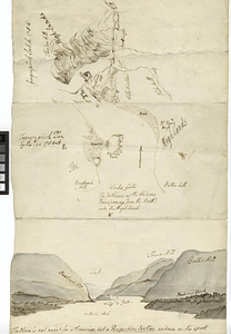
![Geographick scetch [sic], 1754](https://bpldcassets.blob.core.windows.net/derivatives/metadata/commonwealth-oai:pk02h894n/image_thumbnail_300.jpg)