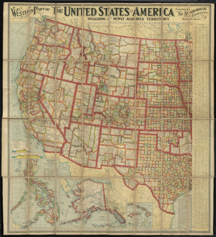
Western part of the United States of America including all its newly acquired territory
Item Information
- Title:
- Western part of the United States of America including all its newly acquired territory
- Creator:
- Scarborough Company
- Name on Item:
-
published by the Scarborough Company
- Date:
-
[ca. 1900–1909]
- Format:
-
Maps/Atlases
- Location:
-
Boston Public Library
Norman B. Leventhal Map & Education Center - Collection (local):
-
Norman B. Leventhal Map & Education Center Collection
- Subjects:
-
United States--Maps
- Places:
-
United States
- Extent:
- 1 map : color ; 94 x 76 cm
- Terms of Use:
-
No known copyright restrictions.
No known restrictions on use.
- Publisher:
-
Boston :
The Company
- Scale:
-
Scale 1:3,294,720
- Language:
-
English
- Notes:
-
Relief shown by hachures.
Includes indexes with population figures, population charts, list of railroads, canal profiles, and distance tables.
Insets: Philippine Islands -- Alaska -- [South Pacific Islands].
Insets: Cuba -- Porto Rico -- Map showing territorial growth in the United States.
Map of eastern part covered by linen.
- Identifier:
-
06_01_009743
- Call #:
-
G4050 1900 .S23x
- Barcode:
-
39999065663195


