Wind and current chart of the North Atlantic [sheet 1]
![Wind and current chart of the North Atlantic [sheet 1]](https://bpldcassets.blob.core.windows.net/derivatives/images/commonwealth:jh344151t/image_access_800.jpg)
Item Information
- Title:
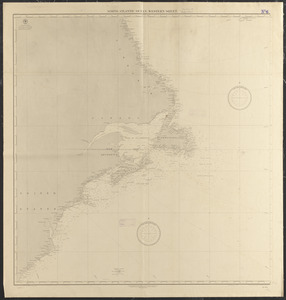
- Wind and current chart of the North Atlantic [sheet 1]
- Cartographer:
- Maury, Matthew Fontaine, 1806-1873
- Cartographer:
- Whiting, W. B.
- Engraver:
- Sherman & Smith
- Publisher:
- United States. Hydrographic Office
- Name on Item:
-
by M.F. Maury A.M. Lieut. U.S. Navy, Superint'dt. of U.S.N. Observatory, Washington ; compiled from materials in the Bureau of Ordnance and Hydrography, Commodore Lewis Warrington, Chief of Bureau ; drawn by Lt. W.B. Whiting, U.S.N.
- Date:
-
1850
- Format:
-
Maps/Atlases
- Location:
-
Boston Public Library
Norman B. Leventhal Map & Education Center - Collection (local):
-
Norman B. Leventhal Map & Education Center Collection
- Subjects:
-
Winds--North Atlantic Ocean--Maps
Magnetic declination--North Atlantic Ocean--Maps
Ocean currents--North Atlantic Ocean--Maps
Ocean temperature--North Atlantic Ocean--Maps
Nautical charts--North Atlantic Ocean
Ocean travel--North Atlantic Ocean--Maps
North Atlantic Ocean--Maps
- Places:
-
Atlantic Ocean
- Extent:
- 1 map : color ; 88 x 61 cm
- Terms of Use:
-
No known copyright restrictions.
No known restrictions on use.
- Publisher:
-
Washington, D.C. :
United States Hydrographical Office
- Edition:
- 3d edition
- Scale:
-
Scale approximately 1:5,500,000
- Language:
-
English
- Notes:
-
Sheet 1 only, covering coast of the United States and Central America, of a set of 8 sheets.
Shows winds, currents, magnetic variation, water temperature, tracks of vessels and month of voyage.
- Notes (citation):
-
Navigation, volume 18, number 2, pages 123-137
- Identifier:
-
06_01_015445
- Call #:
-
G9111.C842 1850 .M38
- Barcode:
-
39999085937090