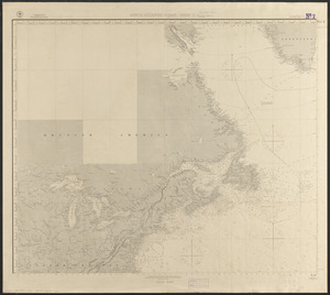
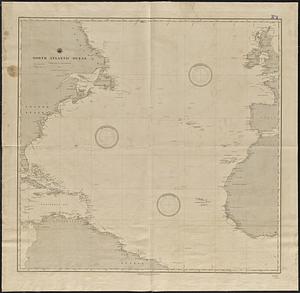
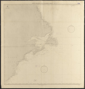
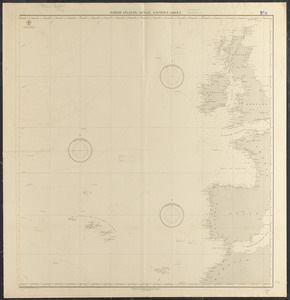
North Atlantic Ocean

Item Information
- Title:
- North Atlantic Ocean
- Title (alt.):
-
North Atlantic Ocean, eastern sheet
North Atlantic Ocean, western sheet
- Issuing body:
- United States. Hydrographic Office
- Engraver:
- Evans, H. C. (Henry C.)
- Engraver:
- Hazzard, J. L. (John L.)
- Cartographer:
- Nell, Louis
- Engraver:
- Ruebsam, E. A. (E. August)
- Name on Item:
-
drawn by Louis Nell ; engraved by J.L. Hazzard and E.A. Ruebsam ; engraved by H.C. Evans and E.A. Ruebsam
- Date:
-
1888
- Format:
-
Maps/Atlases
- Location:
-
Boston Public Library
Norman B. Leventhal Map & Education Center - Collection (local):
-
Norman B. Leventhal Map & Education Center Collection
- Subjects:
-
Nautical charts--North Atlantic Ocean
North Atlantic Ocean--Maps
- Places:
-
Atlantic Ocean
- Extent:
- 1 map on 2 sheets ; 97 x 184 cm, on sheets 108 x 104 cm
- Terms of Use:
-
No known copyright restrictions.
No known restrictions on use.
- Publisher:
-
Washington, D.C. :
Hydrographic Office
- Edition:
- Edition of August 1888
- Scale:
-
Scale approximately 1:4,200,000
- Language:
-
English
- Table of Contents:
-
Eastern sheet
Western sheet.
- Notes:
-
Depths shown by soundings.
"Cor. (1888-47."
- Identifier:
-
06_01_015512B
06_01_015512A
- Call #:
-
G9096.P5 svar .U55 no.955-956
- Barcode:
-
39999085937579