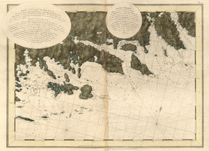
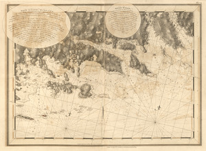
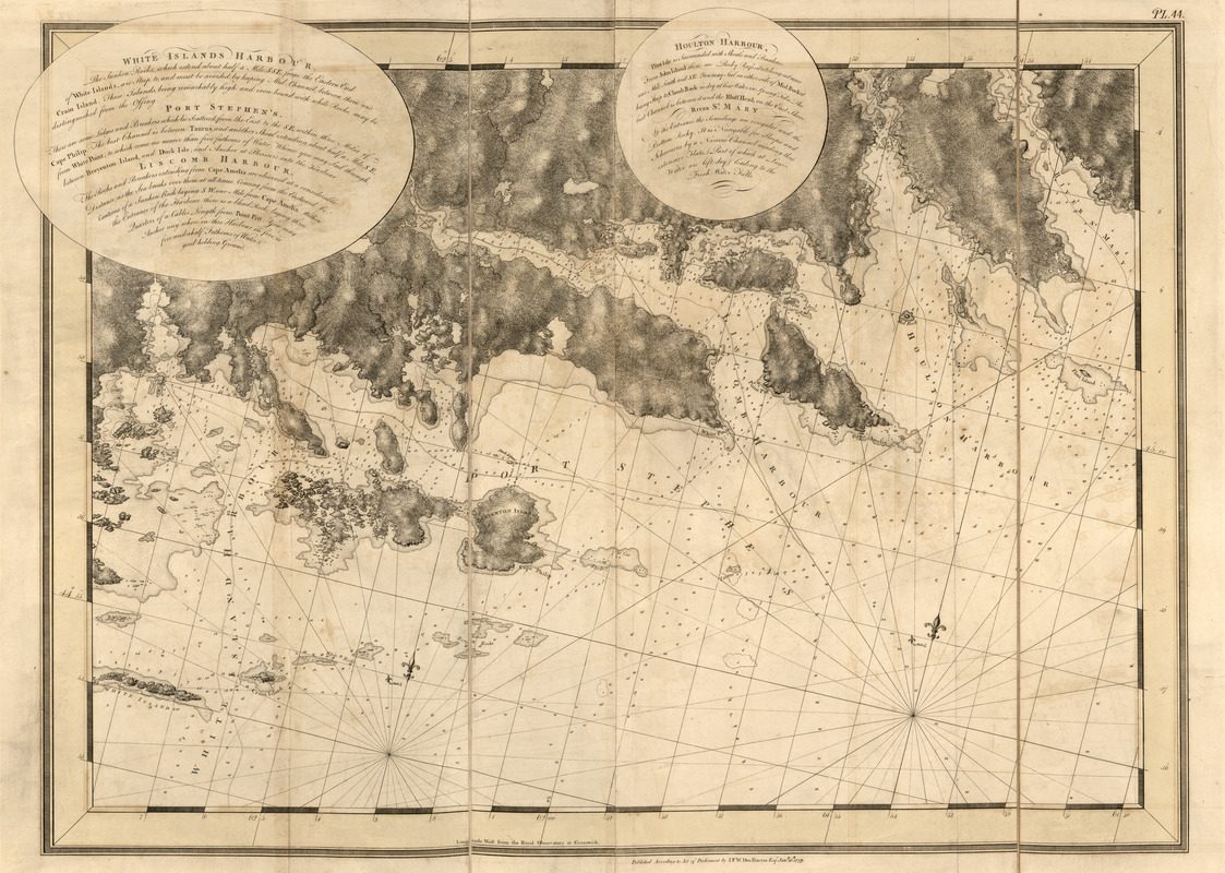
White Islands Harbour ; Port Stephen's ; Liscomb Harbour ; Houlton Harbour ; River St. Mary
This map is also available in American Revolutionary Geographies Online (ARGO), a collections portal especially built for material relating to the American Revolutionary War Era. Visit ARGO to learn more about this item and explore the historical geography of North America in the late eighteenth century.
Item Information
- Title:
- White Islands Harbour ; Port Stephen's ; Liscomb Harbour ; Houlton Harbour ; River St. Mary
- Publisher:
- Des Barres, Joseph F. W. (Joseph Frederick Wallet), 1722-1824
- Date:
-
1779
- Format:
-
Maps/Atlases
- Location:
- Library of Congress Geography and Map Division
- Collection (local):
-
Library of Congress Geography and Map Division
- Subjects:
-
Coasts--Nova Scotia--Maps
Houlton Harbour (N.S.)--Maps
Liscomb Harbour (N.S.)--Maps
Port Stephen's (N.S.)--Maps
Saint Mary River (N.S.)--Maps
White Islands Harbour (N.S.)--Maps
- Places:
-
CanadaSaint Marys River
Liscomb Harbour
Gegogan Harbour
Marie Joseph Harbour
Ecum Secum Harbour
- Extent:
- 1 map ; 69 x 96 cm.
- Terms of Use:
-
No known copyright restrictions.
This work is licensed for use under a Creative Commons Attribution Non-Commercial Share Alike License (CC BY-NC-SA).

- Publisher:
-
[London] :
J.F.W. Des Barres
- Scale:
-
Scale [ca. 1:20,833]
- Language:
-
English
- Catalog Record:
-
https://lccn.loc.gov/75332500
- Notes:
-
State 3. Date of imprint advanced to Jany. 15th, 1779 and "Pl. 44" engraved in upper right.