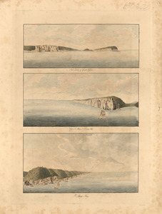
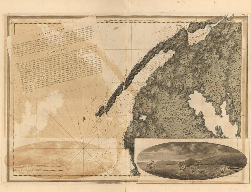
Annapolis Royal ; St. Mary's Bay
This map is also available in American Revolutionary Geographies Online (ARGO), a collections portal especially built for material relating to the American Revolutionary War Era. Visit ARGO to learn more about this item and explore the historical geography of North America in the late eighteenth century.
Item Information
- Title:
- Annapolis Royal ; St. Mary's Bay
- Publisher:
- Des Barres, Joseph F. W. (Joseph Frederick Wallet), 1722-1824
- Date:
-
1781
- Format:
-
Maps/Atlases
- Location:
- Library of Congress Geography and Map Division
- Collection (local):
-
Library of Congress Geography and Map Division
- Subjects:
-
Coasts--Nova Scotia--Maps
Annapolis Basin (N.S.)--Maps
Annapolis Royal (N.S.)--Maps
Saint Mary Bay (N.S.)--Maps
- Places:
-
CanadaAnnapolis Basin (bay)
CanadaAnnapolis Royal
CanadaSaint Mary's Bay
- Extent:
- 1 map : hand col. ; 73 x 103 cm
- Terms of Use:
-
No known copyright restrictions.
This work is licensed for use under a Creative Commons Attribution Non-Commercial Share Alike License (CC BY-NC-SA).

- Publisher:
-
[London] :
J.F.W. Des Barres
- Scale:
-
Scale [ca. 1:120,000]
- Language:
-
English
- Catalog Record:
-
https://lccn.loc.gov/75332518
- Notes:
-
State 7. Date of imprint advanced to January 1, 1781; Rock and tree-like symbols added to the interior; relief shading darkened; additional settlements inserted near Annapolis Royal and along the east side of St. Mary's Bay.