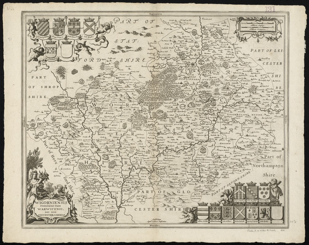
Wigorniensis comitatus cum Warwicensi, nec non Conventriae Libertas
Item Information
- Title:
- Wigorniensis comitatus cum Warwicensi, nec non Conventriae Libertas
- Title (alt.):
-
Collection of old maps
- Creator:
- Jansson, Jan, 1588-1664
- Date:
-
[1646?]
- Format:
-
Maps/Atlases
- Location:
-
Boston Public Library
Norman B. Leventhal Map & Education Center - Collection (local):
-
Norman B. Leventhal Map & Education Center Collection
- Subjects:
-
Worcestershire (England)--Maps--Early works to 1800
Warwickshire (England)--Maps--Early works to 1800
- Places:
-
EnglandWarwickshire (county)
EnglandWorcestershire (county)
- Extent:
- 1 map ; 42 x 52 cm.
- Terms of Use:
-
No known copyright restrictions.
No known restrictions on use.
- Publisher:
-
Amstelodami :
apud Ioannem Ianssonium
- Scale:
-
Scale [ca. 1: 179,000]
- Language:
-
Latin
- Notes:
-
Relief shown pictorially.
Cartouche decorated with mythological figures. Coats of arms of local nobility in upper left and lower right corners.
Lacks text on verso.
Struck from the same plate as a map found in: Nieuwen atlas ofte werelt-beschrijvinge, vertoonende de voornaemste rijckenende landen des gheheelen aerdt-bodems. Vermeerdert met veele schoone landt-kaarten. Nieuwelijcks uytgegeven.... Amsterdam : apud Ioannem Ianssonium, 1657-[87] 6 vols. (Vol. 4, map no. 29).
Cataloging, conservation, and digitization made possible in part by The National Endowment for the Humanities: Exploring the human endeavor.
Part of composite portfolio atlas with title "Collection of old maps."
- Identifier:
-
06_01_010093
- Call #:
-
G1015 .C651 1630
- Barcode:
-
30000003119371


