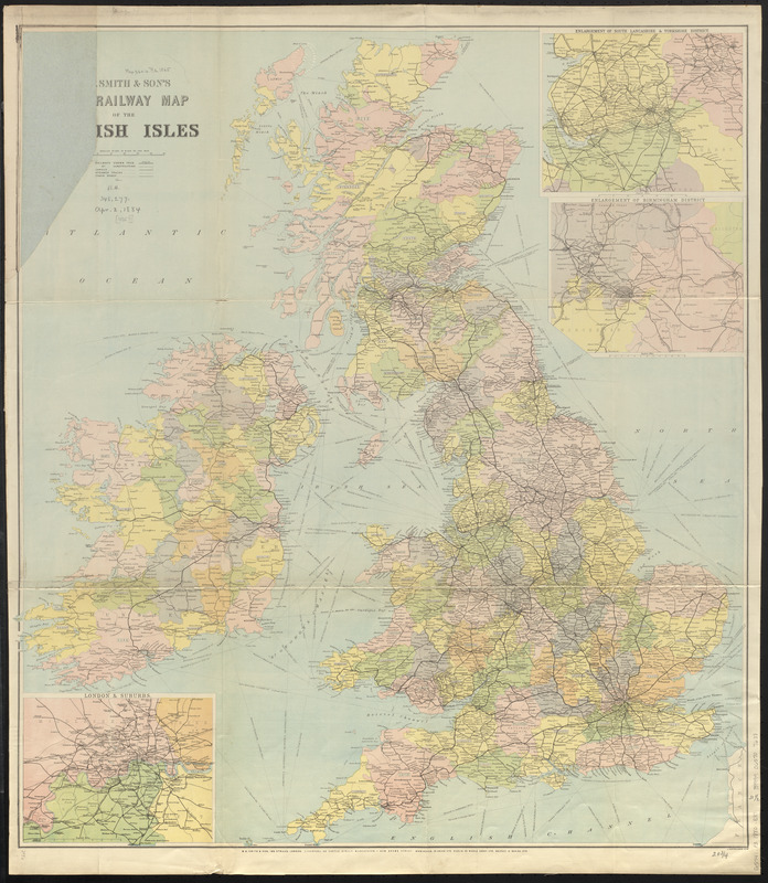
W.H. Smith & Son's new railway map of the British Isles
Item Information
- Title:
- W.H. Smith & Son's new railway map of the British Isles
- Title (alt.):
-
New railway map of the British Isles
- Cartographer:
- Bartholomew, John, 1831-1893
- Publisher:
- W.H. Smith & Son
- Name on Item:
-
J. Bartholomew
- Date:
-
[ca. 1880–1882]
- Format:
-
Maps/Atlases
- Location:
-
Boston Public Library
Norman B. Leventhal Map & Education Center - Collection (local):
-
Norman B. Leventhal Map & Education Center Collection
- Subjects:
-
Railroads--British Isles--Maps
Shipping--British Isles--Maps
British Isles--Maps
- Places:
-
British Isles (area)
- Extent:
- 1 map : color ; 82 x 74 cm
- Terms of Use:
-
No known copyright restrictions.
No known restrictions on use.
- Publisher:
-
London :
W.H. Smith & Son
- Scale:
-
Scale 1:1,203,840. 19 miles to 1 inch
- Language:
-
English
- Notes:
-
Shows railways and stations, canals, steamer tracks and coach roads.
Relief shown by spot heights.
Date estimated from construction on railways.
Colored by county.
Insets: Enlargement of South Lancashire & Yorkshire district. Scale approximately 1:563,200 -- Enlargement of Birmingham district. Scale approximately 1:253,440 -- London & suburbs. Scale approximately 1:168,960.
- Identifier:
-
06_01_014860
- Call #:
-
G5741.P3 1880 .B37
- Barcode:
-
39999065707638


