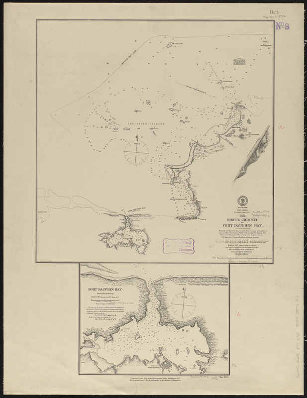
West-Indies, n. coast of Haiti, from Monte Christi to Fort Dauphin Bay ; Fort Dauphin Bay : from a French Survey
Item Information
- Title:
- West-Indies, n. coast of Haiti, from Monte Christi to Fort Dauphin Bay ; Fort Dauphin Bay : from a French Survey
- Title (alt.):
-
From Monte Christi to Fort Dauphin Bay
Fort Dauphin Bay : from a French Survey
West-Indies, n. coast of Haiti, from Monte Christi to Fort Dauphin Bay
- Issuing body:
- United States. Hydrographic Office
- Date:
-
1877
- Format:
-
Maps/Atlases
- Location:
-
Boston Public Library
Norman B. Leventhal Map & Education Center - Collection (local):
-
Norman B. Leventhal Map & Education Center Collection
- Subjects:
-
Coasts--Hispaniola--Maps
Nautical charts--Dominican Republic--Monte Cristi Bay
Nautical charts--Manzanillo Bay (Dominican Republic and Haiti)
Nautical charts--Haiti--Fort Liberté Bay
Monte Cristi Bay (Dominican Republic)--Maps
Manzanillo Bay (Dominican Republic and Haiti)--Maps
Fort Liberté Bay (Haiti)--Maps
- Places:
-
Dominican RepublicMonte Cristi (province)Monte Cristi, Bahía de
Manzanillo Bay
HaitiNord-EstFort Liberté, Baie de (bay)
- Extent:
- 2 maps on 1 sheet ; 44 x 43 and 20 x 27 cm, on sheet 71 x 54 cm
- Terms of Use:
-
No known copyright restrictions.
No known restrictions on use.
- Publisher:
-
Washington, D.C. :
Hydrographic Office
- Scale:
-
Scale approximately 1:36,500
Scale approximately 1:103,500
- Language:
-
English
- Table of Contents:
-
From Monte Christi to Fort Dauphin Bay
Fort Dauphin Bay.
- Notes:
-
Relief shown by hachures and spot heights. Depths shown by soundings and isolines.
- Identifier:
-
06_01_015702
- Call #:
-
G9096.P5 svar .U55
- Barcode:
-
39999085939112


