Toggle navigation
LMEC Home
Exhibitions
Georeferencing
Tools for Teachers
Collections
My Favorites
Sign Up / Log In
Search
Search the map portal
Map Collection
Map Collection
Map Sets
Search
Search
Search for
Search In
All Fields
Creator
Title
Subject
Place
Search All Digital Collections
Advanced Search
13385 Results
Filter your Search
Place
North and Central America
9,353
United States
7,078
Suffolk (county)
1,664
Boston
1,621
Europe
1,035
Canada
949
Massachusetts
794
New York
532
more
Place
»
Topic
Boston (Mass.)--Maps
741
City planning--Massachusetts--Boston--Maps
418
United States--History--Revolution, 1775-1783--Maps
329
United States--Maps
315
Urban renewal--Massachusetts--Boston--Maps
254
Real property--Massachusetts--Boston--Maps
252
Massachusetts--Maps
219
Insurance surveys
197
more
Topic
»
Date
Date range begin
–
Date range end
Current results range from
1482
to
2023
View distribution
Creator
United States. Hydrographic Office
595
Boston Redevelopment Authority
403
Des Barres, Joseph F. W. (Joseph Frederick Wallet), 1722-1824
247
Royal United Services Institute for Defence and Security Studies
160
Jefferys, Thomas, -1771
154
George, III, King of Great Britain, 1738-1820
152
George, IV, King of Great Britain, 1762-1830
151
O.H. Bailey & Co
148
more
Creator
»
Format
Maps/Atlases
13,205
Manuscripts
985
Prints
102
Books
49
Drawings/Illustrations
44
Photographs
15
Objects/Artifacts
13
Documents
7
more
Format
»
Georeferenced
Yes
979
No
12,406
Collection
Norman B. Leventhal Map Center Collection
8,891
American Revolutionary War-Era Maps
3,305
Boston and New England Maps
2,804
Urban Maps
2,397
Maritime Charts and Atlases
1,150
William L. Clements Library Collection
910
Library of Congress Collection
618
Boston Redevelopment Authority Collection
475
more
Collection
»
Available to use
No known restrictions
9,952
Creative Commons license
1,677
Search Constraints
Sort by relevance
relevance
title
date (asc)
date (desc)
Number of results to display per page
100 per page
10
per page
20
per page
50
per page
100
per page
View results as:
grid view
map view
Search Results
10501.
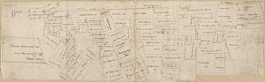
Portion of a map of Feliciana District, Spanish Louisiana, from the Lac de la Croix to Thompson's Creek
10502.
Portion of the copper district, Michigan, Lake Superior
10503.
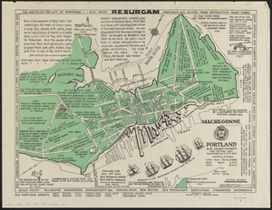
Portland also called Falmouth first settled 1632 chartered as a city 1832
10504.
Portland, Penn
10505.
Porto Rico and Virgin Isles : Haiti, Hispaniola or St. Domingo
10506.
Portolan atlas
10507.
Porto-Rico showing road work, light houses, rail roads, towns and coast line
10508.
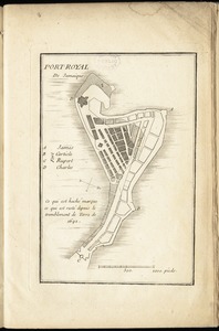
Port-Royal de Jamaique
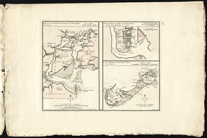
10509.
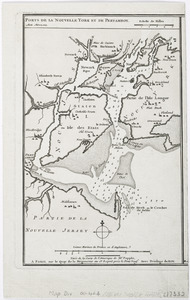
Ports de la Nouvelle York et de Pertamboy -- Plan de la ville et du port de Charles Town dans la Caroline Méridionale -- I. de...
10510.
Ports de la Nouvelle York et Pertamboy : aux anglois
10511.
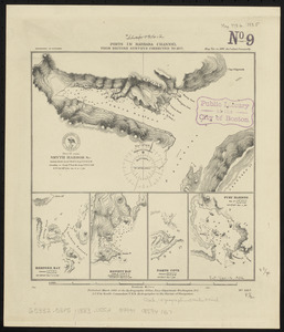
Ports in Barbara Channel : from British surveys corrected to 1877
10512.
Ports in the Philippine Islands
10513.
Portsmouth
10514.
Portsmouth and Norfolk
10515.
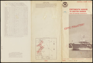
Portsmouth Harbor to Boston Harbor
10516.
Portsmouth, New Hampshire
10517.
Portugal is not a small country
10518.
The Portuguese Douro and the adjacent country : and so much of the river as can be made navigable in Spain = Douro Portuguez e...
10519.
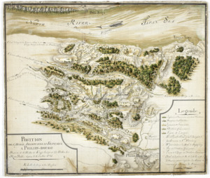
Position de 'larmee Américane et Française a Philips-bourg : distante de 12 milles de Kings-bridge et 25 milles de New-York,...
10520.
Position de notre camp le 24 juin 1777 à Perth Amboy
10521.
Position der Koenigl;Grosbrittanischen und derer vereinigten provinzial armée in New York und dem Jerseys in Nord America im...
10522.
Position des Armées amériquaine et françoise à Kings-ferry, Peaks-hill, Crompond et Hunts-taverne : du 17. septembre au 20...
10523.
Position du camp de l'armée combinée a Philipsburg du 6 juillet au 19 aoust
10524.
Position of the army near Iron Hill
10525.
Position of the army on the 8th Octbr. 1777
10526.
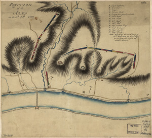
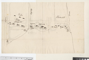
Position of the detachment under Lieut. Col. Baum, at Walmscock near Bennington shewing the attacks of the enemy on the 16th...
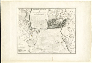
10527.
Position of the detachment under Lieut. Col. Baum, at Walmscock near Bennington shewing the attacks of the enemy on the 16th...
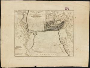
10528.
Position of the detachment under Lieut't Col. Baum & attacks of the enemy on the 16th August at Walmscock near Benington, 1777
10529.
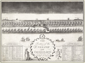
The position of the English and French fleets on the 12th of April 1782 at 10 oclock in the morning
10530.
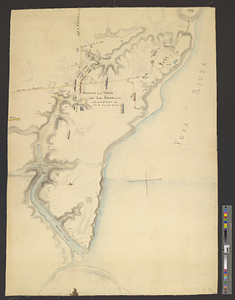
Position of the troops under Earl Cornwallis on the 28 and 29th September 1781; when the enemy first appeared
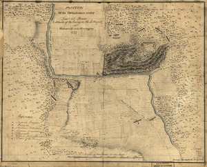
10531.
Positions of the British troops between the Hudson River and the Bronx River at Valentine's Hill
10532.
Post road & Kaskutahook
10533.
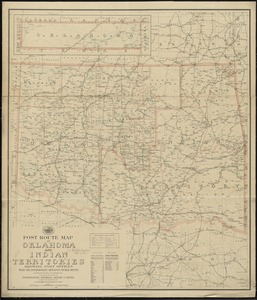
Post route map of Oklahoma and Indian territories showing post offices with the intermediate distances on mail routes in...
10534.
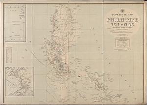
Post route map of Philippine Islands showing post offices in operation on the 1st of December, 1903
10535.
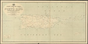
Post route map of Porto-Rico showing post offices in operation on the 1st of December, 1903
10536.
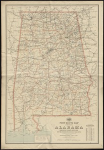
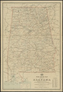
Post route map of the State of Alabama showing post offices with the intermediate distances on mail routes in operation on the...
10537.
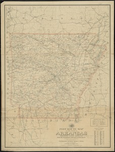
Post route map of the state of Alabama showing post offices with the intermediate distances on mail routes in operation on the...
10538.
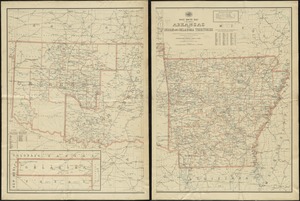
Post route map of the state of Arkansas and of Indian and Oklahoma territories showing post offices with the intermediate...
10539.
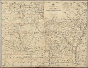
Post route map of the State of Arkansas and of Indian and Oklahoma territories with adjacent portions of Mississippi,...
10540.
Post route map of the State of Arkansas and of Indian and Oklahoma territories with adjacent portions of Mississippi,...
10541.
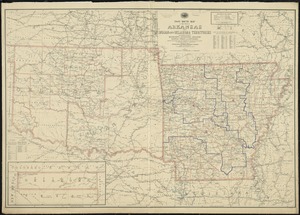
Post route map of the state of Arkansas and of the Indian Territory, with adjacent portions of Mississippi, Tennessee,...
10542.
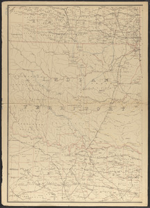
Post route map of the state of Arkansas showing post offices with the intermediate distances on mail routes in operation on the...
10543.
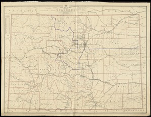
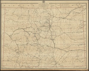
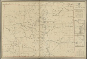
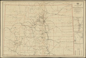
Post route map of the State of Colorado showing post offices with the intermediate distances and mail routes in operation on...
10544.
Post route map of the State of Colorado showing post offices with the intermediate distances and mail routes in operation on...
10545.
Post route map of the State of Colorado showing post offices with the intermediate distances on mail routes in operation on the...
10546.
Post route map of the State of Colorado showing post offices with the intermediate distances on mail routes in operation on the...
10547.
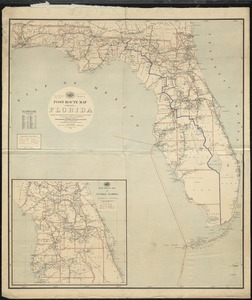
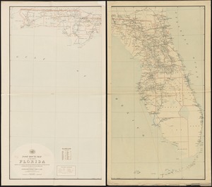
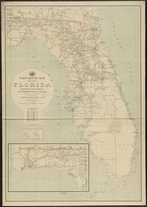
Post route map of the State of Florida showing post offices with the intermediate distances and mail routes in operation on the...
10548.
Post route map of the state of Florida showing post offices with the intermediate distances and mail routes in operation on the...
10549.
Post route map of the state of Florida showing post offices with the intermediate distances on mail routes in operation on the...
10550.
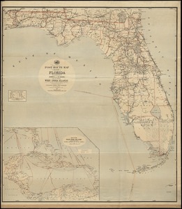
Post route map of the State of Florida with adjacent parts of Georgia and Alabama also the neighboring West India Islands...
10551.
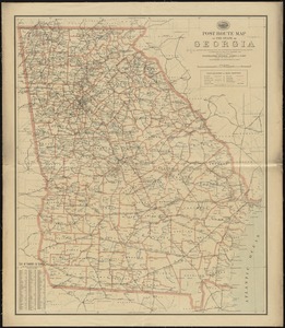
Post route map of the State of Georgia showing post offices with the intermediate distances and mail routes in operation on the...
10552.
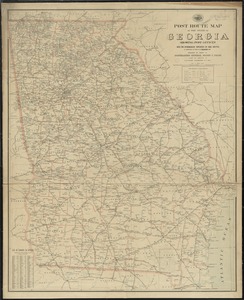
Post route map of the state of Georgia showing post offices with the intermediate distances on mail routes in operation on the...
10553.
Post route map of the state of Georgia showing post offices with the intermediate distances on mail routes in operation on the...
10554.
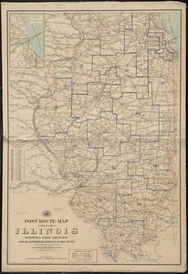
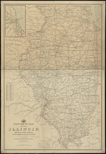
Post route map of the state of Illinois showing post offices with the intermediate distances on mail routes in operation on the...
10555.
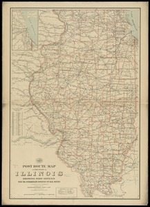
Post route map of the state of Illinois showing post offices with the intermediate distances on mail routes in operation on the...
10556.
Post route map of the state of Illinois showing post offices with the intermediate distances on mail routes in operation on the...
10557.
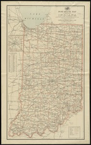
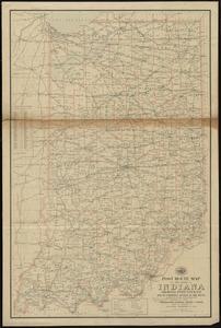
Post route map of the state of Indiana showing post offices with the intermediate distances on mail routes in operation on the...
10558.
Post route map of the state of Indiana showing post offices with the intermediate distances on mail routes in operation on the...
10559.
Post route map of the State of Iowa showing post offices with the intermediate distances and mail routes in operation on the...
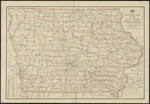
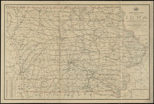
10560.
Post route map of the state of Iowa showing post offices with the intermediate distances on mail routes in operation on the 1st...
10561.
Post route map of the state of Iowa showing post offices with the intermediate distances on mail routes in operation on the 1st...
10562.
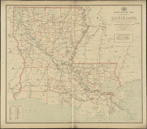
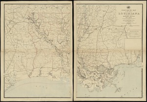
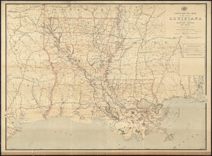
Post route map of the state of Louisiana showing post offices and the intermediate distances on mail routes in operation on the...
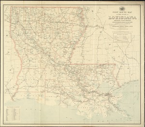
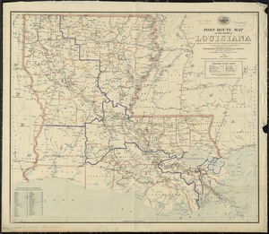
10563.
Post route map of the State of Louisiana showing post offices with the intermediate distances and mail routes in operation on...
10564.
Post route map of the state of Louisiana showing post offices with the intermediate distances on mail routes in operation on...
10565.
Post route map of the state of Louisiana with adjacent parts of Mississippi, Arkansas, and Texas : showing post offices, with...
10566.
Post route map of the State of Louisiana with adjacent parts of Mississippi, Arkansas, and Texas showing post offices with the...
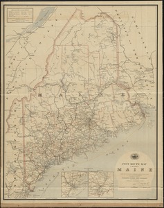
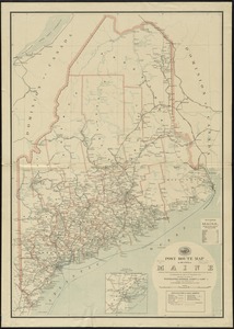
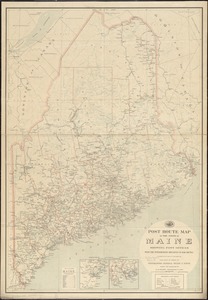
10567.
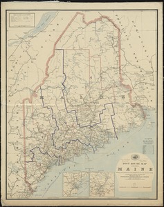
Post route map of the State of Maine showing post offices with the intermediate distances and mail routes in operation on the...
10568.
Post route map of the State of Maine showing post offices with the intermediate distances and mail routes in operation on the...
10569.
Post route map of the state of Maine showing post offices with the intermediate distances on mail routes in operation on the...
10570.
Post route map of the state of Maine showing post offices with the intermediate distances on mail routes in operation on the...
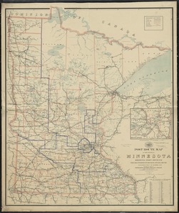
10571.
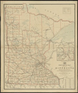
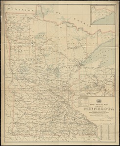
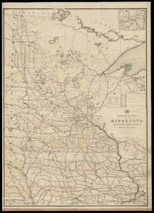
Post route map of the State of Minnesota showing post offices with the intermediate distances and mail routes in operation on...
10572.
Post route map of the state of Minnesota showing post offices with the intermediate distances and mail routes in operation on...
10573.
Post route map of the state of Minnesota showing post offices with the intermediate distances and mail routes in operation on...
10574.
Post route map of the State of Minnesota with adjacent parts of Iowa, Nebraska, Dakota, Wisconsin and of the British...
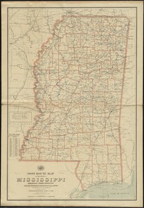
10575.
Post route map of the state of Mississippi showing post offices with the intermediate distances on mail routes in operation on...
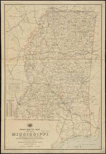
10576.
Post route map of the state of Mississippi showing post offices with the intermediate distances on mail routes in operation on...
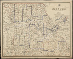
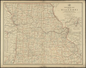
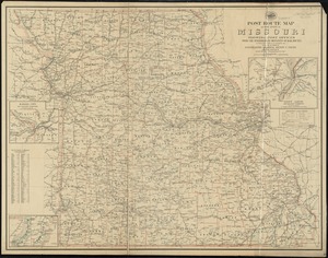
10577.
Post route map of the State of Missouri showing post offices with the intermediate distances on mail routes in operation on the...
10578.
Post route map of the state of Missouri showing post offices with the intermediate distances on mail routes in operation on the...
10579.
Post route map of the state of Missouri showing post offices with the intermediate distances on mail routes in operation on the...
10580.
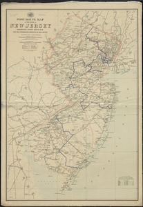
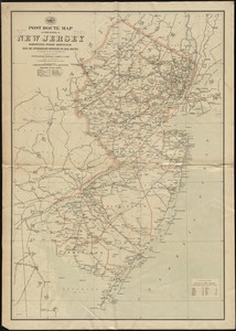
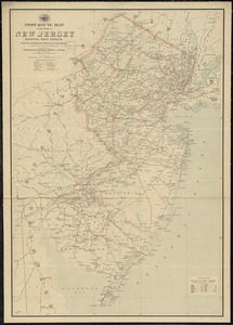
Post route map of the State of New Jersey showing post offices with the intermediate distances on mail routes in operation on...
10581.
Post route map of the state of New Jersey showing post offices with the intermediate distances on mail routes in operation on...
10582.
Post route map of the state of New Jersey showing post offices with the intermediate distances on mail routes in operation on...
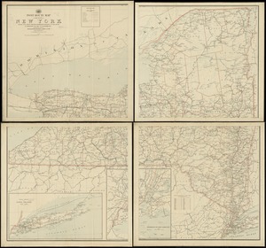
10583.
Post route map of the State of New York and parts of Vermont, Massachusetts, Connecticut, New Jersey, and Pennsylvania also the...
10584.
Post route map of the State of New York and parts of Vermont, Massachusetts, Connecticut, New Jersey, and Pennsylvania also the...
10585.
Post route map of the state of New York showing post offices with the intermediate distances on mail routes in operation on the...
10586.
Post route map of the State of New York showing post offices with the intermediate distances on mail routes in operation on the...
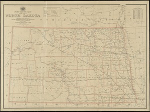
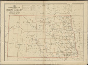
10587.
Post route map of the state of North Dakota showing post offices with the intermediate distances and mail routes in operation...
10588.
Post route map of the state of North Dakota showing post offices with the intermediate distances on mail routes in operation on...
10589.
Post route map of the State of Ohio showing post offices with the intermediate distances and mail routes in operation on the...
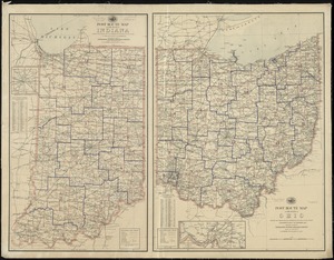
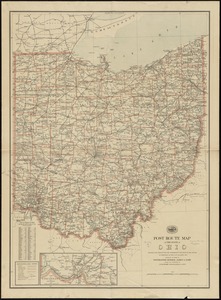
10590.
Post route map of the state of Ohio showing post offices with the intermediate distances on mail routes in operation on the...
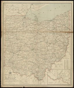
10591.
Post route map of the state of Ohio showing post offices with the intermediate distances on mail routes in operation on the 1st...
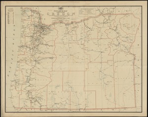
10592.
Post route map of the state of Oregon showing post offices with the intermediate distances on mail routes in operation on the...
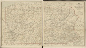
10593.
Post route map of the state of Pennsylvania showing post offices and the intermediate distances on mail routes in operation on...
10594.
Post route map of the state of Pennsylvania showing post offices with the intermediate distances on mail routes in operation on...
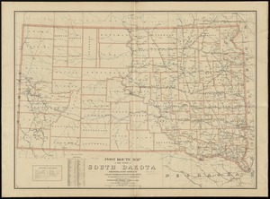
10595.
Post route map of the state of South Dakota showing post offices with the intermediate distances on mail routes in operation on...
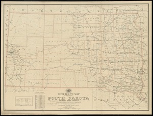
10596.
Post route map of the state of South Dakota showing post offices with the intermediate distances on mail routes in operation on...
10597.
Post route map of the state of Texas showing post offices with the intermediate distances on mail routes in operation on the...
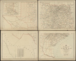
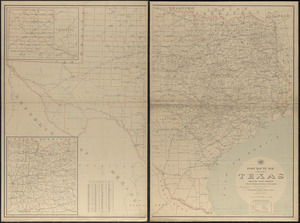
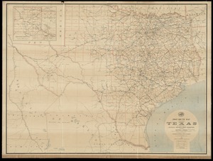
10598.
Post route map of the state of Texas showing post offices with the intermediate distances on mail routes in operation on the...
10599.
Post route map of the state of Texas with adjacent parts of Louisiana, Arkansas, Indian Territory and of the Republic of Mexico...
10600.
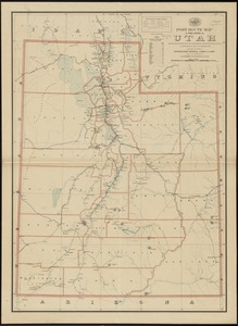
Post route map of the state of Utah showing post offices with the intermediate distances on mail routes in operation on the...
‹ Prev
Next ›
1
2
…
102
103
104
105
106
107
108
109
110
…
133
134