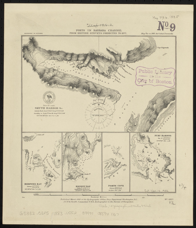
Ports in Barbara Channel : from British surveys corrected to 1877
Item Information
- Title:
- Ports in Barbara Channel : from British surveys corrected to 1877
- Issuing body:
- United States. Hydrographic Office
- Date:
-
1883
- Format:
-
Maps/Atlases
- Location:
-
Boston Public Library
Norman B. Leventhal Map & Education Center - Collection (local):
-
Norman B. Leventhal Map & Education Center Collection
- Subjects:
-
Nautical charts--Chile--Smyth Harbor
Nautical charts--Chile--Bedford Bay
Nautical charts--Chile--Hewett Bay
Nautical charts--Chile--Norte Cove
Nautical charts--Chile--Furia Bay
Barbara Channel (Chile)--Maps
Smyth Harbor (Chile)--Maps
Bedford Bay (Chile)--Maps
Hewett Bay (Chile)--Maps
Norte Cove (Chile)--Maps
Furia Bay (Chile)--Maps
- Places:
-
ChileMagallanes y de la Antártica Chilena (region)Hewett, Puerto (cove)
ChileMagallanes y de la Antártica Chilena (region)Norte, Caleta (cofe)
ChileMagallanes y de la Antártica Chilena (region)Furia, Bahía (bay)
Seno Smyth
- Extent:
- 5 maps on 1 sheet ; 23 x 22 cm
- Terms of Use:
-
No known copyright restrictions.
No known restrictions on use.
- Publisher:
-
Washington, D.C. :
Hydrographic Office
- Scale:
-
Scale approximately 1:80,100
- Language:
-
English
- Table of Contents:
-
Smyth Harbor &c.
Bedford Bay
Hewett Bay
North Cove
Fury Harbor.
- Notes:
-
Relief shown by hachures. Depths shown by soundings.
- Identifier:
-
06_01_015885
- Call #:
-
G9096.P5 svar .U55
- Barcode:
-
39999085941167