Toggle navigation
LMEC Home
Exhibitions
Georeferencing
Tools for Teachers
Collections
My Favorites
Sign Up / Log In
Search
Search the map portal
Map Collection
Map Collection
Map Sets
Search
Search
Search for
Search In
All Fields
Creator
Title
Subject
Place
Search All Digital Collections
Advanced Search
337 Results
My Search
Start Over
More Like
commonwealth:z603vv407
Remove constraint More Like: commonwealth:z603vv407
Filter your Search
Place
North and Central America
270
United States
208
Suffolk (county)
72
Boston
70
Massachusetts
38
New York
32
Canada
28
North America
27
more
Place
»
Topic
Boston (Mass.)--Maps--Early works to 1800
46
Boston Harbor (Mass.)--Maps--Early works to 1800
21
Boston (Mass.)--History--Revolution, 1775-1783--Maps--Early works to 1800
19
North America--Maps--Early works to 1800
18
New England--Maps--Early works to 1800
11
United States--History--Revolution, 1775-1783--Maps--Early works to 1800
11
Vues d'optique
10
Fortification--Massachusetts--Boston--Maps--Early works to 1800
9
more
Topic
»
Date
Date range begin
–
Date range end
Current results range from
1694
to
1879
View distribution
Creator
Faden, William, 1749-1836
33
Jefferys, Thomas, -1771
30
Le Rouge, Georges-Louis
24
Des Barres, Joseph F. W. (Joseph Frederick Wallet), 1722-1824
22
Sayer, Robert, 1725-1794
19
Korn, Christoph Heinrich, 1726-1783
11
Raspe, Gabriel Nicolaus, 1712-1785
11
Simcoe, John Graves, 1752-1806
10
more
Creator
»
Format
Maps/Atlases
294
Prints
32
Manuscripts
25
Drawings/Illustrations
9
Books
2
Georeferenced
Yes
18
No
319
Collection
American Revolutionary War-Era Maps
327
Richard H. Brown Revolutionary War Map Collection at Mount Vernon
293
Boston and New England Maps
41
Norman B. Leventhal Map & Education Center Collection
38
Urban Maps
25
Mapping Boston Collection
8
Maritime Charts and Atlases
6
Library of Congress Collection
3
more
Collection
»
Available to use
Creative Commons license
305
No known restrictions
32
Search Constraints
Sort by relevance
relevance
title
date (asc)
date (desc)
Number of results to display per page
50 per page
10
per page
20
per page
50
per page
100
per page
View results as:
grid view
map view
Search Results
1.
Plan de Boston
2.
The seat of war in New England, by an American volunteer : with the marches of the several corps sent by the Colonies towards...
3.
Boston
4.
Boston
5.
Boston, its environs and harbour, with the rebel works raised against that town in 1775 : from the observations of Lieut. Page...
6.
Bowles's map of the seat of war in New England, comprehending the provinces of Massachusets Bay, and New Hampshire : with the...
7.
Carte de la ville, baye et environs de Baston
8.
Carte des environs de Boston, capitale de la Nlle. Angleterre en Amerique
9.
A chart of the coast of New England, from Beverly to Scituate harbour, including the ports of Boston and Salem
10.
A chart of the harbour of Boston
11.
A chart of the harbour of Boston
12.
A chart of the harbour of Boston
13.
A draught of Boston Harbor by Capt. Cyprian Southake
14.
Die gegend um Boston
15.
Grundriss von der Stadt Boston und ihren Gegenden
16.
Grundriss von der stadt Boston und ihren gegenden
17.
Hafen von Boston
18.
A map of 100 miles round Boston
19.
A Map of forty miles north, thirty miles west, and twentyfive miles south of Boston : including an accurate draft of the...
20.
Map of the environs of Boston
21.
A map of the most inhabited part of New England : containing the provinces of Massachusets Bay and New Hampshire, with the...
22.
A map of the most inhabited part of New England : containing the provinces of Massachusets Bay and New Hampshire, with the...
23.
A new and accurate plan of the town of Boston in New England : A new plan of Boston Harbor from an actual survey
24.
A new and correct plan of the town of Boston
25.
A New Plan of ye Great Town of BOSTON in New England in AMERICA with the many Additionall Buildings & New Streets to the Year,...
26.
A new plan of ye great town of Boston in New England in America, with the many additionall buildings & new streets to the year...
27.
A new plan of ye great town of Boston in New England in America, with the many additionall [sic] buildings, & new streets, to...
28.
Particular draughts and plans of some of the principal towns and harbours belonging to the English, French, and Spaniards, in...
29.
Plan de Boston
30.
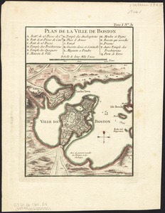
Plan de la ville de Boston
31.
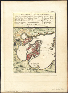
Plan de la ville de Boston
32.
Plan de la ville de Boston
33.
Plan de la ville de Boston et ses environs
34.
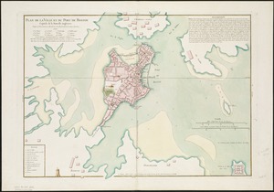
Plan de la ville et du port de Boston : capitale de la Nouvelle Angleterre
35.
Plan de la ville et du port de Boston : capitale de la Nouvelle Angleterre : erigée prémierement en 1630, et en 1735 elle fut...
36.
Plan de la ville et du port de Boston : capitale de la Nouvelle Angleterre
37.
A plan of Boston, from actual survey
38.
A plan of Boston, from actual survey
39.
A Plan of the Battle of Bunker Hill
40.
A plan of the town and chart of the harbour of Boston exhibiting a view of the islands, castle forts, and entrances into the...
41.
The seat of war, in New England, by an American volunteer : with the marches of the several corps sent by the colonies, towards...
42.
The seat of war in New England, by an American volunteer : with the marches of the several corps sent by the Colonies towards...
43.
Thirty-miles round Boston
44.
The town of Boston in New England
45.
The town of Boston in New England
46.
The town of Boston in New England
47.
[A map of part of Pennsylvania & Maryland intended to shew, at one view, the several places proposed for opening a...
48.
Abriss der stadt Gibraltar und der darinn befindlichen festen platze, nebst dem meerbusen von Algesiras
49.
An accurate map of His Majesty's province of New-Hampshire in New England : taken from actual surveys of all the inhabited...
50.
An accurate map of Staten Island : with that part of New York, Long Island and the Jerseys, which is the rendesvous of the two...
‹ Prev
Next ›
1
2
3
4
5
6
7


![A new plan of ye great town of Boston in New England in America, with the many additionall [sic] buildings, & new streets, to the year, 1769](https://bpldcassets.blob.core.windows.net/derivatives/images/commonwealth:3f462v50z/image_thumbnail_300.jpg)


![[A map of part of Pennsylvania & Maryland intended to shew, at one view, the several places proposed for opening a communication between the waters of the Delaware & Chesopeak Bays]](https://bpldcassets.blob.core.windows.net/derivatives/images/commonwealth:z603vt12v/image_thumbnail_300.jpg)


