Hafen von Boston
Item Information
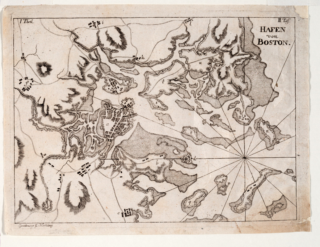
- Title:
- Hafen von Boston
- Description:
-
This map of Boston Harbor and vicinity is one of an unrecorded pair of German engravings, originally printed in a book, pertaining to Boston. Together they present a detailed picture of the setting of the Boston Massacre and the town of Boston in the final decades of the eighteenth century. This regional map provides a detailed chart of the harbor.
- Name on Item:
-
Gerstmayr sc. Meming
- Date:
-
1780
- Format:
-
Maps/Atlases
- Location:
- Private Collection
- Collection (local):
-
Mapping Boston Collection
- Subjects:
-
Boston Harbor (Mass.)--Maps--Early works to 1800
Boston (Mass.)--Maps--Early works to 1800
- Places:
-
MassachusettsBoston Harbor
MassachusettsSuffolk (county)Boston
- Extent:
- 1 map ; 25 x 18 cm.
- Terms of Use:
-
No known copyright restrictions.
This work is licensed for use under a Creative Commons Attribution Non-Commercial Share Alike License (CC BY-NC-SA).

- Publisher:
-
Germany :
[s.n.]
- Scale:
-
Scale not given
- Language:
-
German
- Notes:
-
Relief shown by hachures.
Mounted with Boston.
- Identifier:
-
05_04_000068
- Barcode:
-
39999052509476


