Toggle navigation
LMEC Home
Exhibitions
Georeferencing
Tools for Teachers
Collections
My Favorites
Sign Up / Log In
Search
Search the map portal
Map Collection
Map Collection
Map Sets
Search
Search
Search for
Search In
All Fields
Creator
Title
Subject
Place
Search All Digital Collections
Advanced Search
95 Results
My Search
Start Over
More Like
commonwealth:q524n5934
Remove constraint More Like: commonwealth:q524n5934
Filter your Search
Place
World
66
North and Central America
14
United States
11
Adams (county)
7
Gettysburg National Military Park
6
Pennsylvania
3
New England
2
America
1
more
Place
»
Topic
World maps--Early works to 1800
76
Cook, James, 1728-1779
5
America--Maps--Early works to 1800
3
Gettysburg (Pa.)--Maps
3
Gettysburg, Battle of, Gettysburg, Pa., 1863
3
Gettysburg, Battle of, Gettysburg, Pa., 1863--Maps
3
United States--History--Civil War, 1861-1865
3
World maps
3
more
Topic
»
Date
Date range begin
–
Date range end
Current results range from
1483
to
1943
View distribution
Creator
Bachelder, John B. (John Badger), 1825-1894
4
Apian, Peter, 1495-1552
3
Bien, Julius, 1826-1909
3
Brady, Mathew B., approximately 1823-1896
3
Endicott & Co. (New York, N.Y.)
3
Mercator, Gerhard, 1512-1594
3
Moll, Herman, d. 1732
3
Neumann, Louis E.
3
more
Creator
»
Format
Maps/Atlases
90
Manuscripts
5
Photographs
3
Books
1
Documents
1
Georeferenced
Yes
1
No
94
Collection
Norman B. Leventhal Map Center Collection
82
Mapping Boston Collection
19
Sidney R. Knafel Map Collection at Phillips Academy
13
American Revolutionary War-Era Maps
8
Boston and New England Maps
2
Available to use
No known restrictions
62
Creative Commons license
19
Search Constraints
Sort by relevance
relevance
title
date (asc)
date (desc)
Number of results to display per page
50 per page
10
per page
20
per page
50
per page
100
per page
View results as:
grid view
map view
Search Results
1.
Carta marina nova tabula
2.
Carta universal en que se contiene todo lo que del mundo se ha descubierto fasta agora
3.
Chart of the track of the Dolphin, Tamar, Swallow & Endeavour through the South Seas ; & of the track of M. Bougainville round...
4.
Chart of the world according to Mercators projection, shewing the tracks & discoveries of Captn. Cook
5.
A chart of the world upon Mercator's projection : describing the tracks of Capt. Cook in the year 1768, 69, 70, 71, and in...
6.
Diversi globi terr-aquei statione variante et visu intercedente, per coluros tropicorum, per ambos polos et particul : sphaerae...
7.
Die gantze Welt in ein Kleberblat, welches in der Stadt Hannover, meines lieben Vaterlandes Wapen
8.
Generale Ptholemei
9.
Geographica restituta per globi trientes
10.
[Hamadaradz Asharhatsuyts] = [Extensive world map]
11.
Hemispheriu[m] ab aequinoctiali linea, ad circulu[m] Poli Arctici : Hemispheriu[m] ab aequinoctiali linea, ad circulu[m] Poli...
12.
La heroike enterprinse faict par le Signeur Draeck d'avoir cirquit toute la terre
13.
A map of the world : corrected from the observations communicated to the Royal Societys of London and Paris
14.
A map of the world from the best authorities
15.
A map of the world on a globular projection : exhibiting particularly the nautical researches of Captain James Cook, F.R.S. :...
16.
Mappa totius mundi : adornata juxta observationes dnn. academiae regalis scientiarum et nonnullorum aliorum secundum...
17.
Mappe Monde ou carte générale du globe terrestre dessinée suivant les regles de la projection des cartes réduites
18.
Mappe-monde
19.
Mappemonde ou Description du globe terrestre
20.
Mappmonde ou description generale du globe terrestre
21.
A Mercators chart
22.
A new & correct map of the whole world : shewing ye situation of its principal parts. viz. the oceans, kingdoms, rivers, capes,...
23.
A new and accurat map of the world
24.
A new and accurat map of the world : drawne according to ye truest descriptions latest discoveries & best observations yt have...
25.
A new and accurat map of the world drawne according to ye truest descriptions latest discoveries & best observations yt have...
26.
A new and correct map of the world, laid down according to the newest discoveries, and from the most exact observations
27.
A new map of the terraqueous globe according to the ancient discoveries and most general divisions of it into continents and...
28.
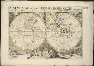
A new map of the terraqueous globe according to the latest discoveries and most general divisions of it into continents and oceans
29.
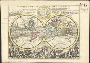
A new map of the whole world with the trade winds according to ye latest and most exact observations
30.
A new map of the world from the latest observations
31.
A new mapp of the world
32.
Noua, et integra vniuersi orbis descriptio
33.
Noua orbis terrarum delineatio singulari ratione accommodata meridiano tabb. Rudolphi astronomicarum
34.
Noua totius terrarum orbis geographica ac hydrographica tabula
35.
Noua totius terrarum orbis geographica ac hydrographica tabula
36.
Nouus planiglobii terrestris per utrumque polum conspectus
37.
Nova, et integra universi orbis descriptio
38.
Nova totius terrarum orbis geographica ac hydrographica tabula
39.
Nova totius terrarum orbis geographica ac hydrographica tabula = Wahre Biltnüss des Gantzen Erden Kraÿses mit allen seinen...
40.
Nova totius terrarum orbis tabula
41.
Nova totivs terrarvm orbis geographica ac hydrographica tabvla
42.
Novissima totius terrarum orbis tabula
43.
Orbis terrae compendiosa descriptio : quam ex magna universali Gerardi Mercatoris Domino Richardo Gartho, geographie ac...
44.
Orbis terrarum nova et accuratissima tabula
45.
Orbis terrarum nova et accuratissima tabula
46.
Orbis terrarum typus de integro multis in locis emendatus
47.
Orbis typus uniuersalis iuxta hydrographorum traditionem
48.
Orbis typus uniuersalis iuxta hydrographorum traditionem
49.
Orbis vetus in utrâque continente juxtà mentem Sansonianam distinctus, nec non observationibus astronomicis
50.
Oval map of the world
‹ Prev
Next ›
1
2


![[Hamadaradz Asharhatsuyts]](https://bpldcassets.blob.core.windows.net/derivatives/images/commonwealth:x633f982n/image_thumbnail_300.jpg)
![Hemispheriu[m] ab aequinoctiali linea, ad circulu[m] Poli Arctici](https://bpldcassets.blob.core.windows.net/derivatives/images/commonwealth:3f462s45p/image_thumbnail_300.jpg)