A map of the world : corrected from the observations communicated to the Royal Societys of London and Paris
Item Information
- Title:
- A map of the world : corrected from the observations communicated to the Royal Societys of London and Paris
- Description:
-
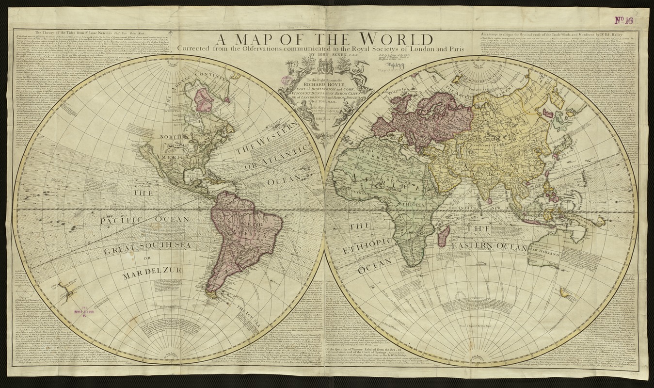
By the end of the 17th century, the Dutch were losing their dominance in the European map trade and were being replaced by French, British, and German publishing firms. Displayed here is an example of an early 18th-century world map by the English map, atlas, and globe publisher John Senex. Utilizing a double hemisphere projection, this map was not as highly ornamented as its Dutch predecessors. The marginal decorations have disappeared. In their place, Senex has included texts about tides, evaporation, and trade winds based on the investigations and theories of Isaac Newton and Edmond Halley. The only ornamentation was confined to the dedication cartouche, which was enclosed by four female figures representing the continents of Europe, America, Africa, and Asia. In addition to the marginal texts, the map included two other types of scientific or thematic information. The Trade Winds were indicated by small directional arrows within the equatorial zone, and lines of magnetic variation were shown with curved lines. Despite the implications that this map was based on precise and accurate observations, it appears that the geographical information was not the latest and best. For example, California was still shown as an island, a cartographic myth that was initially challenged during the first decade of the 18th century.
- Creator:
- Senex, John, d. 1740
- Name on Item:
-
John Senex.
- Date:
-
1725
- Format:
-
Maps/Atlases
- Location:
-
Boston Public Library
Norman B. Leventhal Map & Education Center - Collection (local):
-
Norman B. Leventhal Map & Education Center Collection
- Subjects:
-
World maps--Early works to 1800
- Places:
-
World
- Extent:
- 1 map : col. ; 65 x 112 cm.
- Terms of Use:
-
No known copyright restrictions.
No known restrictions on use.
- Publisher:
-
London :
J. Senex
- Scale:
-
Scale not given.
- Language:
-
English
- Notes:
-
Relief shown pictorially.
Dedication: To the right honourable Richard Boyle, Earl of Burlington and Cork, Viscount Dungarvan, Baron Clifford of Lansborough and Baron Boyle of Youghall.
Exhibited in “Journeys of the Imagination,” at the Boston Public Library, Boston, MA, April - August 2006. MB (BRL)
- Identifier:
-
05_01_000223
- Call #:
-
G3200 1725 .S46
- Barcode:
-
39999052507066


