Toggle navigation
LMEC Home
Exhibitions
Georeferencing
Tools for Teachers
Collections
My Favorites
Sign Up / Log In
Search
Search the map portal
Map Collection
Map Collection
Map Sets
Search
Search
Search for
Search In
All Fields
Creator
Title
Subject
Place
Search All Digital Collections
Advanced Search
8167 Results
My Search
Start Over
More Like
commonwealth:cj82m302v
Remove constraint More Like: commonwealth:cj82m302v
Filter your Search
Place
North and Central America
4,916
United States
3,749
Suffolk (county)
1,026
Boston
999
Europe
963
Canada
427
France
269
Massachusetts
258
more
Place
»
Topic
Boston (Mass.)--Maps
574
United States--Maps
270
Real property--Massachusetts--Boston--Maps
174
Massachusetts--Maps
160
Landowners--Massachusetts--Boston--Maps
132
North America--Maps--Early works to 1800
103
New England--Maps
99
Europe--Maps
78
more
Topic
»
Date
Date range begin
–
Date range end
Current results range from
1482
to
2023
View distribution
Creator
United States. Hydrographic Office
357
O.H. Bailey & Co
148
Des Barres, Joseph F. W. (Joseph Frederick Wallet), 1722-1824
123
United States. Post Office Dept
120
Ptolemy, 2nd cent
100
Walling, Henry Francis, 1825-1888
94
Jefferys, Thomas, -1771
84
Geological Survey (U.S.)
82
more
Creator
»
Format
Maps/Atlases
8,108
Manuscripts
215
Prints
51
Books
36
Objects/Artifacts
10
Drawings/Illustrations
8
Posters
4
Georeferenced
Yes
869
No
7,298
Collection
Norman B. Leventhal Map Center Collection
8,162
Boston and New England Maps
2,184
Urban Maps
1,925
Maritime Charts and Atlases
750
American Revolutionary War-Era Maps
621
Boston Redevelopment Authority Collection
86
William L. Clements Library Collection
5
Available to use
No known restrictions
8,021
Creative Commons license
46
Search Constraints
Sort by relevance
relevance
title
date (asc)
date (desc)
Number of results to display per page
50 per page
10
per page
20
per page
50
per page
100
per page
View results as:
grid view
map view
Search Results
1.
Map of Louisiana, Mississippi and Alabama : constructed from the latest authorities
2.
Mississippi Territory and Georgia
3.
[Northern Mississippi and Alabama
4.
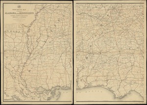
Post route map of the states of Alabama and Mississippi with adjacent parts of Florida, Georgia, Tennessee, Arkansas and...
5.
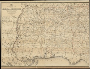
Post route map of the states of Alabama and Mississippi with adjacent parts of Florida, Georgia, Tennessee, Arkansas and...
6.
Carte composée des differens ouvrages de messieurs les ingenieurs qui ont eté à Louisiane, avec les renvois alphabetiques de...
7.
A map of part of West Florida done under the direction of the honourable John Stuart esqr: & by him humbly inscribed to his...
8.
Alabama
9.
Map of Alabama, showing location of property owned by the Fort Payne Coal & Iron Company
10.
Map of northern Georgia
11.
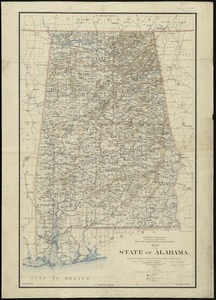
Map of the state of Alabama
12.
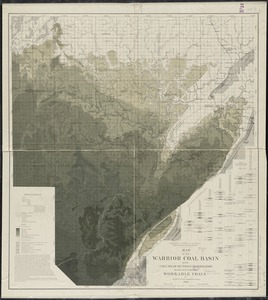
Map of the Warrior coal basin with columnar sections of formation, so far as it carries workable coals
13.
Northern Alabama and Georgia
14.
Northwestern Georgia : (with portions of the adjoining states of Tennessee and Alabama) being part of the Department of the...
15.
Post route map of the State of Alabama showing post offices with the intermediate distances on mail routes in operation on the...
16.
Post route map of the state of Alabama showing post offices with the intermediate distances on mail routes in operation on the...
17.
The Rand-McNally new commercial atlas map of Alabama
18.
State of Alabama
19.
System of state roads
20.
The country of So red the rose, by Stark Young, Scribners
21.
From Vicksburg to New Orleans
22.
Map of a part of Louisiana and Mississippi, illustrating the operations of the U.S. Forces in the Department of the Gulf
23.
Map of the lands in Mississippi ceded by the Chickasaws to the United States in 1832 and 1834
24.
Post route map of the state of Mississippi showing post offices with the intermediate distances on mail routes in operation on...
25.
Post route map of the state of Mississippi showing post offices with the intermediate distances on mail routes in operation on...
26.
Scarborough's new county and post office map of Louisiana and Mississippi : with complete index giving population and location...
27.
State of Mississippi
28.
State of Mississippi
29.
A draught of the upper Creek nation, taken in May 1757
30.
A draught of the river Missisippi. From the Balise to Fort Cavendish : taken in the months of June, July, August, September,...
31.
A sketch of the river Missisippi from New Orleans to the Rock of Davion
32.
The 100th anniversary map of Abraham Lincoln's visit to Massachusetts, September 11-23, 1848
33.
1630 shoreline
34.
1879. Progress map of the U.S. Geographical Surveys west of the 100th Meridian : prepared under the direction of 1st Lieut....
35.
1903 Map of Salem and surrounding places
36.
19th annual convention of the National Association of Real Estate Boards : at Tulsa, June 7 to June 11 in 1926
37.
2005 significant U.S. hurricane strikes
38.
The 2100 project : an atlas for the Green New Deal
39.
227 Harzgerode
40.
305 Glatz
41.
38,000,000 escaped -- 10,000,000 died
42.
4 Kinten
43.
660 Wakulah St., Roxbury
44.
[A chart of Boston Bay and vicinity]
45.
[A chart of New York Island & North River : East River, passage through Hell Gate, Flushing Bay, Hampstead Bay, Oyster,...
46.
The A.A.A. key road map of continental Europe
47.
Aaron Bohrod's America, its history
48.
ABC pathfinder railway guide map : eastern division
49.
Abolition of Slavery, 1863
50.
Aboriginal map of North America, denoting the boundaries and the locations of various Indian tribes
‹ Prev
Next ›
1
2
3
4
5
…
163
164


![[A chart of Boston Bay and vicinity]](https://bpldcassets.blob.core.windows.net/derivatives/images/commonwealth:cj82m2976/image_thumbnail_300.jpg)


