Toggle navigation
LMEC Home
Exhibitions
Georeferencing
Tools for Teachers
Collections
My Favorites
Sign Up / Log In
Search
Search the map portal
Map Collection
Map Collection
Map Sets
Search
Search
Search for
Search In
All Fields
Creator
Title
Subject
Place
Search All Digital Collections
Advanced Search
8553 Results
My Search
Start Over
More Like
commonwealth:3t947b94s
Remove constraint More Like: commonwealth:3t947b94s
Filter your Search
Place
North and Central America
5,848
United States
4,769
Massachusetts
2,052
Europe
1,359
Suffolk (county)
1,034
Boston
1,007
Canada
451
Asia
422
more
Place
»
Topic
Boston (Mass.)--Maps
577
United States--Maps
273
Real property--Massachusetts--Boston--Maps
174
Massachusetts--Maps
160
Landowners--Massachusetts--Boston--Maps
132
North America--Maps--Early works to 1800
103
New England--Maps
99
Europe--Maps
78
more
Topic
»
Date
Date range begin
–
Date range end
Current results range from
1482
to
2023
View distribution
Creator
United States. Hydrographic Office
594
O.H. Bailey & Co
148
Des Barres, Joseph F. W. (Joseph Frederick Wallet), 1722-1824
123
United States. Post Office Dept
120
Ptolemy, 2nd cent
100
Walling, Henry Francis, 1825-1888
94
Geological Survey (U.S.)
86
Jefferys, Thomas, -1771
85
more
Creator
»
Format
Maps/Atlases
8,494
Manuscripts
215
Prints
56
Books
36
Objects/Artifacts
10
Drawings/Illustrations
8
Posters
4
Georeferenced
Yes
869
No
7,684
Collection
Norman B. Leventhal Map & Education Center Collection
8,549
Boston and New England Maps
2,204
Urban Maps
1,936
Maritime Charts and Atlases
1,081
American Revolutionary War-Era Maps
620
Boston Redevelopment Authority Collection
87
William L. Clements Library Collection
3
Library and Archives Canada Collection
1
Available to use
No known restrictions
8,408
Creative Commons license
46
Search Constraints
Sort by relevance
relevance
title
date (asc)
date (desc)
Number of results to display per page
50 per page
10
per page
20
per page
50
per page
100
per page
View results as:
grid view
map view
Search Results
1.
Map showing elevators in Manitoba, Saskatchewan and Alberta
2.
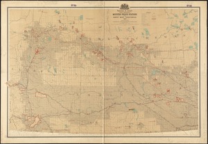
Alberta and western portions of Saskatchewan and Assiniboia
3.
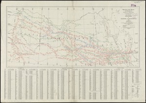
Map showing mounted police stations in the North West Territories
4.
Coal fields of Manitoba and Saskatchewan
5.
Saskatchewan : map showing disposition of lands
6.
Saskatchewan : map showing disposition of lands
7.
Alberta, southern : map showing disposition of lands
8.
Alberta, southern : map showing disposition of lands
9.
Cereal map of Alberta : showing acreage under crop in each township in wheat, oats, barley and flax
10.
Coal fields of Alberta and British Columbia
11.
Geological and topographical map of Crows Nest coal-fields, East Kootenay District, B.C. ; Geological sketch map of part of the...
12.
Map from the Pacific Ocean across the Rocky Mountain zone : to accompany report on the exploratory survey
13.
Map of British Columbia and part of western Canada, showing the lines and lands of the Canadian Pacific Railway
14.
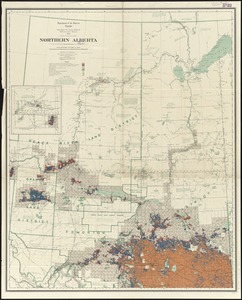
Northern Alberta : map showing disposition of lands
15.
Northern Alberta : map showing disposition of lands
16.
Southern Alberta : map showing disposition of lands
17.
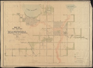
Manitoba
18.
Manitoba : map showing disposition of lands
19.
Manitoba : map showing disposition of lands
20.
Manitoba : map showing disposition of lands
21.
Map of Manitoba
22.
Map of Manitoba
23.
Map of Manitoba
24.
Map of Manitoba shewing provincial government lands for sale
25.
Map of the province of Manitoba, shewing the surveys effected in 1871
26.
New railway, post office and municipal map of Manitoba : compiled from the latest government surveys and other official sources
27.
Carte des découvertes qui ont été faites dans la partie occidentale du Canada sur les mémoires de Mr de la Varanderie [Vérendrye]
28.
A map of the lakes & Hudsons Bay
29.
A map of the lakes & Hudsons Bay
30.
Posts of the Hudson's Bay Company 1790
31.
The 100th anniversary map of Abraham Lincoln's visit to Massachusetts, September 11-23, 1848
32.
1630 shoreline
33.
1879. Progress map of the U.S. Geographical Surveys west of the 100th Meridian : prepared under the direction of 1st Lieut....
34.
1903 Map of Salem and surrounding places
35.
19th annual convention of the National Association of Real Estate Boards : at Tulsa, June 7 to June 11 in 1926
36.
2005 significant U.S. hurricane strikes
37.
The 2100 project : an atlas for the Green New Deal
38.
227 Harzgerode
39.
305 Glatz
40.
38,000,000 escaped -- 10,000,000 died
41.
4 Kinten
42.
660 Wakulah St., Roxbury
43.
[A chart of Boston Bay and vicinity]
44.
[A chart of New York Island & North River : East River, passage through Hell Gate, Flushing Bay, Hampstead Bay, Oyster,...
45.
The A.A.A. key road map of continental Europe
46.
Aaron Bohrod's America, its history
47.
ABC pathfinder railway guide map : eastern division
48.
Abolition of Slavery, 1863
49.
Aboriginal map of North America, denoting the boundaries and the locations of various Indian tribes
50.
Acapulco, México
‹ Prev
Next ›
1
2
3
4
5
…
171
172


![Carte des découvertes qui ont été faites dans la partie occidentale du Canada sur les mémoires de Mr de la Varanderie [Vérendrye]](https://bpldcassets.blob.core.windows.net/derivatives/images/commonwealth:wp98ck41z/image_thumbnail_300.jpg)


![[A chart of Boston Bay and vicinity]](https://bpldcassets.blob.core.windows.net/derivatives/images/commonwealth:cj82m2976/image_thumbnail_300.jpg)


