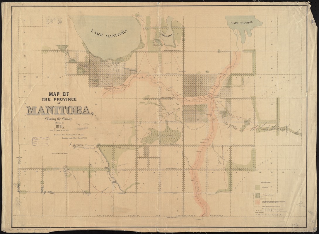
Map of the province of Manitoba, shewing the surveys effected in 1871
Item Information
- Title:
- Map of the province of Manitoba, shewing the surveys effected in 1871
- Creator:
- Canada
- Name on Item:
-
Department of the Secretary of State of Canada, Dominion Lands Office.
- Date:
-
1872
- Format:
-
Maps/Atlases
- Location:
-
Boston Public Library
Norman B. Leventhal Map & Education Center - Collection (local):
-
Norman B. Leventhal Map & Education Center Collection
- Subjects:
-
Land use--Manitoba--Maps
Manitoba--Surveys--Maps
Manitoba--Maps
- Places:
-
CanadaProvince of Manitoba (province)
- Extent:
- 1 map : col. ; 73 x 97 cm.
- Terms of Use:
-
No known copyright restrictions.
No known restrictions on use.
- Publisher:
-
Ontario :
[Dominion Lands Office]
- Scale:
-
Scale [1:253,440]
- Language:
-
English
- Notes:
-
Relief shown by hachures.
- Identifier:
-
06_01_011658
- Call #:
-
G3481.B5 1872 .C36
- Barcode:
-
39999065687574


