Toggle navigation
LMEC Home
Exhibitions
Georeferencing
Tools for Teachers
Collections
My Favorites
Sign Up / Log In
Search
Search the map portal
Map Collection
Map Collection
Map Sets
Search
Search
Search for
Search In
All Fields
Creator
Title
Subject
Place
Search All Digital Collections
Advanced Search
322 Results
My Search
Start Over
More Like
commonwealth:z603vr88s
Remove constraint More Like: commonwealth:z603vr88s
Filter your Search
Place
North and Central America
245
United States
182
Suffolk (county)
35
Boston
33
New York
33
North America
33
Canada
32
Charleston (county)
12
more
Place
»
Topic
United States--History--Revolution, 1775-1783--Maps--Early works to 1800
36
North America--Maps--Early works to 1800
20
Boston (Mass.)--History--Revolution, 1775-1783--Maps--Early works to 1800
18
United States--Maps--Early works to 1800
13
Gibraltar--History--Siege, 1779-1783--Maps--Early works to 1800
10
Vues d'optique
10
New England--Maps--Early works to 1800
9
New York (N.Y.)--Pictorial works--Early works to 1800
9
more
Topic
»
Date
Date range begin
–
Date range end
Current results range from
1740
to
1799
View distribution
Creator
Faden, William, 1749-1836
36
Jefferys, Thomas, -1771
30
Le Rouge, Georges-Louis
24
Des Barres, Joseph F. W. (Joseph Frederick Wallet), 1722-1824
21
Sayer, Robert, 1725-1794
19
Korn, Christoph Heinrich, 1726-1783
11
Raspe, Gabriel Nicolaus, 1712-1785
11
Robert Sayer and John Bennett (Firm)
10
more
Creator
»
Format
Maps/Atlases
279
Prints
32
Manuscripts
23
Drawings/Illustrations
9
Books
2
Georeferenced
Yes
13
No
309
Collection
American Revolutionary War-Era Maps
321
Richard H. Brown Revolutionary War Map Collection at Mount Vernon
293
Norman B. Leventhal Map Center Collection
16
Boston and New England Maps
8
Urban Maps
4
Harvard Map Collection
3
New York Public Library Collection
3
New-York Historical Society Collection
3
more
Collection
»
Available to use
Creative Commons license
301
No known restrictions
19
Search Constraints
Sort by relevance
relevance
title
date (asc)
date (desc)
Number of results to display per page
50 per page
10
per page
20
per page
50
per page
100
per page
View results as:
grid view
map view
Search Results
1.
Carte de l'Amérique Septle. pour servir à l'intelligence de la guerre entre les Anglois et les insurgents
2.
Carte des Etats-Unis d'Amérique, et du cours du Mississippi : rédigée d'après différentes cartes et relations Anglaises et...
3.
Carte generale des colonies angloises dans l'Amerique Septentrionale pour l'intelligence de la guerre presente : d'apres des...
4.
Karte von Neu England, Neu Yorck und Pensilvanien
5.
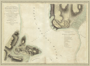
A plan of the surprise of Stoney Point, by a detachment of the American army commanded by Brigr. Genl. Wayne, on the 15th July...
6.
Suite du theatre de la guerre dans l'Amérique Septentrionale y compris le Golfe du Méxique
7.
Théatre de la guerre en Amerique, avec les Isles Antilles : projetté et assujettie aux observations
8.
Boston, its environs and harbour, with the rebel works raised against that town in 1775 : from the observations of Lieut. Page...
9.
Boston with its environs
10.
Bowles's map of the seat of war in New England, comprehending the provinces of Massachusets Bay, and New Hampshire : with the...
11.
Carte des Etats-Unis de l'Amerique suivant le Traité de Paix de 1783
12.
Carte du théatre de la guerre entre les Anglais et les Américains
13.
Carte générale des colonies Angloises : dans l'Amérique Septentrionale
14.
Carte generale des colonies angloises dans l'Amerique Septentrionale pour l'intelligence de la guerre presente : d'apres des...
15.
The Country twenty five miles round New York
16.
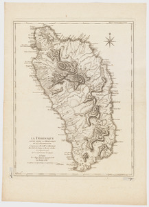
La Dominique située entre La Martinique et La Guadeloupe : conquise par M. le Mis. de Bouillé Marechal des camps et armées du...
17.
A general map of the southern British colonies in America comprehending North and South Carolina, Georgia, East and West...
18.
Map for the interior travels through America : delineating the march of the army
19.
Map for the interior travels through America, delineating the march of the army
20.
A MAP of the BRITISH COLONIES in North America : WITH THE Roads, Distances, Limits, and Extent of the SETTLEMENTS, Humbly...
21.
A new and accurate map of the present seat of war in North America
22.
A new and accurate map of the present seat of war in North America : from a late survey
23.
A new and correct map of North America : in which the places of the principal engagements during the present war are accurately...
24.
A new and correct map of North America : in which the places of the principal engagements during the present war are accurately...
25.
Partie de l'Amerique Septentrionale, qui comprend le Canada, la Louisiane, le Labrador, le Groenland, la Nouvelle Angleterre,...
26.
Plan der landung der Gebrüdere Howe, bey dem ausfluss des Elk Strom ...Lords Cornwallis
27.
A plan of the attack made Nov.ber 27t. 1781 : by a detachment commanded by Brigadier-General Ross, from the Garrison of...
28.
A plan of the operations of the King's army under the command of General Sr. William Howe, K.B. in New York and east New...
29.
Plan of the town of Boston, with the attack on Bunkers-Hill, in the peninsula of Charlestown, the 17th of June, 1775
30.
The provinces of New York and New Jersey : with part of Pensilvania, and the Province of Quebec
31.
The seat of war, in New England, by an American volunteer : with the marches of the several corps sent by the colonies, towards...
32.
A sketch of Charleston Harbour : shewing the disposition of the British fleet under the command of Vice Adml. Mariot Arbuthnot...
33.
Theatre de la guerre en Amerique
34.
Théatre de la guerre en Amerique, avec les Isles Antilles : projetté et assujettie aux observations
35.
Théatre de la guerre en Amerique, avec les Isles Antilles : projetté et assujettie aux observations
36.
The theatre of war in North America, with the roads, and tables, of the superficial contents, distances, &ca
37.
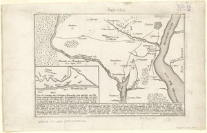
[A map of part of Pennsylvania & Maryland intended to shew, at one view, the several places proposed for opening a...
38.
Abriss der stadt Gibraltar und der darinn befindlichen festen platze, nebst dem meerbusen von Algesiras
39.
An accurate map of His Majesty's province of New-Hampshire in New England : taken from actual surveys of all the inhabited...
40.
An accurate map of Staten Island : with that part of New York, Long Island and the Jerseys, which is the rendesvous of the two...
41.
An accurate map of the country round Boston in New England from the best authorities
42.
Action at Spencer's ordinary : June 26th. 1781
43.
Affair at Quintin's Bridge : 18th March 1778
44.
Allgemeine charte von Nord America als den sitz des krieges zwischen den Konigl. Engl. truppen u:den provinzialen
45.
Ambuscade of the Indians at Kingsbridge : August 31st. 1778
46.
L'Amerique divisée en septentrionale et méridionale, subdivisée en ses principales parties, dressée sur les relations les...
47.
L'Amerique divisée en ses principaux États
48.
L'Amerique Septentrionale
49.
Amérique septentrionale avec les routes, distances en miles, limites et etablissements françois et anglois
50.
Amerique Septentrionale divisée en ses principales parties, ou sont distingués les vns des autres les estats suivant qu'il...
‹ Prev
Next ›
1
2
3
4
5
6
7


![[A map of part of Pennsylvania & Maryland intended to shew, at one view, the several places proposed for opening a communication between the waters of the Delaware & Chesopeak Bays]](https://bpldcassets.blob.core.windows.net/derivatives/images/commonwealth:z603vt12v/image_thumbnail_300.jpg)


