Toggle navigation
LMEC Home
Exhibitions
Georeferencing
Tools for Teachers
Collections
My Favorites
Sign Up / Log In
Search
Search the map portal
Map Collection
Map Collection
Map Sets
Search
Search
Search for
Search In
All Fields
Creator
Title
Subject
Place
Search All Digital Collections
Advanced Search
75 Results
My Search
Start Over
More Like
commonwealth:z603vh67k
Remove constraint More Like: commonwealth:z603vh67k
Filter your Search
Place
United States
48
North and Central America
44
Gibraltar
10
Charleston (county)
8
North America
8
Boston
7
Canada
7
Suffolk (county)
7
more
Place
»
Topic
United States--History--Revolution, 1775-1783--Maps--Early works to 1800
36
Gibraltar--History--Siege, 1779-1783--Maps--Early works to 1800
10
Gibraltar--History--Revolution, 1775-1783--Maps--Early works to 1800
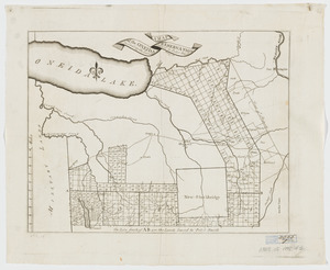
6
North America--History--Revolution, 1775-1783--Maps--Early works to 1800
6
Yorktown (Va.)--History--Siege, 1781--Maps--Early works to 1800
6
New England--Maps--Early works to 1800
5
United States--Maps--Early works to 1800
5
Antilles, Greater--Maps--Early works to 1800
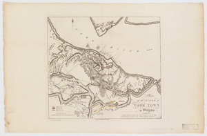
4
more
Topic
»
Date
Date range begin
–
Date range end
Current results range from
1775
to
1795
View distribution
Creator
Faden, William, 1749-1836
12
Aitken, Robert, 1735-1802
6
Conder, Thomas, 1746 or 1747-1831
5
Bonne, Rigobert, 1727-1794
4
Brion de la Tour, Louis
3
Des Barres, Joseph F. W. (Joseph Frederick Wallet), 1722-1824
3
Lattré, Jean
3
Robert Sayer and John Bennett (Firm)
3
more
Creator
»
Format
Maps/Atlases
64
Books
7
Prints
4
Manuscripts
3
Georeferenced
Yes
1
No
74
Collection
American Revolutionary War-Era Maps
74
Harvard Map Collection
31
Norman B. Leventhal Map Center Collection
17
Richard H. Brown Revolutionary War Map Collection at Mount Vernon
17
Boston and New England Maps
4
New York Public Library Collection
3
New-York Historical Society Collection
3
Boston Athenaeum, Cartographic Collection
2
more
Collection
»
Available to use
Creative Commons license
53
No known restrictions
20
Search Constraints
Sort by relevance
relevance
title
date (asc)
date (desc)
Number of results to display per page
100 per page
10
per page
20
per page
50
per page
100
per page
View results as:
grid view
map view
Search Results
1.
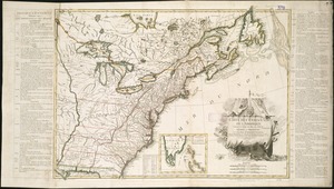
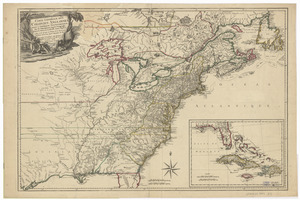
Carte générale des colonies Angloises : dans l'Amérique Septentrionale
2.
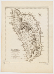
La Dominique située entre La Martinique et La Guadeloupe : conquise par M. le Mis. de Bouillé Marechal des camps et armées du...
3.
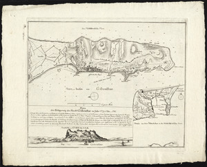
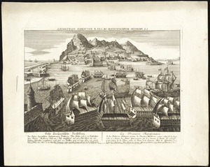
Abriss der stadt Gibraltar und der darinn befindlichen festen platze, nebst dem meerbusen von Algesiras
4.
Neuester und acurater plan der weltberuhmten Englischen berg festung Gibraltar auf der Spitze von Spanien : derer wercher...
5.
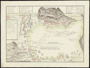
[Plan de Gibraltar]
6.
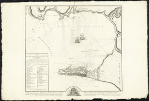
Plan de Gibraltar
7.
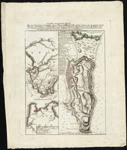
Plan de la ville et des forts de Gibraltar, avec la Baye d'Algesiras
8.
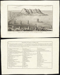
Plan der belagerung der stadt Gibraltar im jahr 1779, 1780, 1781
9.
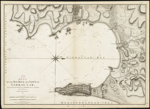
Plan of the bay, rock and town of Gibraltar, from an actual survey by an officer who was at Gibraltar from 1769 to 1775
10.
La premiere representation de les X batteries flottantes
11.
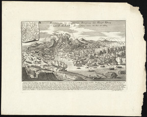
Prospect von Gibraltar mit seinen werken, umliegenden gegenden und iezigen neuern belagerungs anstalten : gezeichnet vor...
12.
Relation von der vergeblichen belagrung der haupt vestung Gibraltar : anno 1782 von 13 bis 17 sbre
13.
Boston, its environs and harbour, with the rebel works raised against that town in 1775 : from the observations of Lieut. Page...
14.
Boston with its environs
15.
Bowles's map of the seat of war in New England, comprehending the provinces of Massachusets Bay, and New Hampshire : with the...
16.
Carte de l'Amérique Septle. pour servir à l'intelligence de la guerre entre les Anglois et les insurgents
17.
Carte des Etats-Unis d'Amérique, et du cours du Mississippi : rédigée d'après différentes cartes et relations Anglaises et...
18.
Carte des Etats-Unis de l'Amerique suivant le Traité de Paix de 1783
19.
Carte des Etats-Unis de l'Amerique suivant le Traité de Paix de 1783
20.
Carte du théatre de la guerre entre les Anglais et les Américains
21.
Carte generale des colonies angloises dans l'Amerique Septentrionale pour l'intelligence de la guerre presente : d'apres des...
22.
Carte generale des colonies angloises dans l'Amerique Septentrionale pour l'intelligence de la guerre presente : d'apres des...
23.
The Country twenty five miles round New York
24.
A general map of the southern British colonies in America comprehending North and South Carolina, Georgia, East and West...
25.
Karte von Neu England, Neu Yorck und Pensilvanien
26.
Map for the interior travels through America : delineating the march of the army
27.
Map for the interior travels through America, delineating the march of the army
28.
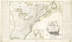
A MAP of the BRITISH COLONIES in North America : WITH THE Roads, Distances, Limits, and Extent of the SETTLEMENTS, Humbly...
29.
A new and accurate map of the present seat of war in North America
30.
A new and accurate map of the present seat of war in North America : from a late survey
31.
A new and correct map of North America : in which the places of the principal engagements during the present war are accurately...
32.
A new and correct map of North America : in which the places of the principal engagements during the present war are accurately...
33.
Partie de l'Amerique Septentrionale, qui comprend le Canada, la Louisiane, le Labrador, le Groenland, la Nouvelle Angleterre,...
34.
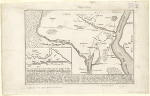
Plan der landung der Gebrüdere Howe, bey dem ausfluss des Elk Strom ...Lords Cornwallis
35.
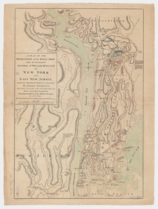
A plan of the operations of the King's army under the command of General Sr. William Howe, K.B. in New York and east New...
36.
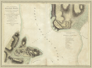
A plan of the surprise of Stoney Point, by a detachment of the American army commanded by Brigr. Genl. Wayne, on the 15th July...
37.
Plan of the town of Boston, with the attack on Bunkers-Hill, in the peninsula of Charlestown, the 17th of June, 1775
38.
The provinces of New York and New Jersey : with part of Pensilvania, and the Province of Quebec
39.
The seat of war, in New England, by an American volunteer : with the marches of the several corps sent by the colonies, towards...
40.
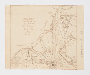
A sketch of Charleston Harbour : shewing the disposition of the British fleet under the command of Vice Adml. Mariot Arbuthnot...
41.
Suite du theatre de la guerre dans l'Amérique Septentrionale y compris le Golfe du Méxique
42.
Theatre de la guerre en Amerique
43.
Théatre de la guerre en Amerique, avec les Isles Antilles : projetté et assujettie aux observations
44.
Théatre de la guerre en Amerique, avec les Isles Antilles : projetté et assujettie aux observations
45.
Théatre de la guerre en Amerique, avec les Isles Antilles : projetté et assujettie aux observations
46.
The theatre of war in North America, with the roads, and tables, of the superficial contents, distances, &ca
47.
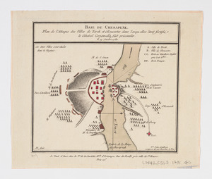
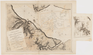
Baie de Chesapeak : plan de l'attaque des villes de Yorck et Gloucester dans lesquelles êtoit fortifie le Général Cornwalia,...
48.
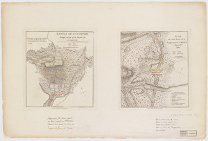
Battle of Guildford, fought on the 15th of March 1781. Plan of the batttle fought near Camden, August 16th, 1780
49.
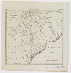
The Carolina's with part of Georgia
50.
Caroline méridionale et partie de la Georgie
51.
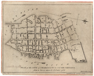
Charles Town, South Carolina : with a chart of the bars & harbour
52.
Charts of the coast and harbors of New England : [title page]
53.
Curious enigmatical epitaphs
54.
Exact plan of General Gage's lines on Boston Neck in America
55.
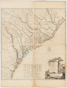
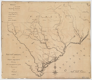
A map of South Carolina and a part of Georgia : Containing the whole sea-coast; all the islands, inlets, rivers, creeks,...
56.
A map of the country in which the army under Lt. General Burgoyne acted in the campaign of 1777 : shewing the marches of the...
57.
A map of the Oneida Reservation : including the lands leased to Peter Smith
58.
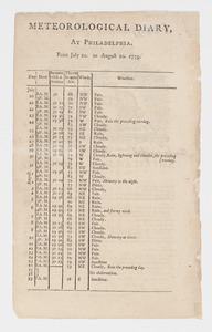
Meteorological diary, at Philadelphia, from July 20, to August 20, 1775
59.
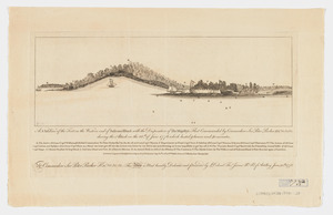
A N.b.E. view of the fort on the western end of Sulivans Island : with the disposition of His Majesty's fleet commanded by...
60.
A new and correct plan of the town of Boston
61.
A new map of Nova Scotia and Cape Breton Island : with the adjacent parts of New England and Canada composed from a great...
62.
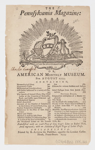
The Pennsylvania Magazine: or, American Monthly Museum : for August 1775 : [table of contents]
63.
A plan of the action at Bunkers Hill on the 17th of June 1775 between His Majesty's troops, under the command of Major General...
64.
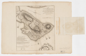
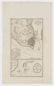
Plan of the city of Charleston, South Carolina
65.
A plan of the operations of the King's army : under the command of General Sr. William Howe, K.B. in New York and east New...
66.
A plan of the posts of York and Gloucester in the province of Virginia, established by His Majesty's army under the command of...
67.
Plan of the siege of York Town in Virginia
68.
A plan of the town, bar, harbour and environs, of Charlestown in South Carolina : with all the channels, soundings,...
69.
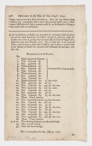
References to charts of the coast and harbors of New England
70.
References to the plan of Gen. Gage's lines
71.
References to the streets, &c. laid down in the plan : [of the city of Charleston, South Carolina]
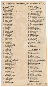
72.
A sketch of the operations before Charlestown, South Carolina, 1780. A sketch of Sr. Peter Parker's attack on Fort Moultrie,...
73.
South-Carolina and parts adjacent : shewing the movements of the American and British armies
74.
The United States of North America, with the British & Spanish territories according to the treaty
75.
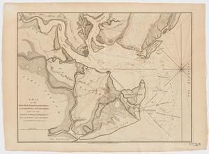
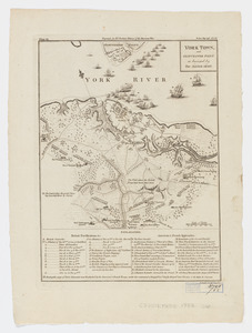
York Town, and Gloucester Point : as besieged by the Allied Army

![[Plan de Gibraltar]](https://bpldcassets.blob.core.windows.net/derivatives/images/commonwealth:z603vt83t/image_thumbnail_300.jpg)