Toggle navigation
LMEC Home
Exhibitions
Georeferencing
Tools for Teachers
Collections
My Favorites
Sign Up / Log In
Search
Search the map portal
Map Collection
Map Collection
Map Sets
Search
Search
Search for
Search In
All Fields
Creator
Title
Subject
Place
Search All Digital Collections
Advanced Search
484 Results
My Search
Start Over
More Like
commonwealth:q524nj64z
Remove constraint More Like: commonwealth:q524nj64z
Filter your Search
Place
North and Central America
420
United States
296
New York
42
Florida
19
Canada
17
Alabama
15
Chatham (county)
15
Savannah
13
more
Place
»
Topic
Manuscript maps--Early works to 1800
92
Manuscript maps
21
Gulf Coast (U.S.)--Maps, Manuscript--Early works to 1800
12
Fortification--New York (State)--New York--Maps--Early works to 1800
11
New York (N.Y.)--Maps, Manuscript--Early works to 1800
11
New York (N.Y.)--Buildings, structures, etc--Maps, Manuscript--Early works to 1800
9
Saratoga Campaign, N.Y., 1777--Maps, Manuscript--Early works to 1800
8
Coasts--Florida--Maps--Early works to 1800
7
more
Topic
»
Date
Date range begin
–
Date range end
Current results range from
1664
to
1899
View distribution
Creator
Hills, John, (Surveyor)
18
Montrésor, John, 1736-1799
16
Bingham, William, 1752-1804
12
Adlum, John, 1759-1836
10
Washington, George, 1732-1799
9
Faden, William, 1749-1836
7
Morgan, Benjamin, (Draftsman)
7
Wangenheim, Friedrich Adam Julius von
7
more
Creator
»
Format
Maps/Atlases
482
Manuscripts
478
Objects/Artifacts
2
Georeferenced
Yes
5
No
479
Collection
American Revolutionary War-Era Maps
483
Library of Congress Collection
480
Maritime Charts and Atlases
31
Urban Maps
16
British Library Collection
3
Norman B. Leventhal Map Center Collection
1
Available to use
Creative Commons license
483
No known restrictions
1
Search Constraints
Sort by relevance
relevance
title
date (asc)
date (desc)
Number of results to display per page
50 per page
10
per page
20
per page
50
per page
100
per page
View results as:
grid view
map view
Search Results
401.
Pto. Rico
402.
Pto. Rico
403.
Puerto del Boston
404.
Puerto Rico
405.
Quatre positions de la flotte française et positions de la flotte anglaise
406.
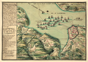
Qubbec, ville de l'Amerique septentrionale dans la Nouvelle France avec titre d'Eveché située sur le fleuve de St. Laurens a...
407.
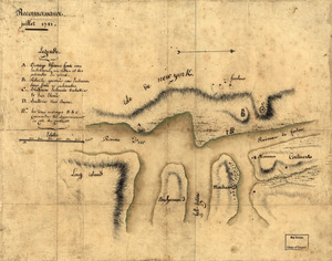
Reconnoissance de King's bridge : I
408.
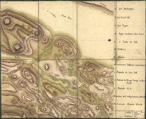
Reconnoissance des ouvrages du nord de l'Isle de Newyork dont on a déterminé géometriquement les principaux points le 22 et...
409.
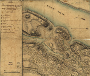
Reconnoissance, juillet 1781
410.
Red Banke
411.
River of Ohio
412.
Roads and country that Col. Campbell marched thro'--Ebenezer to Augusta in Georgia
413.
Savannah
414.
Savannah & its fortifications
415.
Savannah and its environs
416.
Savannah River & Ogeechee River
417.
Siege d'York, 1781 : Plan d'York en Virginie avec les attaques et les campemens de l'Armée combinée de France et d'Amérique
418.
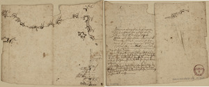
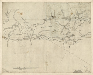
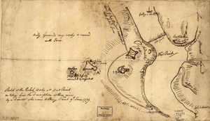
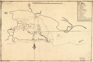
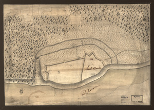
S[i]r: This is minuts of the fort at Crown Point and of the redouts built round it; which I took on the mountain to the west of...
419.
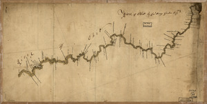
Skecth [sic] of the road from Kings Bridge to White Plains
420.
Sketch map of fortifications in the vicinity of Fort Washington, Manhattan Island, New York
421.
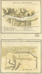
Sketch of Brunswick : Sketch of the ground near Mr. Low's at Rariton Landing
422.
Sketch of Forts Clinton & Montgomery : stormed the 6th Octob. 1777 by the troops under the command of Sir Henry Clinton, K.B.,...
423.
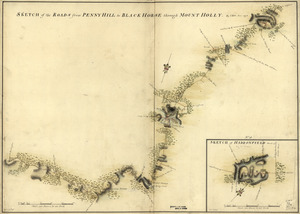
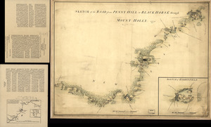
Sketch of Haddonfield, March 1778 : Sketch of the roads from Pennyhill to Black Horse through Mount Holly
424.
Sketch of Haddonfield. Sketch of the road from Penny Hill to Black Horse through Mount Holly, 1778
425.
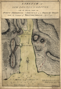
A sketch of New London & Groton with the attacks made on Forts Trumbull & Griswold by the British troops : under the command of...
426.
Sketch of New York, narrows & part of Long Island with the roads
427.
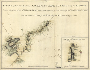
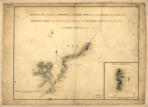
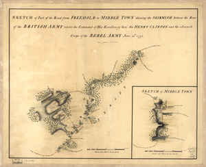
Sketch of part of the road from Freehold to Middle Town : shewing the skirmish between the rear of the British Army under the...
428.
Sketch of part of the road from Freehold to Middle Town : shewing the skirmish between the rear of the British Army under the...
429.
Sketch of part of the road from Freehold to Middle Town : shewing the skirmish between the rear of the British Army under the...
430.
Sketch of Stoney & Verplank's Points upon the North River : as taken possession of, and fortified by His Excellency Sir H:...
431.
Sketch of the battle of Camden, Augt. 16, 1780
432.
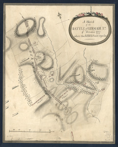
A Sketch of the Battle of German. Tn : 4th. October 1777, where the rebels were repulsed
433.
A Sketch of the Battle of German. Tn : 4th October 1777, where the rebels were repulsed
434.
Sketch of the coast from South Edisto to Charles Town, 1st March 1780
435.
Sketch of the engagement at Trenton : given on the 26th of December 1776 betwixt the American troops under command of General...
436.
A sketch of the field of battle with the disposition of the troops in the beginning of the engagement of the 9th of July on the...
437.
Sketch of the ground about Charles Town
438.
Sketch of the harbour of Charles Town
439.
A Sketch of the harbour of Port Francoise on the Island of Hispaniola
440.
A Sketch of the harbour of St. Iago de Cuba
441.
Sketch of the Heights of Kingsbridge 1777, with the proposed redoubts coloured orange : Old rebel works coloured black
442.
Sketch of the Heights of Kingsbridge, with the proposed redouts couloured yellow
443.
A sketch of the northern parts of New Jersey
444.
Sketch of the rebel works at West Point : as taken from the description of them given by a deserter who came to Stoney Point,...
445.
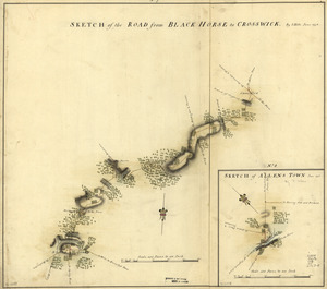
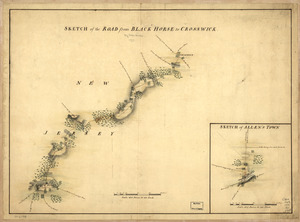
Sketch of the road from Black Horse to Crosswick
446.
Sketch of the road from Black Horse to Crosswick. Sketch of Allen's Town
447.
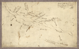
Sketch of the road from Fredericksburg to Norfolk in Virginia
448.
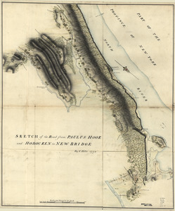
Sketch of the road from Paulus Hook and Hobocken to New Bridge
449.
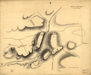
Sketch of the White Plains
450.
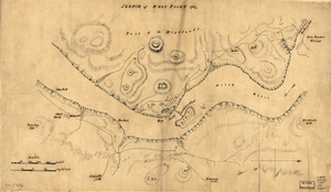
Sketch of West Point
‹ Prev
Next ›
1
2
…
5
6
7
8
9
10
![S[i]r: This is minuts of the fort at Crown Point and of the redouts built round it; which I took on the mountain to the west of Crown Point abt. a miles distance](https://bpldcassets.blob.core.windows.net/derivatives/images/commonwealth:q524nd85w/image_thumbnail_300.jpg)
![Skecth [sic] of the road from Kings Bridge to White Plains](https://bpldcassets.blob.core.windows.net/derivatives/images/commonwealth:q524n8895/image_thumbnail_300.jpg)