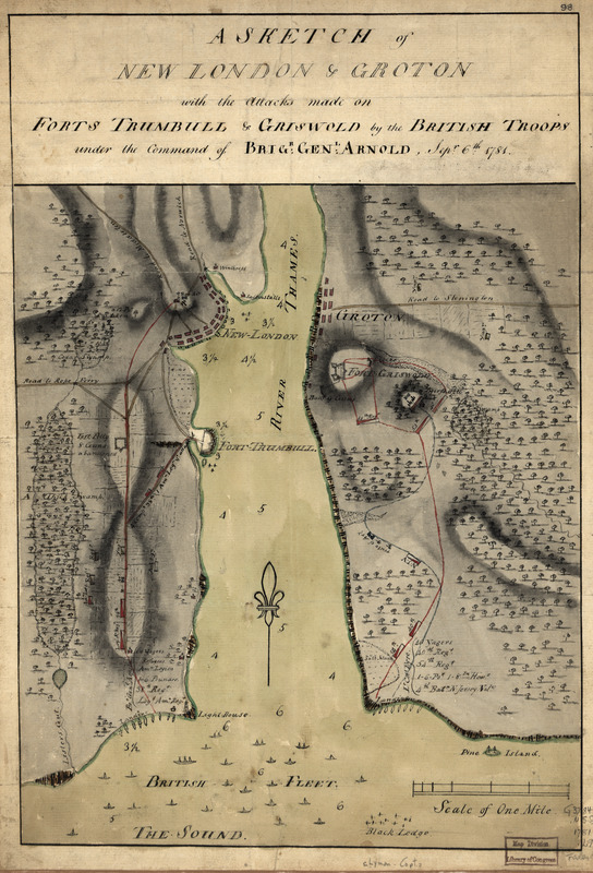
A sketch of New London & Groton with the attacks made on Forts Trumbull & Griswold by the British troops : under the command of Brigr. Genl. Arnold, Sept. 6th. 1781
This map is also available in American Revolutionary Geographies Online (ARGO), a collections portal especially built for material relating to the American Revolutionary War Era. Visit ARGO to learn more about this item and explore the historical geography of North America in the late eighteenth century.
Item Information
- Title:
- A sketch of New London & Groton with the attacks made on Forts Trumbull & Griswold by the British troops : under the command of Brigr. Genl. Arnold, Sept. 6th. 1781
- Creator:
- Lyman, Daniel
- Date:
-
[1781]
- Format:
-
Maps/Atlases
Manuscripts
- Location:
- Library of Congress Geography and Map Division
- Collection (local):
-
Library of Congress Collection
- Subjects:
-
Groton Heights, Battle of, Conn., 1781--Maps, Manuscript--Early works to 1800
New London (Conn.)--History--Burning by the British, 1781--Maps, Manuscript--Early works to 1800
- Places:
-
New London (county)New London
- Extent:
- 1 manuscript map : hand color 41 x 28 cm.
- Terms of Use:
-
No known copyright restrictions.
This work is licensed for use under a Creative Commons Attribution Non-Commercial Share Alike License (CC BY-NC-SA).

- Scale:
-
Scale ca. 1:21,000
- Language:
-
English
- Catalog Record:
-
https://lccn.loc.gov/gm71000695
- Notes:
-
Manuscript, pen-and-ink and watercolor.
Relief shown by shading and land form drawings.
- Notes (date):
-
This date is inferred.
- Notes (citation):
-
LC Maps of North America, 1750-1789, 1027
- Identifier:
-
ar102700


