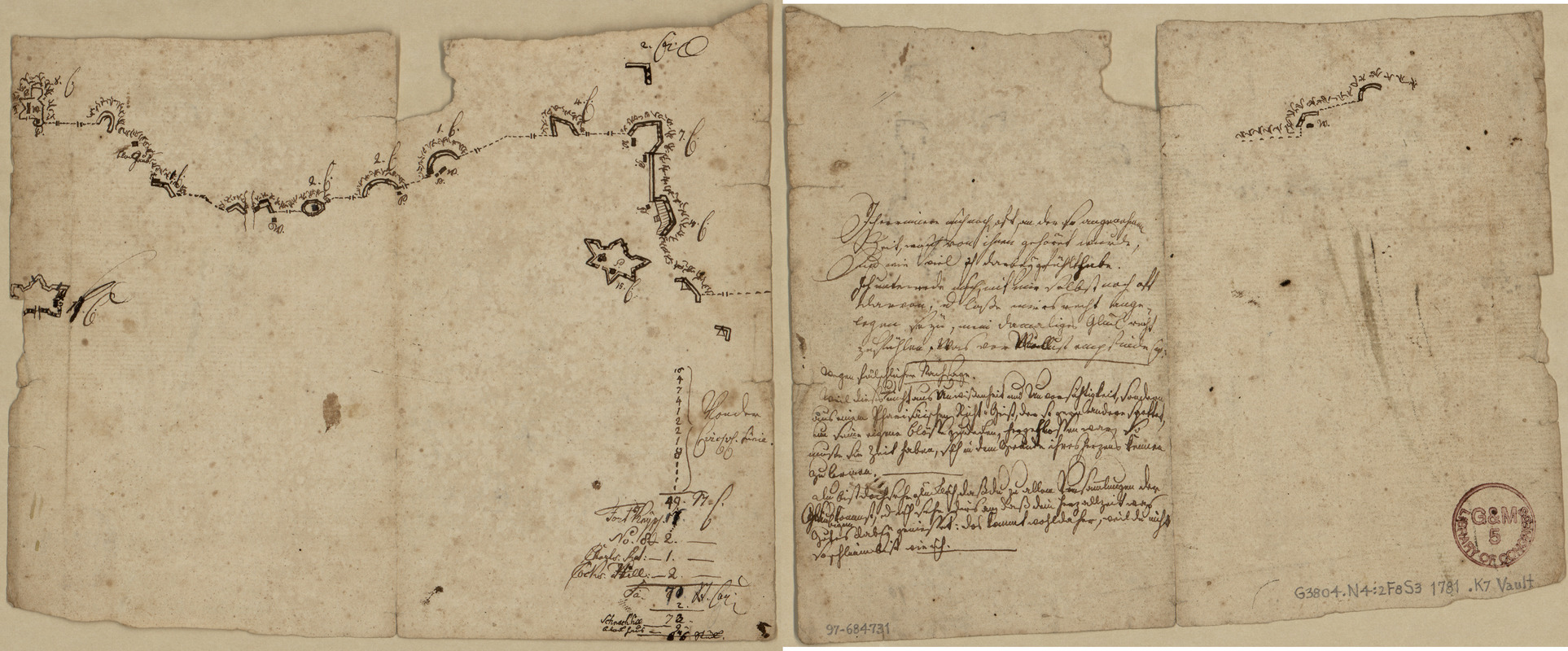
Sketch map of fortifications in the vicinity of Fort Washington, Manhattan Island, New York
This map is also available in American Revolutionary Geographies Online (ARGO), a collections portal especially built for material relating to the American Revolutionary War Era. Visit ARGO to learn more about this item and explore the historical geography of North America in the late eighteenth century.
Item Information
- Title:
- Sketch map of fortifications in the vicinity of Fort Washington, Manhattan Island, New York
- Creator:
- Krafft, Johann Carl Philipp von, 1752-1804
- Date:
-
[1781?]
- Format:
-
Maps/Atlases
Manuscripts
- Location:
- Library of Congress Geography and Map Division
- Collection (local):
-
Library of Congress Collection
- Subjects:
-
Fort Washington (New York, N.Y.)--Maps, Manuscript--Early works to 1800
Fortification--New York (State)--New York--Maps, Manuscript--Early works to 1800
United States--History--Revolution, 1775-1783--Participation, German--Maps--Early works to 1800
- Places:
-
Fort Washington (historical)
- Extent:
- 1 map : ms. ; on sheet 16 x 19 cm.
- Terms of Use:
-
No known copyright restrictions.
This work is licensed for use under a Creative Commons Attribution Non-Commercial Share Alike License (CC BY-NC-SA).

- Scale:
-
Scale not given
- Language:
-
German
- Catalog Record:
-
https://lccn.loc.gov/97684731
- Notes:
-
Relief shown by hachures.
Title devised by cataloger.
Pen-and-ink.
Watermark (unclear--mostly torn away at upper edge).
Sheet cut/torn from larger sheet; missing small sections at edges; has vertical fold line at center.
Includes unidentified handwritten numbered list (referring to Fort Knyphausen, also called Fort Washington) at lower right.
German text in 2 hands and small sketch map of fortifications on verso.
In German.
- Identifier:
-
ar306300z


