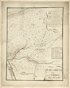
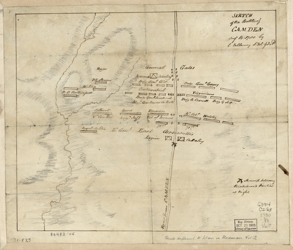
Sketch of the battle of Camden, Augt. 16, 1780
This map is also available in American Revolutionary Geographies Online (ARGO), a collections portal especially built for material relating to the American Revolutionary War Era. Visit ARGO to learn more about this item and explore the historical geography of North America in the late eighteenth century.
Item Information
- Title:
- Sketch of the battle of Camden, Augt. 16, 1780
- Creator:
- Vallancey, Charles, 1721-1812
- Name on Item:
-
by C. Vallancy
- Date:
-
[1780]
- Format:
-
Maps/Atlases
Manuscripts
- Location:
- Library of Congress Geography and Map Division
- Collection (local):
-
Library of Congress Collection
- Subjects:
-
Camden, Battle of, Camden, S.C., 1780--Maps, Manuscript--Early works to 1800
Camden (S.C.)--Maps--Early works to 1800
- Places:
-
Kershaw (county)Camden
- Extent:
- 1 manuscript map 25 x 30 cm.
- Terms of Use:
-
No known copyright restrictions.
This work is licensed for use under a Creative Commons Attribution Non-Commercial Share Alike License (CC BY-NC-SA).

- Scale:
-
Scale not given
- Language:
-
English
- Catalog Record:
-
https://lccn.loc.gov/gm71000873
- Notes:
-
Manuscript, pen-and-ink and pencil.
On verso: Map of Camden fight, 1780. P.C. ...?
- Notes (date):
-
This date is inferred.
- Notes (citation):
-
LC Maps of North America, 1750-1789, 1565
- Identifier:
-
ar156500