Toggle navigation
LMEC Home
Exhibitions
Georeferencing
Tools for Teachers
Collections
My Favorites
Sign Up / Log In
Search
Search the map portal
Map Collection
Map Collection
Map Sets
Search
Search
Search for
Search In
All Fields
Creator
Title
Subject
Place
Search All Digital Collections
Advanced Search
8551 Results
My Search
Start Over
More Like
commonwealth:cj82m544s
Remove constraint More Like: commonwealth:cj82m544s
Filter your Search
Place
North and Central America
5,846
United States
4,769
Massachusetts
2,052
Europe
1,359
Suffolk (county)
1,034
Boston
1,007
Canada
448
Asia
422
more
Place
»
Topic
Boston (Mass.)--Maps
577
United States--Maps
273
Real property--Massachusetts--Boston--Maps
174
Massachusetts--Maps
160
Landowners--Massachusetts--Boston--Maps
132
North America--Maps--Early works to 1800
103
New England--Maps
99
Europe--Maps
78
more
Topic
»
Date
Date range begin
–
Date range end
Current results range from
1482
to
2023
View distribution
Creator
United States. Hydrographic Office
594
O.H. Bailey & Co
148
Des Barres, Joseph F. W. (Joseph Frederick Wallet), 1722-1824
123
United States. Post Office Dept
120
Ptolemy, 2nd cent
100
Walling, Henry Francis, 1825-1888
94
Geological Survey (U.S.)
86
Jefferys, Thomas, -1771
85
more
Creator
»
Format
Maps/Atlases
8,492
Manuscripts
217
Prints
56
Books
36
Objects/Artifacts
10
Drawings/Illustrations
8
Posters
4
Georeferenced
Yes
869
No
7,682
Collection
Norman B. Leventhal Map & Education Center Collection
8,549
Boston and New England Maps
2,204
Urban Maps
1,936
Maritime Charts and Atlases
1,080
American Revolutionary War-Era Maps
618
Boston Redevelopment Authority Collection
87
Newberry Library Collection
2
Available to use
No known restrictions
8,408
Creative Commons license
46
Search Constraints
Sort by relevance
relevance
title
date (asc)
date (desc)
Number of results to display per page
50 per page
10
per page
20
per page
50
per page
100
per page
View results as:
grid view
map view
Search Results
1.
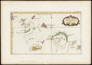
Carte des isles situées au nord de St. Domingue : avec les passages pour le retour appellés Debouqemens 1763
2.
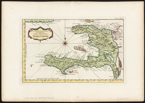
Environs de Leogane et du Port Au Prince dans l'Isle de St. Domingue
3.
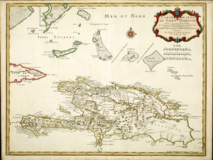
La partie Francoise de l'isle de Saint Domingue
4.
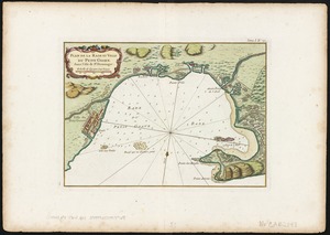
Plan de la Rade et Ville du Petit Goave dans i'Isle de St. Domingue
5.
The Windward passage from Jamaica, betwene the east end of Cuba, and the west end of Hispaniola
6.
Bahía y ciudad de Bayaha, o Puerto del Delfin, en la Isla de Santo Domingo
7.
Beschryvinghe der eylanden van Cuba, Hispaniola, Iamaica, S. Ioannis ende Margarita
8.
Carte de l'Isle de Saint Domingue
9.
Carte de l'isle de Saint Domingue
10.
Carte de L'Isle de St. Domingue une des Grandes Antilles, Colonies Francoise et Espagnole
11.
The island of Hispaniola called by the French St. Domingo : subject to France & Spain
12.
Isle of St. Domingo or Hispaniola
13.
A map of the island of St. Domingo
14.
A new & accurate map of the islands of Hispaniola or St. Domingo, and Porto Rico
15.
La Spagnuola
16.
Spagnvola
17.
Spagnvola
18.
Zeilan Insula
19.
I. de St. Domingue
20.
I. de St. Domingue
21.
The 100th anniversary map of Abraham Lincoln's visit to Massachusetts, September 11-23, 1848
22.
1630 shoreline
23.
1879. Progress map of the U.S. Geographical Surveys west of the 100th Meridian : prepared under the direction of 1st Lieut....
24.
1903 Map of Salem and surrounding places
25.
19th annual convention of the National Association of Real Estate Boards : at Tulsa, June 7 to June 11 in 1926
26.
2005 significant U.S. hurricane strikes
27.
The 2100 project : an atlas for the Green New Deal
28.
227 Harzgerode
29.
305 Glatz
30.
38,000,000 escaped -- 10,000,000 died
31.
4 Kinten
32.
660 Wakulah St., Roxbury
33.
[A chart of Boston Bay and vicinity]
34.
[A chart of New York Island & North River : East River, passage through Hell Gate, Flushing Bay, Hampstead Bay, Oyster,...
35.
The A.A.A. key road map of continental Europe
36.
Aaron Bohrod's America, its history
37.
ABC pathfinder railway guide map : eastern division
38.
Abolition of Slavery, 1863
39.
Aboriginal map of North America, denoting the boundaries and the locations of various Indian tribes
40.
Acapulco, México
41.
Accurata delineatio Castrorum Suecicorum, ut et Haffniae, Regni Daniae Metropolis
42.
Accurata delineatio oppugnatae a faederatis, Caesareis, Polonicis, Danicis, et Brandeburgicis copijs sub-ductu Seren: Electoris...
43.
Accurata delineatio regionis circa Nieburgum Fioniæ cum prælio ibi commisso inter Danorum et fæderatorum exercitum ab una et...
44.
Accurata Scaniae, Blekingiae et Hallandiae descriptio
45.
An accurate map of Cuba, and the adjacent islands
46.
An accurate map of Dorset Shire divided into hundreds
47.
An accurate map of Dorset Shire, divided into its hundreds
48.
An accurate map of England and Wales with the principal roads from the best authorities
49.
An accurate map of England and Wales with the principal roads from the best authorities
50.
An accurate map of Europe from the best authorities
‹ Prev
Next ›
1
2
3
4
5
…
171
172


![[A chart of Boston Bay and vicinity]](https://bpldcassets.blob.core.windows.net/derivatives/images/commonwealth:cj82m2976/image_thumbnail_300.jpg)


