Toggle navigation
LMEC Home
Exhibitions
Georeferencing
Tools for Teachers
Collections
My Favorites
Sign Up / Log In
Search
Search the map portal
Map Collection
Map Collection
Map Sets
Search
Search
Search for
Search In
All Fields
Creator
Title
Subject
Place
Search All Digital Collections
Advanced Search
8178 Results
My Search
Start Over
More Like
commonwealth:cj82km79d
Remove constraint More Like: commonwealth:cj82km79d
Filter your Search
Place
North and Central America
4,927
United States
3,614
Suffolk (county)
1,026
Boston
999
Europe
963
Canada
427
France
269
Massachusetts
249
more
Place
»
Topic
Boston (Mass.)--Maps
574
United States--Maps
270
Real property--Massachusetts--Boston--Maps
174
Massachusetts--Maps
160
Landowners--Massachusetts--Boston--Maps
132
North America--Maps--Early works to 1800
103
New England--Maps
99
Europe--Maps
78
more
Topic
»
Date
Date range begin
–
Date range end
Current results range from
1482
to
2023
View distribution
Creator
United States. Hydrographic Office
357
O.H. Bailey & Co
148
Des Barres, Joseph F. W. (Joseph Frederick Wallet), 1722-1824
123
United States. Post Office Dept
119
Ptolemy, 2nd cent
100
Walling, Henry Francis, 1825-1888
94
Jefferys, Thomas, -1771
85
Geological Survey (U.S.)
82
more
Creator
»
Format
Maps/Atlases
8,119
Manuscripts
216
Prints
51
Books
36
Objects/Artifacts
10
Drawings/Illustrations
8
Posters
4
Georeferenced
Yes
869
No
7,309
Collection
Norman B. Leventhal Map Center Collection
8,162
Boston and New England Maps
2,184
Urban Maps
1,925
Maritime Charts and Atlases
751
American Revolutionary War-Era Maps
631
Boston Redevelopment Authority Collection
86
William L. Clements Library Collection
10
American Antiquarian Society Collection
3
more
Collection
»
Available to use
No known restrictions
8,021
Creative Commons license
48
Search Constraints
Sort by relevance
relevance
title
date (asc)
date (desc)
Number of results to display per page
50 per page
10
per page
20
per page
50
per page
100
per page
View results as:
grid view
map view
Search Results
1.
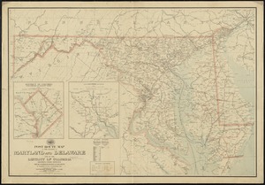
Post route map of the states of Maryland and Delaware and of the District of Columbia showing post offices with the...
2.
Post route map of the states of Virginia and West Virginia together with Maryland and Delaware with adjacent parts of...
3.
Delaware and Maryland
4.
Post route map of the states of Pennsylvania, New Jersey, Delaware, and Maryland and of the District of Columbia with adjacent...
5.
Scarborough's new county and post office map of Virginia, Maryland, Delaware, and District of Columbia : with complete index...
6.
The seat of war : birds eye view of Virginia, Maryland, Delaware, and the District of Columbia
7.
Colton's new topographical map of the states of Virginia, Maryland & Delaware, showing also eastern Tennessee & parts of other...
8.
Colton's new topographical map of the states of Virginia, West Virginia, Maryland & Delaware and portions of other adjoining...
9.
Johnson's Virginia, Delaware, Maryland & West Virginia
10.
Manuscript maps of U.S. states
11.
Map of the State of Virginia
12.
Map of Virginia and Maryland, constructed from the latest authorities
13.
A chorographical map of the country round Philadelphia = Carte particuliere des environs de Philadelphia
14.
Delaware Bay and Chesapeake Bay
15.
Delaware Bay and Chesapeake Bay
16.
A map of part of Pennsylvania & Maryland intended to shew, at one view, the several places ...
17.
A map of the Delaware and Chesapeak bays with the peninsula between them
18.
The States of Maryland and Delaware, from the latest surveys
19.
The states of Maryland and Delaware from the latest surveys, 1799
20.
Delaware
21.
Delaware, from the best authorities
22.
Carte générale des États-Unis de l'Amérique avec les plans des principales villes
23.
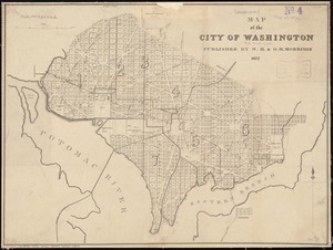
City of Washington
24.
Colton's Georgetown and the city of Washington : the capital of the United States of America ; Colton's map showing part of...
25.
E. & G.W. Blunt's corrected map of Washington and the seat of war on the Potomac
26.
Map of n. eastern Virginia and vicinity of Washington
27.
Map of the city of Washington
28.
Map of the city of Washington in the District of Columbia shewing the architectvre and history from the most ancient times down...
29.
Map of the seat of war : containing a map of the vicinity of Washington, Baltimore, Harper's Ferry and Annapolis, with five...
30.
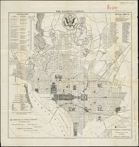
The nation's capital : [Washington D.C.]
31.
New bond paper map of the city of Washington
32.
A new map of the state of Virginia : exhibiting its internal improvements, roads, distances, &c
33.
Plan of the city of Washington, in the territory of Columbia, ceded by the States of Virginia and Maryland to the United States...
34.
Plan of the city of Washington, seat of government of the United States
35.
Rand, McNally & Co.'s indexed atlas of the world : map of Washington, D.C
36.
Rand McNally standard map of Washington D.C.
37.
Topographical map of the District of Columbia
38.
Topographical map of the District of Columbia and a portion of Virginia
39.
The tourist's pocket map of the state of Virginia : exhibiting its internal improvements, roads, distances &c
40.
Washington and vicinity
41.
An historical and literary map of the Old Line State of Maryland : showing forth divers curious and notable facts relating to...
42.
Index chart of natural oyster bars, crab bottoms, clam bars and triangulation stations of Maryland surveyed by Maryland Shell...
43.
Manuscript maps of U.S. states, possibly drawn by a schoolchild
44.
Map of eastern Virginia
45.
Map of eastern Virginia
46.
Map of the country embracing the several routes examined with a view to a national road from Washington to Lake Ontario
47.
Maryland
48.
The new war map of Virginia, Maryland & Pennsylvania
49.
Official map of the state of Virginia : from actual surveys by order of the executive, 1828 & 1859
50.
Seat of war in Virginia and Maryland
‹ Prev
Next ›
1
2
3
4
5
…
163
164