Plan of the city of Washington, seat of government of the United States
Item Information
- Title:
- Plan of the city of Washington, seat of government of the United States
- Creator:
- Elliot, William, 1773?-1837
- Date:
-
[1822]
- Format:
-
Maps/Atlases
- Location:
-
Boston Public Library
Norman B. Leventhal Map & Education Center - Collection (local):
-
Norman B. Leventhal Map & Education Center Collection
- Subjects:
-
Washington (D.C.)--Maps
- Places:
-
District of ColumbiaWashington
- Extent:
- 1 map ; 43 x 51 cm.
- Terms of Use:
-
No known copyright restrictions.
No known restrictions on use.
- Publisher:
-
Washington, D.C :
S.A. Elliot
- Scale:
-
Scale [ca. 1:19,500]
- Language:
-
English
- Notes:
-
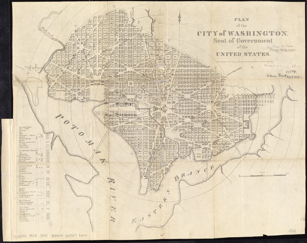
Shows block numbers, wards, existing and planned government buildings, and radial distances from Capitol.
"Entered according to Act of Congress on the 12 day of Nov. 1822 by S.A. Elliot of the District of Columbia."
From William Elliot's The Washington guide, 1822.
Includes indexed table of points of interest.
- Notes (date):
-
This date is inferred.
- Identifier:
-
06_01_010836
- Call #:
-
G3850 1822 .E45
- Barcode:
-
39999065678300
- LCCN:
-
88694090


