Map of the city of Washington in the District of Columbia shewing the architectvre and history from the most ancient times down to the present
Item Information
- Title:
- Map of the city of Washington in the District of Columbia shewing the architectvre and history from the most ancient times down to the present
- Title (alt.):
-
Capital map
- Cartographer:
- Olsen, Edwin
- Cartographer:
- Clark, Blake, 1900-
- Publisher:
- Houghton Mifflin Company
- Name on Item:
-
by Edwin Olsen and Blake Clark
- Date:
-
1926
- Format:
-
Maps/Atlases
- Location:
-
Boston Public Library
Norman B. Leventhal Map & Education Center - Collection (local):
-
Norman B. Leventhal Map & Education Center Collection
- Subjects:
-
Public buildings--Washington (D.C.)--Maps
Central business districts--Washington (D.C.)--Maps
Historic buildings--Washington (D.C.)--Maps
Washington (D.C.)--History--Maps
Washington (D.C.)--Maps
- Places:
-
District of Columbia
- Extent:
- 1 map : color ; 58 x 80 cm, on sheet 73 x 94 cm, folded in envelope 35 x 28 cm
- Terms of Use:
-
No known copyright restrictions.
No known restrictions on use.
- Publisher:
-
Boston :
Houghton Mifflin Co.
- Scale:
-
Scale approximately 1:6,336
- Language:
-
English
- Notes:
-
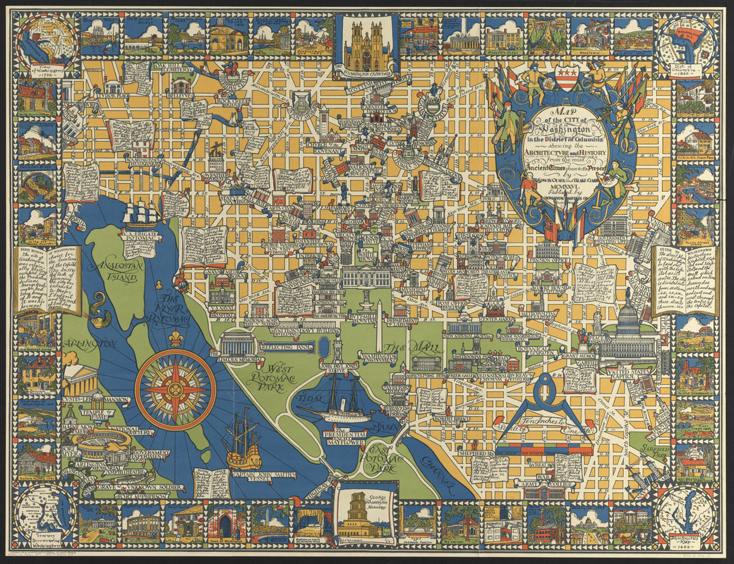
Pictorial map of central business district.
Includes text, historical and descriptive notes, color illustrations and coat of arms.
Ancillary maps in the 4 corners: View of Washington 1792 -- Dist. of Columbia 1800 -- John Smith's map 1606 -- Townes surrounding Washington.
- Identifier:
-
06_01_014778
- Call #:
-
G3851.S1 1926 .O47
- Barcode:
-
39999065705137


