Toggle navigation
LMEC Home
Exhibitions
Georeferencing
Tools for Teachers
Collections
My Favorites
Sign Up / Log In
Search
Search the map portal
Map Collection
Map Collection
Map Sets
Search
Search
Search for
Search In
All Fields
Creator
Title
Subject
Place
Search All Digital Collections
Advanced Search
8649 Results
My Search
Start Over
More Like
commonwealth:bg25bn93v
Remove constraint More Like: commonwealth:bg25bn93v
Filter your Search
Place
North and Central America
5,887
United States
4,806
Massachusetts
2,068
Europe
1,392
Suffolk (county)
1,041
Boston
1,014
Canada
448
Asia
437
more
Place
»
Topic
Boston (Mass.)--Maps
582
United States--Maps
279
Real property--Massachusetts--Boston--Maps
175
Massachusetts--Maps
161
Landowners--Massachusetts--Boston--Maps
133
North America--Maps--Early works to 1800
102
New England--Maps
101
Europe--Maps
79
more
Topic
»
Date
Date range begin
–
Date range end
Current results range from
1482
to
2023
View distribution
Creator
United States. Hydrographic Office
595
O.H. Bailey & Co
148
Des Barres, Joseph F. W. (Joseph Frederick Wallet), 1722-1824
123
United States. Post Office Dept
120
Ptolemy, 2nd cent
100
Walling, Henry Francis, 1825-1888
94
Geological Survey (U.S.)
86
Jefferys, Thomas, -1771
85
more
Creator
»
Format
Maps/Atlases
8,589
Manuscripts
215
Prints
56
Books
36
Objects/Artifacts
10
Drawings/Illustrations
8
Posters
5
Georeferenced
Yes
869
No
7,780
Collection
Norman B. Leventhal Map & Education Center Collection
8,649
Boston and New England Maps
2,222
Urban Maps
1,992
Maritime Charts and Atlases
1,086
American Revolutionary War-Era Maps
614
Boston Redevelopment Authority Collection
87
Applied Geographics, Inc. Records
4
Available to use
No known restrictions
8,507
Creative Commons license
47
Search Constraints
Sort by relevance
relevance
title
date (asc)
date (desc)
Number of results to display per page
20 per page
10
per page
20
per page
50
per page
100
per page
View results as:
grid view
map view
Search Results
1.
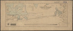
Map of the submarine telegraph between America & Europe, with its various communications on the two continents
2.
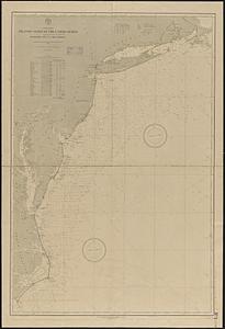
Telegraph chart
3.
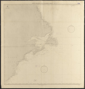
A chart of the North-American coast, for the navigation between Halifax and Philadelphia
4.
Limits under fishery treaties, 1818 and 1888
5.
A new chart of ye coast of New Found Land, New Scotland and New England &c.
6.
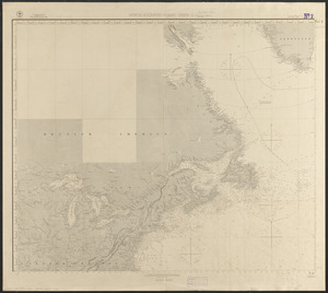
Coast of North America from Point Judith to St. Antonio, (island of Cuba) including the Bahama Banks
7.
North America, Atlantic coast of the United States, Buzzard's Bay to Cape Lookout : compiled from the latest United States...
8.
Via RCA : a direct marine radio service to and from ships at sea
9.
British Isles
10.
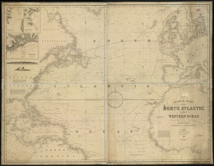
General chart, of the North Atlantic, or Western Ocean, from the equator to 62° north latitude, according to the latest,...
11.
Great circle sailing chart of the North Atlantic Ocean
12.
Map of the seat of war : showing the only practical method by which the movements of the warships of both nations can be...
13.
March 17-21 ; March 22-26
14.
A new chart of the vast Atlantic or Western Ocean including the sea coast of Europe, Africa, America, and the West India...
15.
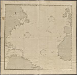
North Atlantic Ocean
16.
North Atlantic Ocean
17.
North Atlantic Ocean : compiled from the latest information, 1888
18.
North Atlantic Ocean, eastern portion
19.
North Atlantic Ocean, southeast coast of North America, including the Bahamas and Greater Antilles
20.
North Atlantic Ocean, West Indies
‹ Prev
Next ›
1
2
3
4
5
…
432
433