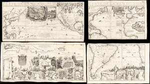
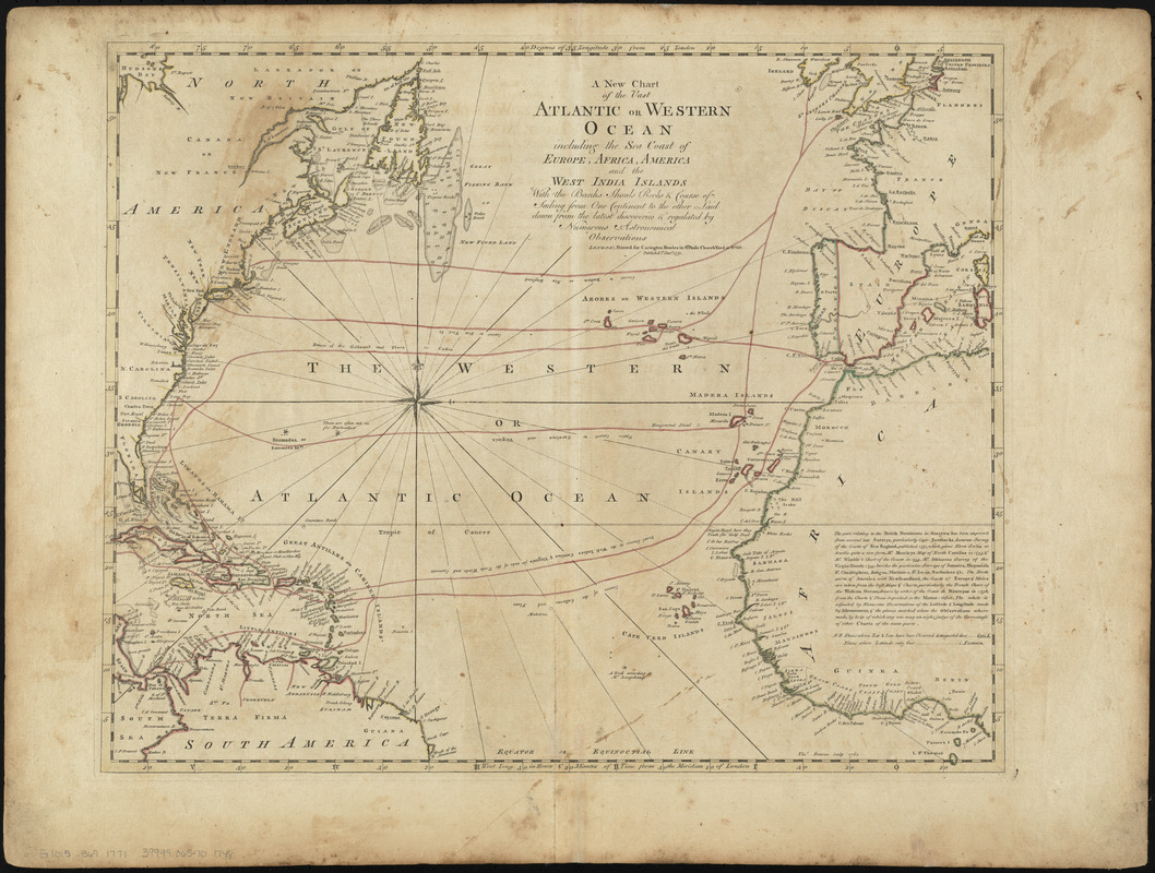
A new chart of the vast Atlantic or Western Ocean including the sea coast of Europe, Africa, America, and the West India Islands with the banks, shoals, rocks & course of sailing from one continent to the other, laid down from the latest discoveries & regulated by numerous astronomical observations
This map is also available in American Revolutionary Geographies Online (ARGO), a collections portal especially built for material relating to the American Revolutionary War Era. Visit ARGO to learn more about this item and explore the historical geography of North America in the late eighteenth century.
Item Information
- Title:
- A new chart of the vast Atlantic or Western Ocean including the sea coast of Europe, Africa, America, and the West India Islands with the banks, shoals, rocks & course of sailing from one continent to the other, laid down from the latest discoveries & regulated by numerous astronomical observations
- Description:
-
We Are One: Most ships used well-established routes to cross the North Atlantic during the colonial period. However, few contemporary maps depict specific voyages. This 1771 chart delineates several general routes, such as the "usual course to the West Indies, Carolinas & Virginia for sake of the Trade Winds and Currents." Contrast these with the ones represented on the map of colonial shipping routes compiled in 2013, which was based on specific voyages documented in ships' logbooks. For example, the 1771 map shows ships landing in Boston, New York, and Charleston, while the modern one notes that ships arrived all along the coast of the North American colonies.
- Creator:
- Bowles, Carington, 1724-1793
- Date:
-
1771
- Format:
-
Maps/Atlases
- Location:
-
Boston Public Library
Norman B. Leventhal Map & Education Center - Collection (local):
-
Norman B. Leventhal Map & Education Center Collection
- Subjects:
-
North Atlantic Ocean--Maps
Atlantic Ocean--Maps--Early works to 1800
- Places:
-
Atlantic Ocean
- Extent:
- 1 map : hand-colored ; 44 x 54 cm
- Terms of Use:
-
No known copyright restrictions.
No known restrictions on use.
- Publisher:
-
London :
Carington Bowles
- Scale:
-
Scale approximately 1:19,000,000 at equator
- Language:
-
English
- Notes:
-
Depths shown by soundings.
Includes text.
This map can be viewed as a georeferenced overlay in an interactive application made especially for We Are One: Mapping America's Road from Revolution to Independence http://d2o8owo4k087al.cloudfront.net/index.html?mapId=22.
Removed from Bowles' A general atlas of thirty-six new and correct maps. [London : Carington Bowles, 1771?]
- Notes (exhibitions):
-
Exhibited: "We Are One: Mapping America's Road from Revolution to Independence" organized by the Norman B. Leventhal Map Center at the Boston Public Library, 2015.
- Identifier:
-
06_01_014250
- Call #:
-
G1015 .B69 1771
- Barcode:
-
39999065701748