Toggle navigation
LMEC Home
Exhibitions
Georeferencing
Tools for Teachers
Collections
My Favorites
Sign Up / Log In
Search
Search the map portal
Map Collection
Map Collection
Map Sets
Search
Search
Search for
Search In
All Fields
Creator
Title
Subject
Place
Search All Digital Collections
Advanced Search
8814 Results
My Search
Start Over
More Like
commonwealth:7h149w35z
Remove constraint More Like: commonwealth:7h149w35z
Filter your Search
Place
North and Central America
5,992
United States
4,888
Massachusetts
2,079
Europe
1,396
Suffolk (county)
1,046
Boston
1,019
Canada
463
Asia
438
more
Place
»
Topic
Boston (Mass.)--Maps
586
United States--Maps
330
Real property--Massachusetts--Boston--Maps
175
Massachusetts--Maps
162
Landowners--Massachusetts--Boston--Maps
133
North America--Maps--Early works to 1800
103
New England--Maps
102
North America--Maps
85
more
Topic
»
Date
Date range begin
–
Date range end
Current results range from
1482
to
2023
View distribution
Creator
United States. Hydrographic Office
595
O.H. Bailey & Co
148
Des Barres, Joseph F. W. (Joseph Frederick Wallet), 1722-1824
123
United States. Post Office Dept
120
Ptolemy, 2nd cent
100
Walling, Henry Francis, 1825-1888
94
Jefferys, Thomas, -1771
88
Geological Survey (U.S.)
87
more
Creator
»
Format
Maps/Atlases
8,754
Manuscripts
216
Prints
56
Books
36
Objects/Artifacts
10
Drawings/Illustrations
8
Posters
5
Georeferenced
Yes
876
No
7,938
Collection
Norman B. Leventhal Map & Education Center Collection
8,702
Boston and New England Maps
2,233
Urban Maps
2,023
Maritime Charts and Atlases
1,085
American Revolutionary War-Era Maps
725
Boston Redevelopment Authority Collection
87
American Antiquarian Society Collection
54
William L. Clements Library Collection
32
more
Collection
»
Available to use
No known restrictions
8,558
Creative Commons license
61
Search Constraints
Sort by relevance
relevance
title
date (asc)
date (desc)
Number of results to display per page
20 per page
10
per page
20
per page
50
per page
100
per page
View results as:
grid view
map view
Search Results
1.
The countries of the Caribbean : including Mexico, Central America, the West Indies and the Panama Canal
2.
Map of the United States of America, Mexico, Central America, and the West India Islands
3.
Map of the United States of America, the British provinces, Mexico, the West Indies and Central America, with part of New...
4.
Colton's map of the United States of America, the British provinces, Mexico and the West Indies : showing the country from the...
5.
Map of Central America, Cuba, Porto Rico, and the islands of the Caribbean Sea
6.
Map of the United States, British & Central America : from state documents & unpublished materials
7.
A map of the United States and Canada, New-Scotland, New-Brunswick and New-Foundland = Carte des Etats-Unis avec le Canada, la...
8.
Case's map of the United States, the British provinces, Mexico, and part of the West Indies : compiled from the latest...
9.
Map of the United States of North America, upper & lower Canada, New Brunswick, Nova Scotia & British Columbia, Mexico, Cuba,...
10.
The Evening Post map of the West Indies
11.
Gulf of Mexico, West Indies and Caribbean Sea : from the most recent U.S. Coast Survey, Spanish and British Admiralty charts
12.
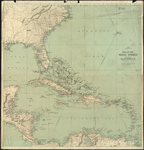
Map of the West Indies
13.
The West India Islands and adjacent territory showing British possessions south of the United States
14.
Chart of the West Indies and Spanish Dominions in North America
15.
Mittel-America und Westindien
16.
West Indien und Mittel America
17.
Nord-u. Mittel-Amerika
18.
Carte du Mexique et des pays limitrophes situés au nord et à l'est : dressée d'après la grande carte de la Nouvelle Espagne...
19.
General railway map engraved expressly for the Official guide of the railways and steam navigation lines of the United States,...
20.
Map of the Mexican National Railway : showing also its relative position to the railway system of the United States, both as to...
‹ Prev
Next ›
1
2
3
4
5
…
440
441