Toggle navigation
LMEC Home
Exhibitions
Georeferencing
Tools for Teachers
Collections
My Favorites
Sign Up / Log In
Search
Search the map portal
Map Collection
Map Collection
Map Sets
Search
Search
Search for
Search In
All Fields
Creator
Title
Subject
Place
Search All Digital Collections
Advanced Search
8325 Results
My Search
Start Over
More Like
commonwealth:4m90fh92c
Remove constraint More Like: commonwealth:4m90fh92c
Filter your Search
Place
North and Central America
5,070
United States
3,826
Suffolk (county)
1,026
Boston
999
Europe
963
Canada
523
France
269
Massachusetts
259
more
Place
»
Topic
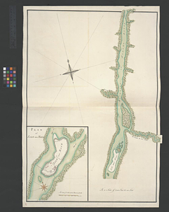
Boston (Mass.)--Maps
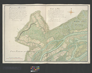
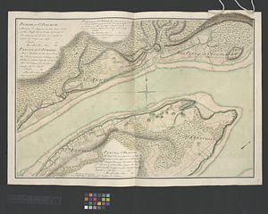
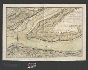
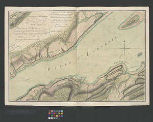
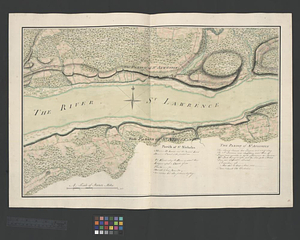
574
United States--Maps
272
Real property--Massachusetts--Boston--Maps
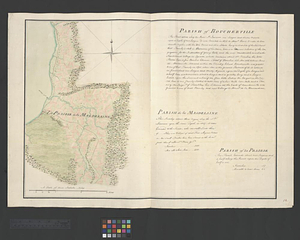
174
Massachusetts--Maps
161
United States--History--French and Indian War, 1754-1763--Maps
161
Landowners--Massachusetts--Boston--Maps
132
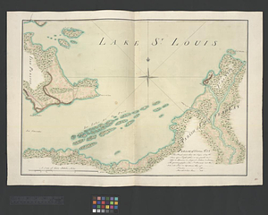
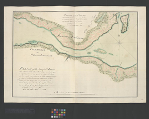
North America--Maps--Early works to 1800
103
New England--Maps
101
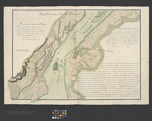
more
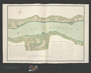
Topic
»
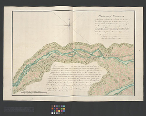
Date
Date range begin
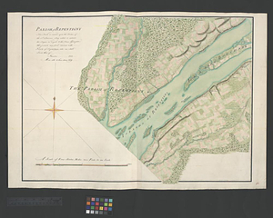
–
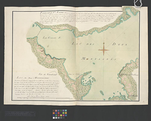
Date range end
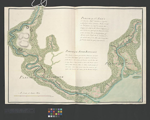
Current results range from
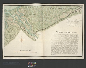
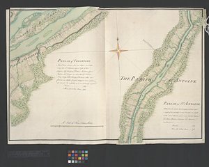
1482
to
2023
View distribution
Creator
United States. Hydrographic Office
357
O.H. Bailey & Co
148
Des Barres, Joseph F. W. (Joseph Frederick Wallet), 1722-1824
123
United States. Post Office Dept
120
Ptolemy, 2nd cent
100
Jefferys, Thomas, -1771
98
Walling, Henry Francis, 1825-1888
94
Geological Survey (U.S.)
82
more
Creator
»
Format
Maps/Atlases
8,265
Manuscripts
216
Prints
52
Books
36
Objects/Artifacts
10
Drawings/Illustrations
8
Posters
4
Georeferenced
Yes
869
No
7,456
Collection
Norman B. Leventhal Map Center Collection
8,162
Boston and New England Maps
2,184
Urban Maps
1,925
American Revolutionary War-Era Maps
779
Maritime Charts and Atlases
750
William L. Clements Library Collection
149
Boston Redevelopment Authority Collection
86
American Antiquarian Society Collection
9
more
Collection
»
Available to use
No known restrictions
8,022
Creative Commons license
50
Search Constraints
Sort by relevance
relevance
title
date (asc)
date (desc)
Number of results to display per page
100 per page
10
per page
20
per page
50
per page
100
per page
View results as:
grid view
map view
Search Results
1.
A Correct plan of the environs of Quebec, : and the battle fought on the 13th September, 1759: together with a particular...
2.
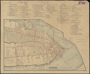
Plan of the city of Quebec : shewing the portions destroyed by the two great fires, May 28th & June 28th, 1845
3.
Quebec
4.
A plan of the disposition of the advanced party consisting of 400 men : to defend the workers in making the road
5.
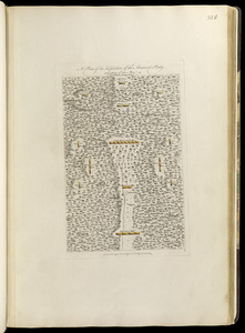
A plan of the encampment of the detachment from the little Meadows
6.
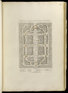
A plan of the line of march of the detachment from the little Meadows
7.
A plan of the line of march with the whole baggage
8.
A new map of the province of Quebec, : according to the Royal proclamation, of the 7th of October 1763
9.
A new map of the province of Quebec, : according to the Royal proclamation, of the 7th of October 1763
10.
Plan de la ville de Quebec
11.
Plan of the city of Quebec
12.
A Plan of the city of Quebec the capital of Canada. : As it surrendered 18 Septembr. 1759 to the British Fleet and Army,...
13.
An accurate map of Canada, with the adjacent countries; exhibiting the late seat of war between the English & French in those...
14.
Attaques des forts de Chouaguen en Amérique pris par les français commandés par le Marquis de Montcalm le 14 Août 1756
15.
Attaques des retranchemens devant le fort Carillon en Amérique par les anglais commandés par le général Abercrombie contre les...
16.
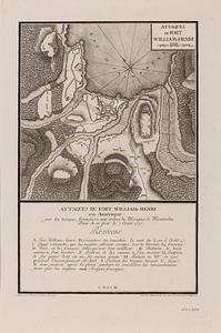
Attaques du fort William-Henri en Amérique par les troupes français aux ordres du Marquis de Montcalm prise de ce fort le 7...
17.
British attack upon Ticonderoga, July 7 & 8, 1758
18.
The Cedres
19.
Continuation of the Grande Riviere with the village of Fariole lying near Cape Torment on the north shore
20.
Continuation of the River Chaudière &c.
21.
Continuation of the River Chaudière from where it falls into the St. Lawrence, as laid down in the lower plan, to the village...
22.
Continuation of the River Chaudière joining to A
23.
Continuation of the River Chaudière joining to B
24.
A correct plan of the environs of Quebec, and of the battle fought on the 13th September, 1759 : together with a particular...
25.
A draught of a route from Québec to Fort Halifax on the River Kennebec and back again to Québec by the rivers Chaudière and...
26.
Draught of the River Pittquioyack in the Bay of Fundy 1758
27.
Draught of the river St. Lawrence from Lake Ontario to Montreal
28.
An exact ground plan of Fort Edward at Pesaquid taken from a survey and laid down by a scale of 60 feet to one inch
29.
Fort Bedford
30.
Fort Edward to Ticonderoga
31.
Fort Halifax and the Kennebec River : Québec July 25th, 1761
32.
Fort William Henry
33.
French draught of Lake Champlain & Lake George with remarks of an English prisoner who return'd from Quebec to Fort Edward by...
34.
Gabarus Bay
35.
Ein grund-ris von der Festung Duquesne ...
36.
Hudson's River from New York to Albany
37.
Lake Champlain
38.
Lake Megantic and the Chaudière River : Québec July 25th, 1761
39.
Map from Albany to Crown Point
40.
A Map of that part of America which was the principal seat of war in 1756
41.
A map of the British and French settlements in North America
42.
A Map of the British dominions in North America as settled by the late treaty of Peace 1763
43.
Map of the British landings at Louisbourg
44.
A map of the country between Will's Creek & Monongahela River shewing the rout and encampments of the English army, in 1755
45.
A map of the island of Cape Breton
46.
Moosehead Lake and the immediate area to the west : Québec July 25th, 1761
47.
A New & accurate map of North America, : including the British acquisitions gain'd by the late war, 1763
48.
A new and accurate map of the English empire in North America : representing their rightful claim as confirm'd by charters, &...
49.
A new and accurate map of the English empire in North America : representing their rightful claim as confirm'd by charters, and...
50.
A new and accurate map of the present seat of war in North America
51.
A new and accurate map of the present war in North America
52.
Oneida Lake to the Mohawk River
53.
Parish of Batiscant. Parish of St. Pierre Becquet. Parish of Champlain. Parish of Gentilly
54.
Parish of Beauport. Parish of L'Ange Gardien. Parish of Chateau Richer
55.
Parish of Berthier. Parish of St. François. Parish of St. Thomas
56.
Parish of Bertier. Isle du Pas
57.
Parish of Boucherville. Parish de la Magdelaine. Parish of La Prairie
58.
Parish of Chambly & Ste. Therese
59.
Parish of Charlebourgh
60.
Parish of Chateau Gay
61.
Parish of Dechaillon or St. Jean. Parish of Grondines
62.
Parish of Dechambeaux. Parish of Cape Sante. Parish of Lotbinière. Parish of St. Croix
63.
Parish of Iamaska
64.
Parish of La Chine. Parish of the Saut of St. Louis. Cocnawaga or St. Louis Indian Castle
65.
Parish of La Norray & Dautray. Parish of Sorrel
66.
Parish of L'Assomption. Parish of St. Sulpice
67.
Parish of Lavalterie. Parish of Contrecoeur
68.
Parish of Long Point. Parish of Longeuil
69.
Parish of Magdelaine. Parish of Becancour
70.
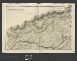
Parish of Old Lorette
71.
The Parish of Omachis
72.
Parish of Omchis. Parish of Pointe du Lac. Parish of Nicolet
73.
Parish of Repentigny
74.
Parish of St. Anne. Lac des Deux Montagnes
75.
Parish of St. Ann's. Parish of the River Batiscant
76.
Parish of St. Antoine. Parish of St. Francois
77.
Parish of St. Charles
78.
Parish of St. Charles
79.
Parish of St. Foix
80.
Parish of St. Genevieve. Parish of Pointe Claire
81.
Parish of St. Joachim. Parish of St. Famille. Parish of St. Anne. Parish of St. François
82.
Parish of St. Joseph [of Masquinonge]. Parish of the River du Loup
83.
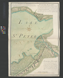
Parish of St. Lawrence. Parish of Beaumont. Parish of St. Peter
84.
Parish of St. Michelle. Parish of St. John Baptist. Parish of St. Vertier
85.
Parish of St. Nicholas. The Parish of St. Augustin
86.
Parish of Terbone
87.
Parish of the Ecureuils. Parish of Point aux Trembles. Parish of St. Antoine. Parish of St. Croix
88.
Parish of Varrenes. Parish of Pointe aux Trembles. Parish of La Chenais
89.
Parish of Vercheres. Parish of St. Antoine
90.
Part of the Richelieu River showing Fort de St. Ieant
91.
Part of the Richelieu River showing Isle aux Noix
92.
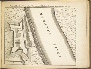
Plan and profile of retrenched work round Harkemeis house at ye German Flats 1756
93.
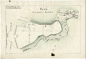
Plan de la pointe à Rochefort
94.
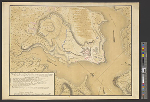
Plan du fort de Carillon et de ses environs avec l'attaque des retranchments faite par une armee Angloise de 25000 homes aux...
95.
Plan du port et de la ville de Louisbourg en l'Isle Royale et des attaques faites par les Anglois pandent le siege depuis le 8...
96.
Plan du port et de la ville de Louisbourg en l'Isle Royale, et des Attaques faites par les Anglois pendant le Siége depuis le 8...
97.
Plan of Fort [Brewerton] at the west end of Onnide Lake
98.
Plan of Fort Edward situated lat. 43 lon. 72 30'
99.
Plan of Fort Frederick at Albany
100.
A plan of Fort Frederick, situated at the entrance of St. John's River : lat 47 long. 66 30'
‹ Prev
Next ›
1
2
3
4
5
…
83
84


![Parish of St. Joseph [of Masquinonge]. Parish of the River du Loup](https://bpldcassets.blob.core.windows.net/derivatives/metadata/commonwealth-oai:8336n077h/image_thumbnail_300.jpg)

![Plan of Fort [Brewerton] at the west end of Onnide Lake](https://bpldcassets.blob.core.windows.net/derivatives/metadata/commonwealth-oai:639615613/image_thumbnail_300.jpg)


