Toggle navigation
LMEC Home
Exhibitions
Georeferencing
Tools for Teachers
Collections
My Favorites
Sign Up / Log In
Search
Search the map portal
Map Collection
Map Collection
Map Sets
Search
Search
Search for
Search In
All Fields
Creator
Title
Subject
Place
Search All Digital Collections
Advanced Search
8182 Results
My Search
Start Over
More Like
commonwealth:4m90f212r
Remove constraint More Like: commonwealth:4m90f212r
Filter your Search
Place
North and Central America
4,931
United States
3,621
Suffolk (county)
1,027
Boston
1,000
Europe
963
Canada
428
France
269
Massachusetts
249
more
Place
»
Topic
Boston (Mass.)--Maps
575
United States--Maps
270
Real property--Massachusetts--Boston--Maps
174
Massachusetts--Maps
160
Landowners--Massachusetts--Boston--Maps
132
North America--Maps--Early works to 1800
103
New England--Maps
99
Europe--Maps
78
more
Topic
»
Date
Date range begin
–
Date range end
Current results range from
1482
to
2023
View distribution
Creator
United States. Hydrographic Office
357
O.H. Bailey & Co
148
Des Barres, Joseph F. W. (Joseph Frederick Wallet), 1722-1824
123
United States. Post Office Dept
120
Ptolemy, 2nd cent
100
Walling, Henry Francis, 1825-1888
94
Jefferys, Thomas, -1771
84
Geological Survey (U.S.)
82
more
Creator
»
Format
Maps/Atlases
8,123
Manuscripts
217
Prints
51
Books
36
Objects/Artifacts
10
Drawings/Illustrations
8
Posters
4
Georeferenced
Yes
869
No
7,313
Collection
Norman B. Leventhal Map Center Collection
8,162
Boston and New England Maps
2,184
Urban Maps
1,926
Maritime Charts and Atlases
750
American Revolutionary War-Era Maps
634
Boston Redevelopment Authority Collection
86
William L. Clements Library Collection
12
American Antiquarian Society Collection
4
more
Collection
»
Available to use
No known restrictions
8,023
Creative Commons license
47
Search Constraints
Sort by relevance
relevance
title
date (asc)
date (desc)
Number of results to display per page
50 per page
10
per page
20
per page
50
per page
100
per page
View results as:
grid view
map view
Search Results
1.
New map of New York City : from the latest authentic surveys, showing all ferries, and all steamship docks both foreign and...
2.
Center of New York, first city of the world
3.
Hagstrom's map of Brooklyn (New York City) : house-number and subway guide
4.
Hammond's complete map of the Bronx
5.
An aerial view of New York City showing how easily the weary traveler may reach the Herald Square Hotel wherein he will find...
6.
Carte générale des États-Unis de l'Amérique avec les plans des principales villes
7.
Citizens & travelers guide map in, to and from the city of New York and adjacent places
8.
The Firemen's guide : a map of the City of New-York, showing the fire districts, fire limits, hydrants, public cisterns,...
9.
Grundriss des nördlichen Theils der Neujorks Insel nebst den am 16. Novbr. 1776. eroberten Fort Washington nun das Fort...
10.
Johnson's map of New York and the adjacent cities
11.
Map of greater New York : Map of the borough of Manhattan
12.
Map of New York and vicinity
13.
Map of northern part of New York City
14.
Map of the cities of New York, Brooklyn, Jersey City, Hudson City and Hoboken
15.
Map of the city & county of New York
16.
Map of the city & county of New York ; Upper part of the city and county of New York on a reduced scale
17.
Map of the city of New York
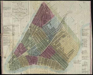
18.
Map of the city of New York and its vicinity
19.
Map of the city of New York, with the latest improvements
20.
A map of the history of New York state
21.
Map of the lands included in the Central Park, from a topographical survey, June 17th, 1856
22.
Map of the State of New-York exhibiting the several towns and counties together with the population as determined by the census...
23.
A map of the wondrous isle of Manhattan
24.
New York, 1695
25.
New York city map
26.
Plan for the improvement of the Central Park, adopted by the Commissioners, June 3rd, 1856
27.
Plan of the city of New York : showing the made and swamp land
28.
Rand McNally & Co.'s map of New York City, Brooklyn, Jersey City and vicinity
29.
The strangers mercantile guide map of the cities of New York, Brooklyn, Jersey City, Hoboken, etc
30.
Topographical map of the City and County of New-York, and the adjacent country : with views in the border of the principal...
31.
British troop dispositions in and near New York City
32.
British troop dispositions in and near New York City, July and August 1781
33.
Map of the city of New-York extending northward to Fiftieth Street
34.
The New York campaign of 1776
35.
The New York campaign of 1776
36.
Plan de New-York et des environs
37.
Plan d'operation de l'armée Angloise sous les ordres du General Howe sur Staten.-Long-&Yorck Island, depuis le mois d'Aout...
38.
[Plan of New York] : To the Honble. John Sullivan Esqr. Major Genl. in the army of the United States of America humbly...
39.
A plan of New York Island with the circumjacent country as far as Dobb's Ferry to the north, and White-Plains the the east;...
40.
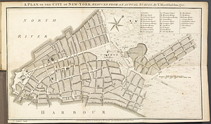
A Plan of the city of New York
41.
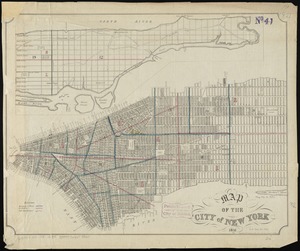
Plan of the city of New York
42.
Plan of the city of New York in North America : surveyed in the years 1766 & 1767
43.
Plan of the city of New-York
44.
A plan of the city of New-York, reduced from an actual survey
45.
The provinces of New York, and New Jersey, : with part of Pensilvania [sic], and the province of Quebec
46.
The seat of action, between the British and American forces or an authentic plan of the western part of Long Island, with the...
47.
Sketch of the country illustrating the late engagement in Long Island
48.
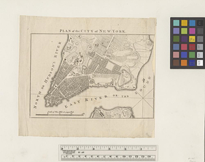
This plan of the City of New York (within the palisades which were erected in the year 1743) was made for the purpose of...
49.
Various plans and draughts of cities, towns, harbours &c. drawn from the latest authorities
50.
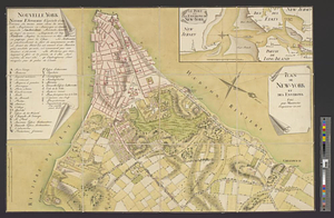
Ville de Manathe ou Nouvelle-Yorc
‹ Prev
Next ›
1
2
3
4
5
…
163
164


![[Plan of New York]](https://bpldcassets.blob.core.windows.net/derivatives/images/commonwealth:6108vt38k/image_thumbnail_300.jpg)